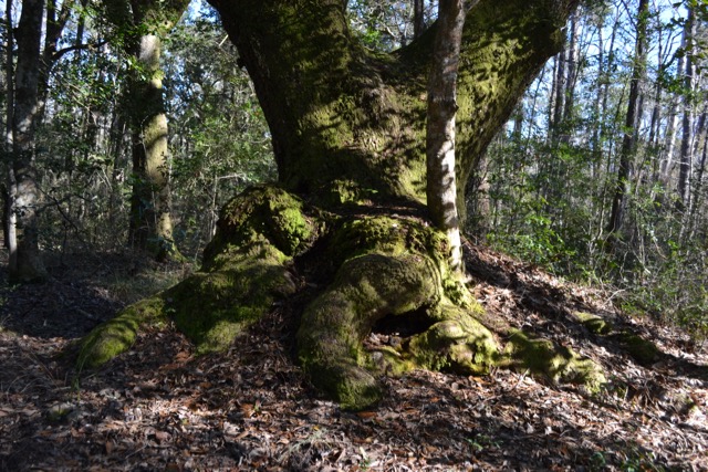
From the small parking area off Mazyck Road in Santee Coastal Reserve, the walk began on one of the unpaved forest roads, Eldorado. A mixed pine and hardwood forest flanked the roadway lined with live oaks. One prominent live oak had a broad base with huge bulges along the ground, and further down the road another live oak, massive and dead, stood in the middle of a junction of several roads. Not far ahead was the entrance to the site of the ruins of Eldorado Plantation.

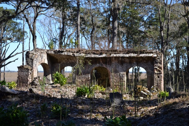
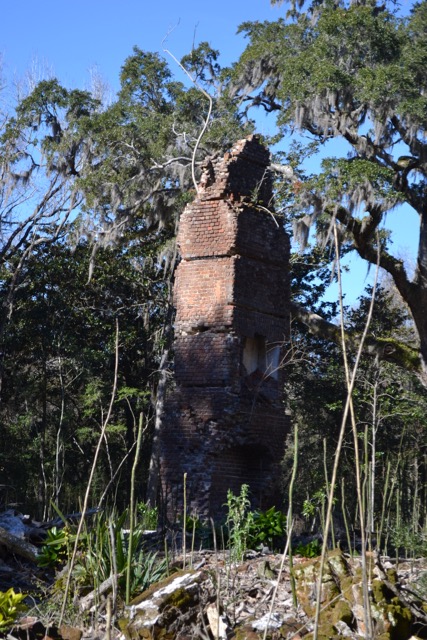
I had visited this place in 2018, and noticed since then that there had been extensive clearing around the ruins. The fenced-off grounds were covered with an extensive layer of brick rubble. The standing brick remains of the first floor contained arches, and one existing chimney towered above all. The house’s demise in a fire in 1897 was suspected by the family to be the result of damage to a chimney that occurred during the Great Charleston earthquake of 1886.
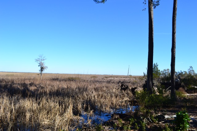
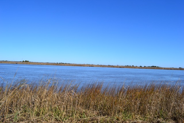
Local tradition suggests the name Eldorado came from its owner, Rebecca Brewton Motte, who noted the abundance of golden pitcher plants on the land. The site has expansive views out to the old rice fields, and during the nineteenth century at the time of rice maturation, it would have been a vista of “golden fields” from the vantage point of the house on that raised foundation. At the edge of the water, the Delta’s wetlands stretched out for miles.
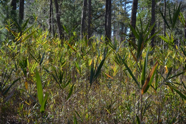
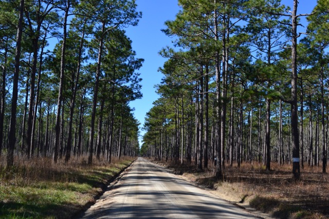
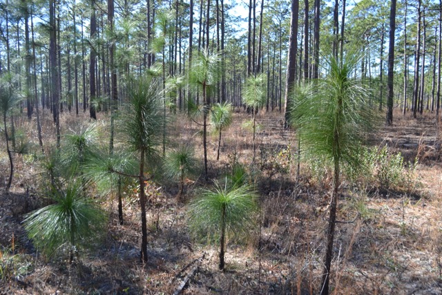
The designated Eldorado loop trail returned to a forested roadway, and a right turn into a section of pines with canes carpeting the forest floor led back to a final stretch of the walk on the Santee Gun Club Road. This main artery into Santee Coastal Reserve has a long straight section running between large stands of longleaf pines, and to the south of that road lies the Washo Sanctuary, a Nature Conservancy reserve. Back near the parking area on Mazyck Road stood a cluster of young longleafs.
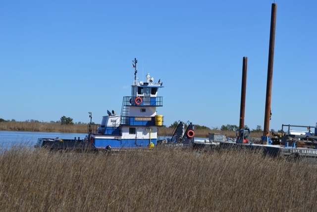
I also planned to walk the Big Well Trail, located by the South Santee River and starting near the dock. I was surprised to see the road (Clubhouse Canal) down to the dock closed, so I parked nearby and walked to the trailhead. It appeared that the road was closed due to marine construction taking place at the dock. Workers were eating lunch; the pushboat Eliza Lucas and several barges were secured there.
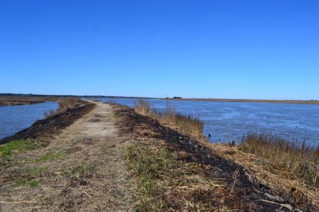
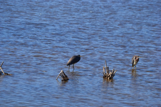
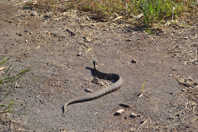
The trail headed on a dike along the South Santee River. It was a sunny and cool day, light winds making for placid conditions on the water. Vegetation on these dikes had been burned off. Between the mainland and the dike along the river were impoundments, populated with wading birds. I turned on one of the cross dikes heading to the mainland, and found a deep canal before land. Though the trail map loops back to the trailhead, I found a dike crossing over to the upland. I also recalled seeing a water moccasin near here in October of 2018, though no snakes were present on this cool January day.
The walk back from these impoundments took me past the Santee Gun Club and to the parking area on the Santee Gun Club Road near the entrance to the Cape Trail. The Cape Trail and the adjacent impoundments are closed during the migratory waterfowl season, to reopen February 8. There are many miles of trails and service roads to explore at Santee Coastal Reserve (SCR Trail Map). I would be back to walk the Cape Trail and the many other paths at Santee Coastal Reserve.
Good story, Bob. Looks like nice walking down there on a sunny winter day. Congrats on the new book!
Thanks, Mike. Another beautiful winter day today, the sun sure feels good.
HAve also enjoyed visiting Eldorado and can only imagine what life was like ..way back when….
Definitely a most interesting place.
Beautiful pics, Bob! Looking forward to seeing those bright blue Lowcountry skies again in the near future.
Yes we can’t wait to have many more of those in the coming days, and share them with you all.
Good morning Bob, I enjoyed the walk and look forward to reading more. Happy birthday. Don
Thanks, Don, for those greetings. If you have not been to the Santee Coastal Reserve, get out there for a walk before the deer flies and mosquitoes dominate.
Thanks for the wonderful pictures and backstory. Can’t wait for the new book!
You are on the short list for the first wave of books.
Wonderful Bob! I envy your adventures and looking forward to reading your new book on the subject!
Thanks for the interest.
Congratulations Bob!
Another book and birthday
Time well spent!
You keep us connected to the wild Nature around us. Thank you and many more happy days. Love, Dana