On our passage to Bull Island, we swept through the marshes at thirty knots. Our craft was my friend Brantley’s Pathfinder 22. It was an exhilarating ride on a crisp and clear morning, and on landing at the public dock it appeared we had the island to ourselves.
Our planned walk was new to me, and only possible due to the new dike across the Jacks Creek impoundment. While the observation tower on Jacks Creek has been located at the eastern end of the Sheepshead Ridge Road, formerly a Dead End, a spur dike connecting to the new main levee allows walks beyond. The commanding view from the tower contained migratory waterfowl and wading birds, and revealed a segmentation of the impoundment. 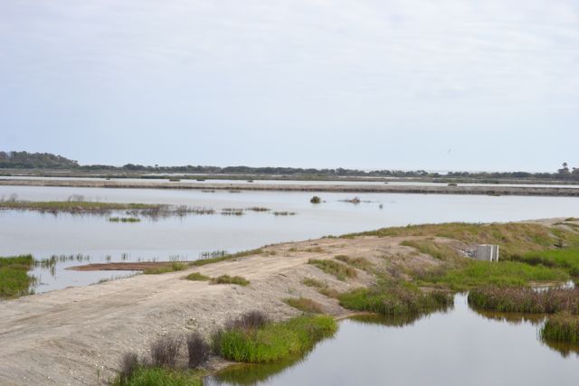
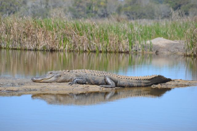
The main dike after many years was still under construction. On our walk to the southeast we encountered alligators swimming and basking, and this path seemed the island’s new Alligator Alley.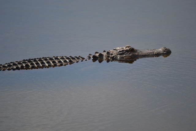
 It also led to the eastern dike around the impoundment, and connecting with an old dike leading to a main island attraction – the Boneyard. On the dike, I pointed out to Brantley the abundance of Hercules Club and the properties of this small tree’s leaves also known as the Toothache Tree. I grabbed some greenery for us to sample under our gums, and noticing some “leaves of three” elsewhere made a comment about poison ivy. Brantley immediately spit out the leaves – I had spontaneously seized on the opportunity for an April Fools prank.
The end of the dike separating the beach from New Pond had significantly degraded since my last viewing. Sand had pushed through to the impoundment, and the embankment had little resemblance to the dike that vehicles once drove over on the way to the Boneyard.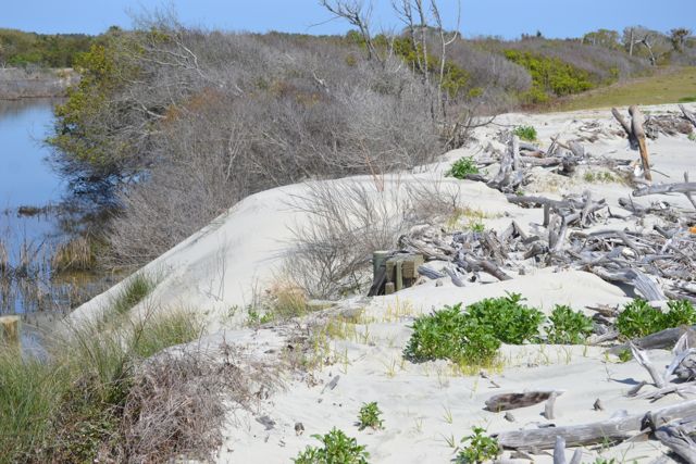 We stopped at the Boneyard for a snack amidst the fallen trees. The clear sky allowed for views far to the south, and I appreciated a restored distance vision with my eyes free of cataracts.
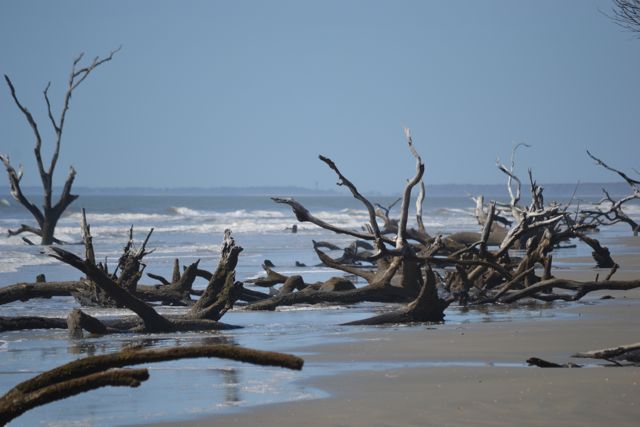 I had a moment of panic prior to continuing our walk, wondering where my new sunglasses could be. Finally finding them safely nestled on my face, I reflected on how karma had come back to bite me after my little April Fools fun with Brantley, to his amusement. The walk south took us past a growing Boneyard as the ocean continued to eat away at the maritime forest and shrub zone above the beach. Around some of the fallen trees on the beach small pools held tiny microsystems, and in several the spawning of large numbers of coquinas was occurring.
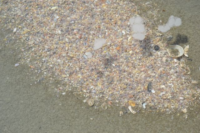
There were no intact dunes all the way to the access to the Beach Road, our path back to the dock.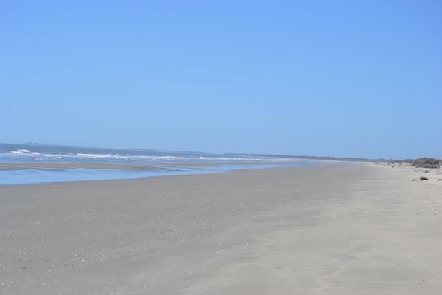 In the island’s center crossing the dikes we could see other island visitors in the distance. Their access to the island was like ours – by outboard as we found at the dock. I had used the app Strava to measure the distance of this new path, and it was a familiar distance – 6.2 miles.
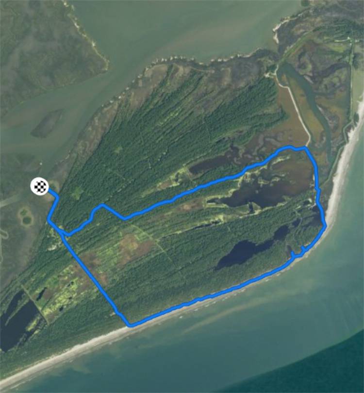
About three weeks later
This trip was my first sail of the year, dating back to a previous sail in September 2017. As I rigged Kingfisher, I wondered would break next on this old boat -most likely the corroded bow handle. My sail plan was exactly like the September sail – out across the Bay to the Northeast Point, and return. I planned a new loop walk using the new levee across Jacks Creek. Despite all my preparations, I managed to lose my second water bottle before shoving off, and missed one element of the rigging procedure. I rounded head to wind in the creek to complete this procedure, but still found myself grounding near the creek bank. But the reach across the southwest wind made for an easy passage, and some fine wildlife sightings. While still in the creek, across my course swam some type of animal – I soon ruled out alligator or bird – and as it scampered up the creek bank its chocolate-colored fur gave it away as a mink. Once out in the Bay, I stood in the cockpit to take in the view, and within seconds eight yards to starboard a loggerhead rose to the surface to breathe and exchange glances with me. After this sighting the sail was uneventful but swift prior to the landing on the Point. A couple of boats had proceeded me there, and I changed my landing spot closer to a snag on the beach for tethering Kingfisher.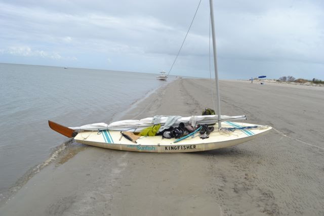
A large section above the beach had already been closed off and posted for seabird nesting. 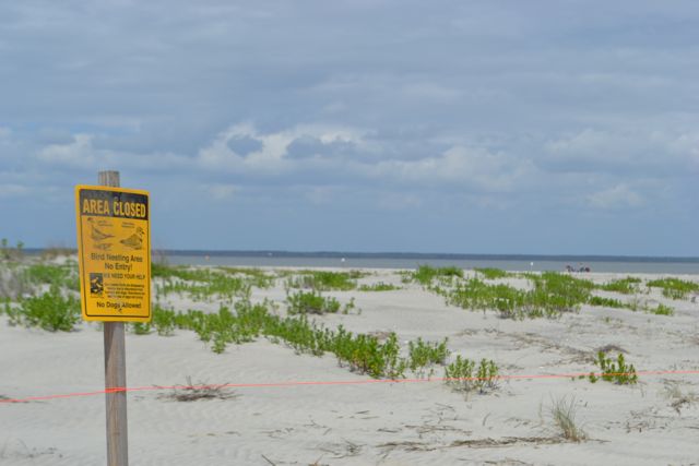 There were three kayaks on the Point above the tide line,
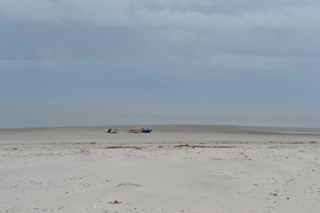 and I noted people further down the beach, in numbers appearing to be more than the boats on the Point could manage. I left the beach quickly to access the entrance to the maritime forest and the Jacks Creek dike system.
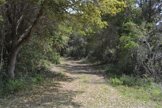 Fortunately this road did not live up to its alternative name – “Deer Fly Alley”. The walk along the northern side of the Jacks Creek impoundment held fine views both of the impounded waters and the Bay and mainland off to the north. It did not take long to reach the Old Fort site, and the octagonal tabby foundation.
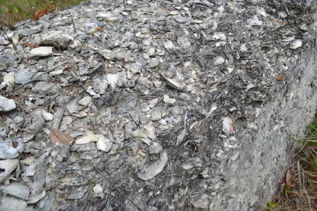 This was the foundation of an early eighteenth century watch tower rather than a fort. It is one of the island’s most important historic cultural resources. And now it provides the entrance to our path on to the new dike across Jacks Creek.
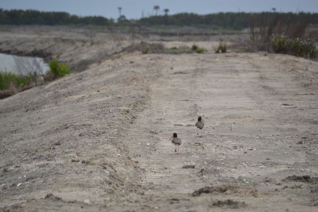
And this end of the dike is also an alligator alley with gators swimming and basking on the side of the built levee as well as on mud flats exposed above the impoundment. In some sections the signs of alligator traffic crossing the dike occurred at least every five feet. There were also birds all along, including pairs of black-necked stilts, and a pair of oystercatchers.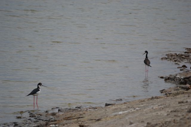
 I kept an eye out for eggs on the levee. Halfway across I saw a trio of walkers heading my way, and my hunch was correct – they were from the three kayaks at the Point. They were walking my same loop but in reverse to my direction, and like me felt the need to hustle before the incoming tide would approach our boats.
I continued with haste, eating and walking on a heading on the eastern dike toward its approach to the beach, noting the hardening of an eroded turn of the dike with bags of concrete.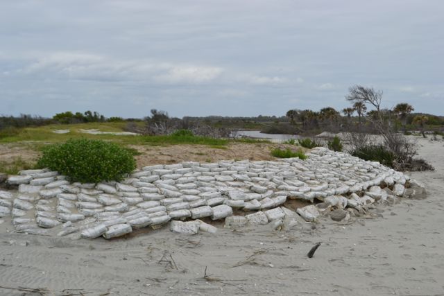 The beach beyond toward the Northeast Point had large sections of marsh sediments exposed. A couple ahead were poring over these island remnants, searching for shells. I chatted with this couple from Indiana about their finds, and they mentioned one large shell. I asked to see it, and she obliged, pulling it out of her pack. It was a very fine specimen of a Florida horse conch, and I pointed out what a fortunate find it was.
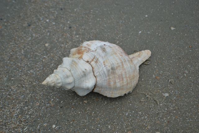 They had come to the island via a Coastal Expeditions beach drop, and I predicted that their captain would drool when seeing the shell.
Completing my walk to the beached Kingfisher, I checked and noted the distance of this loop – exactly five miles. 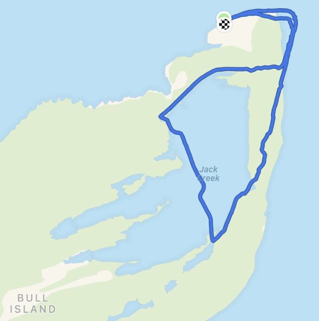 It seemed a complementary distance to the other new loop walk via the new levee but by the dock – 6.2 miles or 10K. But the following Wednesday the new levee was closed to visitors due to nesting birds – oystercatchers. This dike had been closed to foot traffic the previous year for nesting least terns. So these new loop paths would not be open again until after the nesting season, perhaps in August. But it demonstrated tangibly the priorities of Cape Romain National Wildlife Refuge. Wildlife trumps human needs. This fact is a vital aspect of the National Wildlife Refuge system. May these public lands continue to be protected.
Nice to see the internal dike finished and being used (even if it is armed with ‘gators 🙂
Almost finished, but definitely armed.