The shift to daylight savings brought an early Lowcountry glimpse of spring; in contrast nor’easters continued to pummel the mid-Atlantic and Northeast. My hiking buddy Brantley Arnau and I headed off to walk the Awendaw Passage in Francis Marion National Forest (FMNF). And we had lots of company: families strolling with children, casual walkers, numerous parties with dogs, bicyclists, and trail runners. I was pleased to see so many people enjoying this wonderful recreation resource in FMNF. After a stretch from Buck Hall, the trail meets up with Awendaw Creek, and parallels this waterway until the canoe dock.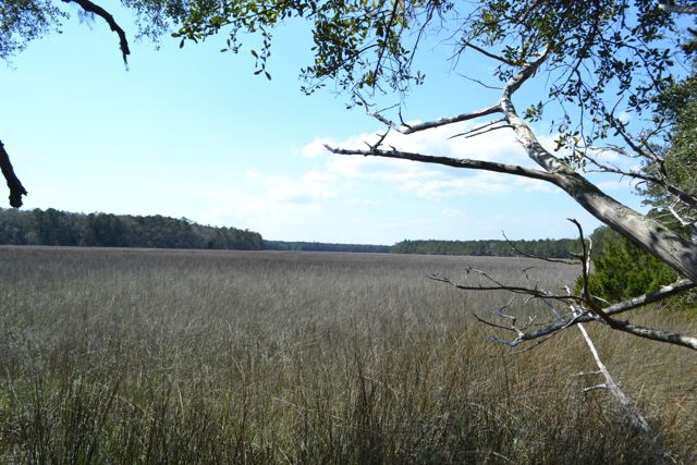 Outboards cruising the waters gave proof to the creek’s depth. It was a delightful walk, finishing up along sizable bluffs by the creek’s northern banks. This four-and-a-half mile section at the coastal end of the Palmetto Trail is one of the gems of Lowcountry designated hiking trails.
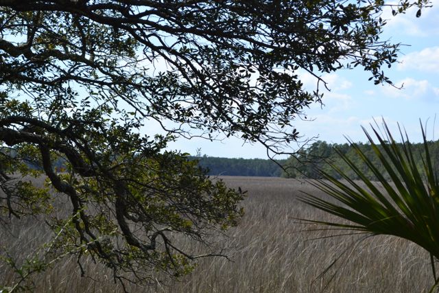
^ ^ ^ ^ ^
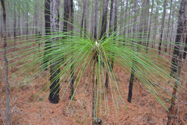
This National Forest road, a spur off of #211, did not have a number. Like many others in FMNF the locked entrance gate invites walkers to explore. Located to the northeast of Still Landing on Wambaw Creek, it curves through pinelands and approaches the bottomland hardwood forest of the Wambaw swamp. Longleaf pines were under cultivation throughout.
 The amorphous end of the road dropped off in elevation to the bottomland communities, and Wambaw was tantalizing close to the west. On the return walk, a small basin off the road held a pond community of cypress and tupelo, providing relief in the pine flatlands, though an elevation gradient was evident throughout these lands.
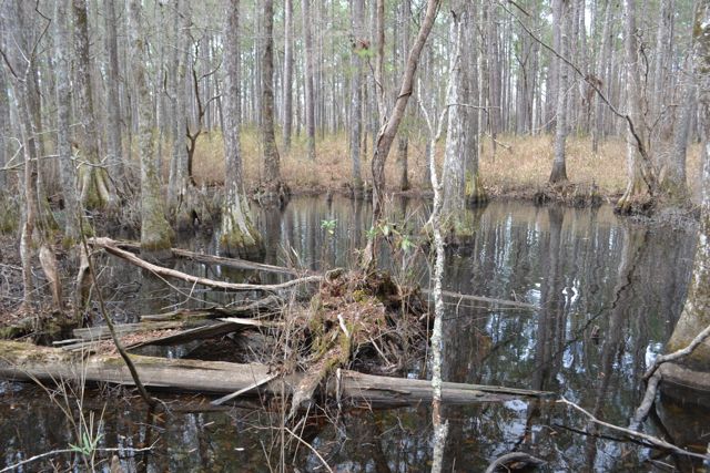
^ ^ ^ ^ ^
I made a second walk in I’on Swamp this year, and took the full loop trail. I’on Swamp Trail is another of the designated trails in FMNF, and contains interpretive signage. The loop took me across dikes containing old rice fields now reverting to bottomland hardwood forest. As in my recent walk near Wambaw Creek, these lands were also once a plantation – Wythewood Plantation. Rice flats transported rice out to the Wando River by the dug Wythewood Canal. On this day solitude reigned, enhanced by the resonance of barred owls calling in the woods.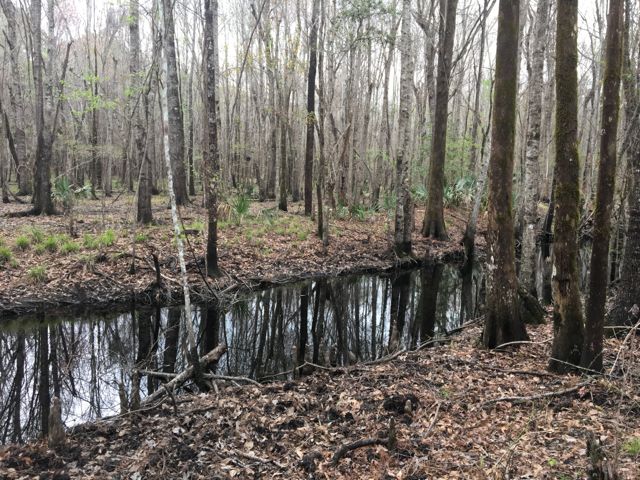
^ ^ ^ ^ ^
I had difficulty finding the Forest road leading out to Guillard Lake Scenic Area, but after several turnarounds was on National Forest road #150. The Gullard Lake Scenic Area contains a ten acre oxbow lake, formed by the Santee River in its meandering course to the coast. A left turn on #150-G leads to a high bluff, one of several alluvial features left by the Santee. A small creek cuts through to the lake on the western side of the site, and is populated with large cypress trees.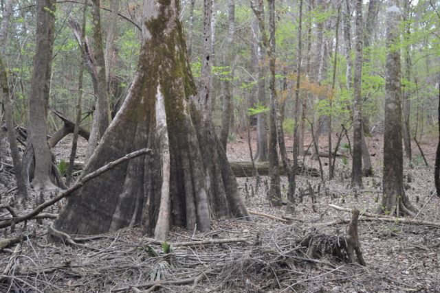 This FMNF Scenic Area had all the signs of a party place: well used fire ring, strewn cans and bottles, and trash spoiling the scene. Several large limestone boulders lay incongruously on the steep bank of the bluff near the water.
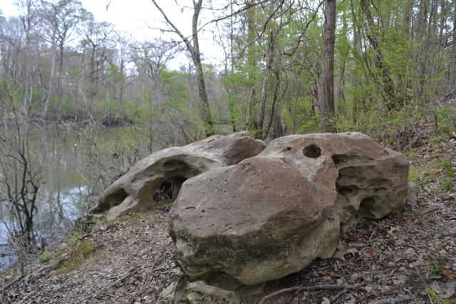 I had seen limestone outcroppings before in Echaw, but much smaller than these remnants. On the east side of the site, a spur of the road leads down to the lake as a put-in for boats to access the lake and its reported excellent freshwater fishing. A homemade sign was taped to a tree proclaiming “This is heaven!! Please don’t trash it and make it look like hell. Please pack it in and pack it out”.
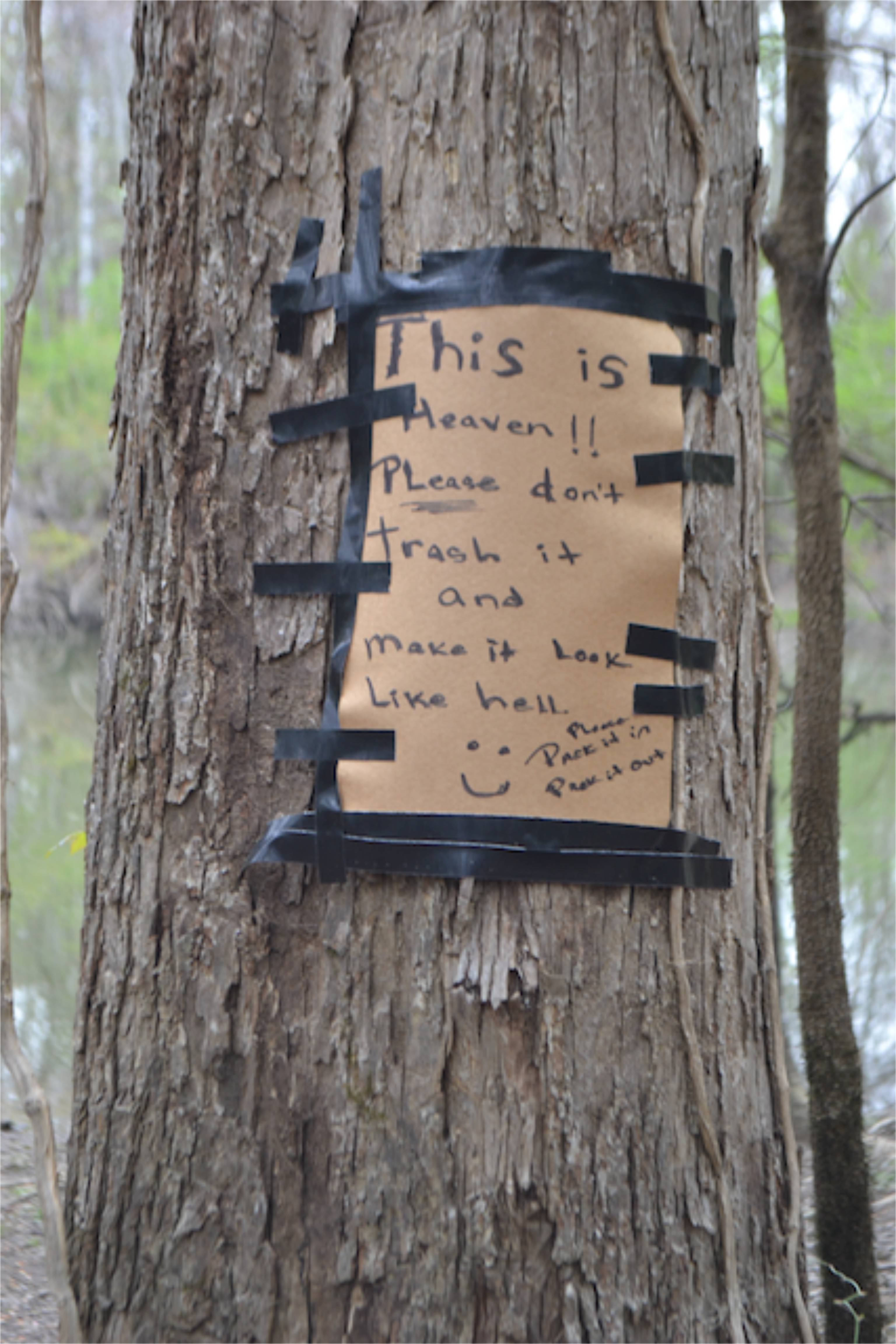 It was an individual’s plea – I seconded the motion. I was reminded of the vast cleanup in the Forest on Palmetto Pride Day with three hundred volunteers participating. The Forest absolutely needs more friends.
^ ^ ^ ^ ^
I parked off the paved road and stepped into the woods. Passing through undergrowth including easter lilies I came into more open pinelands allowing for easy walking.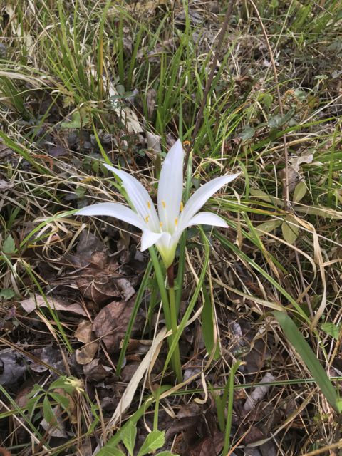 I began an exploration of the fork of two creeks in the Forest, following a detailed 1792 plat. I anticipated having to cross a slough, and was pleased to find it dry. The sun was warming up the forest floor, and I encountered a black racer. We both stopped and took stock of each other before moving on. I passed a bay blue flag iris, the first I had seen blooming this season. I found some high ground, and descended the narrow elevation grade until reaching the beginning of an extensive bottomland hardwood swamp; familiar red wilderness signs announced it was the edge of Wambaw Creek Wilderness Area.
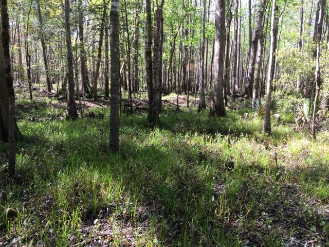 The plat laid out the site of a former plantation, containing pinelands, cultivated fields, and a settlement with slave dwellings laid out in two rows. There was no visible evidence of buildings from that plantation, yet the high ground of the former fields and settlement was prominent. There was also the remnant of a dike on the Wambaw border, probably the edge of a rice field. The cool morning, sun coming through the open woodlands, the different forest communities, and the “pathless woods” all made for a stimulating experience.
Great posting, Bob. I never realized that there was so much rice grown in the area in the past. The pictures added a great deal.
Thanks Linda. The areas I covered are only a small glimpse into the Rice Kingdom in the Lowcountry.
It is heaven there Bob, and we love it so even though we are 360 miles away in Pittsburgh. We get our dose every year visiting Myrtle Beach and I remember the trip Debbie and I took to Bulls Island a few years ago. Maybe again this year?
You are fortunate to live in such a wonderful place! Thank you for the continuing stories.
Ron
My next post Ron will be a trip to the island several weeks ago.
Another nice one Bob.
The first section of the Palmetto Trail starting at Buck Hall is pretty nice. A friend and i have walked it a good bit over time. Over the last few years I have walked all of the Palmetto Trail up past Lake Moultrie. It is absolutely worth the effort.
Keep up the good work.
Thanks Hal. Looking forward to seeing more of the Palmetto Trail.
Saw lots of miles of trails in the Smokies last week – more about that soon.