There were a number of river crossings on the way to the mountains. Enoree, Tyger, N. Pacolet, Green. My excitement grew as the elevation rose on a trip postponed for two years. I was following the waters of the Santee watershed to its upper elevations at the Blue Ridge.
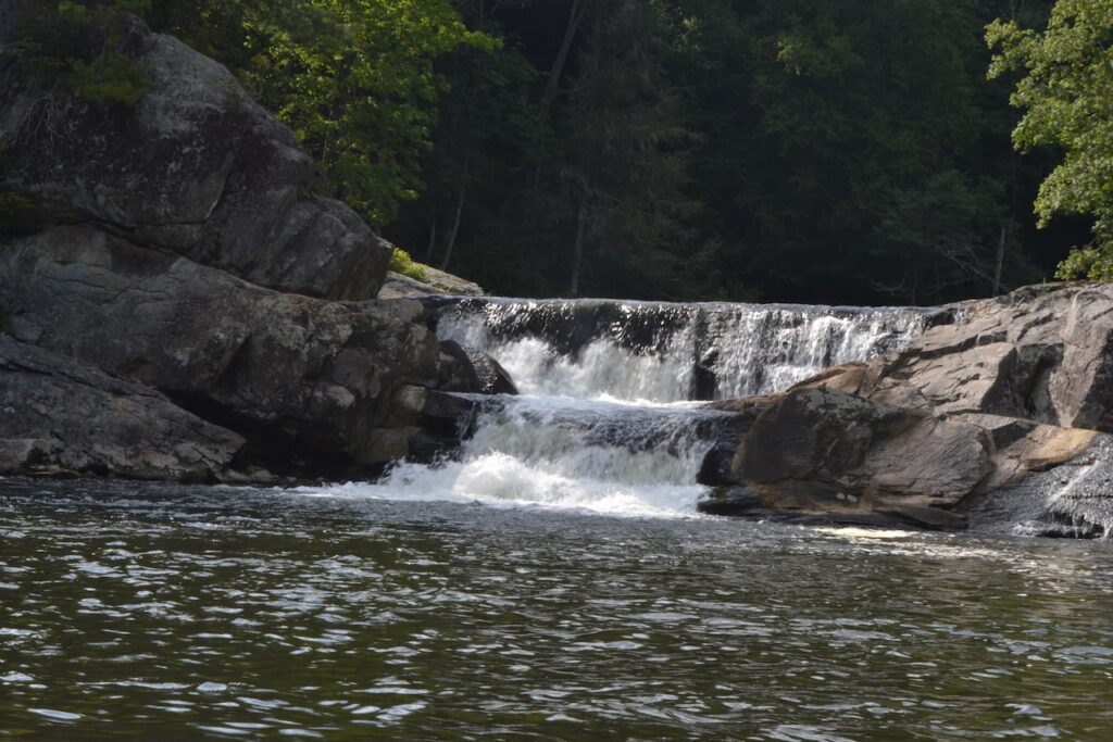
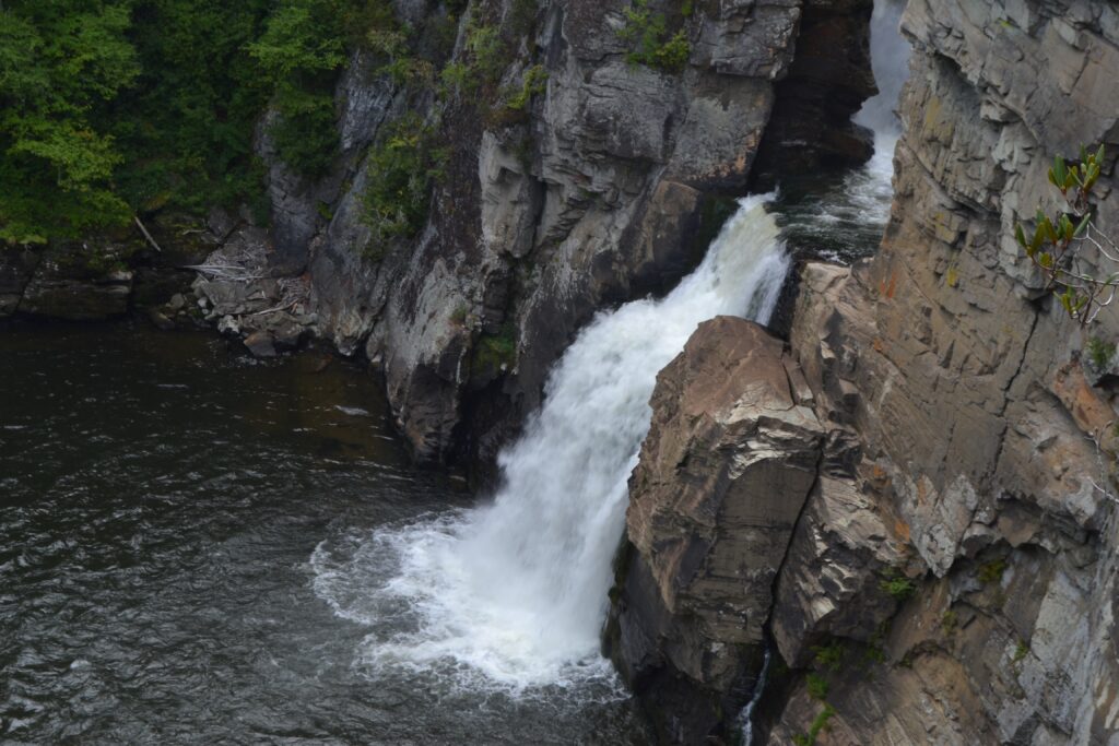
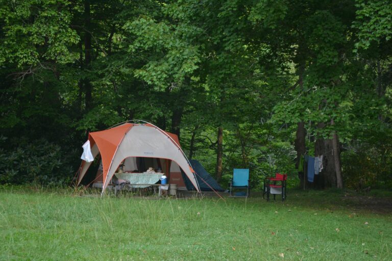
I met my old friend Mike Phillips at the Linville Falls campground, and we set up our camp within earshot of the flowing Linville River. After Joel Fine joined us, we made the short drive to Linville Falls to view these much visited cataracts. The trails were mostly wide and easily walked, with plenty of other people seeking the falls. Our first view was of the lower (and larger) falls from a high overlook. Looking south from near this same location gave a fine vista of the beginning of the Linville Gorge to the south. A large plunge pool collects the waters from the cataract. We made our way to the upper falls, tumbling over metamorphosed granite,and the serpentine canal carved in quartzite, funneling the water to those lower falls. Several dozen people occupied the space, and scuttled over the flat rock near the upper falls pool. Before returning to our camp we took another trail leading to a view of the lower falls plunge pool.
My expectation to experience the cool weather of the mountains after a very hot Lowcountry summer was tempered by fine warm and sunny weather. In fact we chose to not light a campfire for any of our three nights. On the first night, a grandfather and his three grandchildren were camped next to us, and a central part of their experience was the campfire. In conversation I inquired about the Grandfather Mountain trail we planned to hike, the Daniel Boone Scout Trail. He knew it, and his summary was “quite rocky, then it mellows out.”
The Linville Falls walks were a warmup to our plans for the next two days – panoramic, challenging, and iconic hikes during North Carolina’s Year of the Trail. We would tackle a hike up the eastern side of Grandfather Mountain first, ascending to Calloway Peak, the highest point on the mountain at 5,964 feet. Waters trickling off the mountain to the south rated as the highest part of the Santee watershed. On the way up the Blue Ridge Parkway to our trailhead, we would pass over what I learned was a famous engineering construction, the Linn Cove Viaduct. The headwaters of Wilson Creek coming off Grandfather Mountain passed under this viaduct, eventually flowing into the Catawba River. The Eastern Continental Divide passes over the peak, and the waters on the other side of the mountain flow to the Mississippi River.
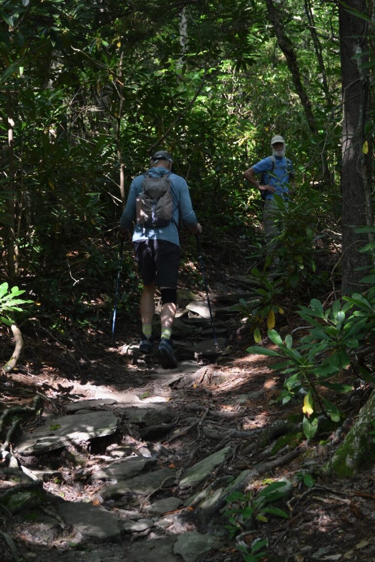
From the Boone Fork parking lot, we took the Tanawha Trail until the junction with the Daniel Boone Scout Trail, and crossed a swinging bridge over the clear waters of Boone Fork flowing down the mountain. After leaving the vicinity of the Blue Ridge Parkway we entered into the Grandfather Mountain State Park, and found a kiosk for registering our hike. This park is separate from the Grandfather Mountain private lands to the west and its mile high swinging bridge. The state park had extensive signage throughout the path: marking the trail, identifying distances, and providing clear trail signs at junctions. Though quite populated with rocks and roots, the trail was well designed for our 2,000 foot ascent to the peak.
The rocks on the trail and the overlooks on rock crags were all part of a bigger and ancient picture. They told stories of the geology of the Blue Ridge here –the Alleghanian orogeny, thrust faults, and the mountain’s rocks starting out 750 million years ago at the bottom of a rift basin.
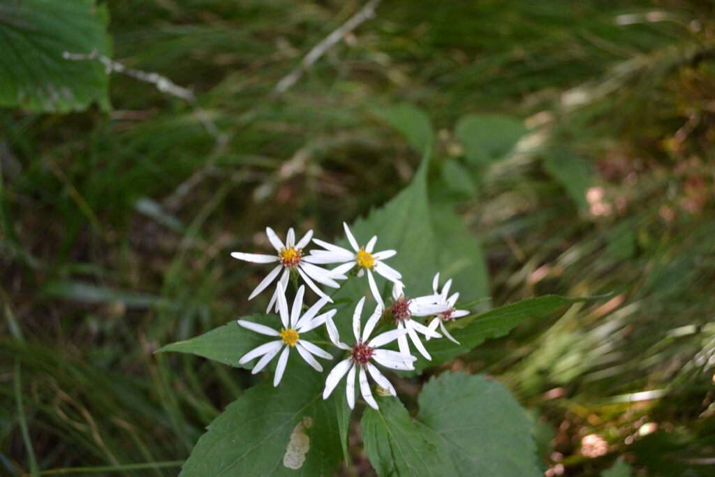
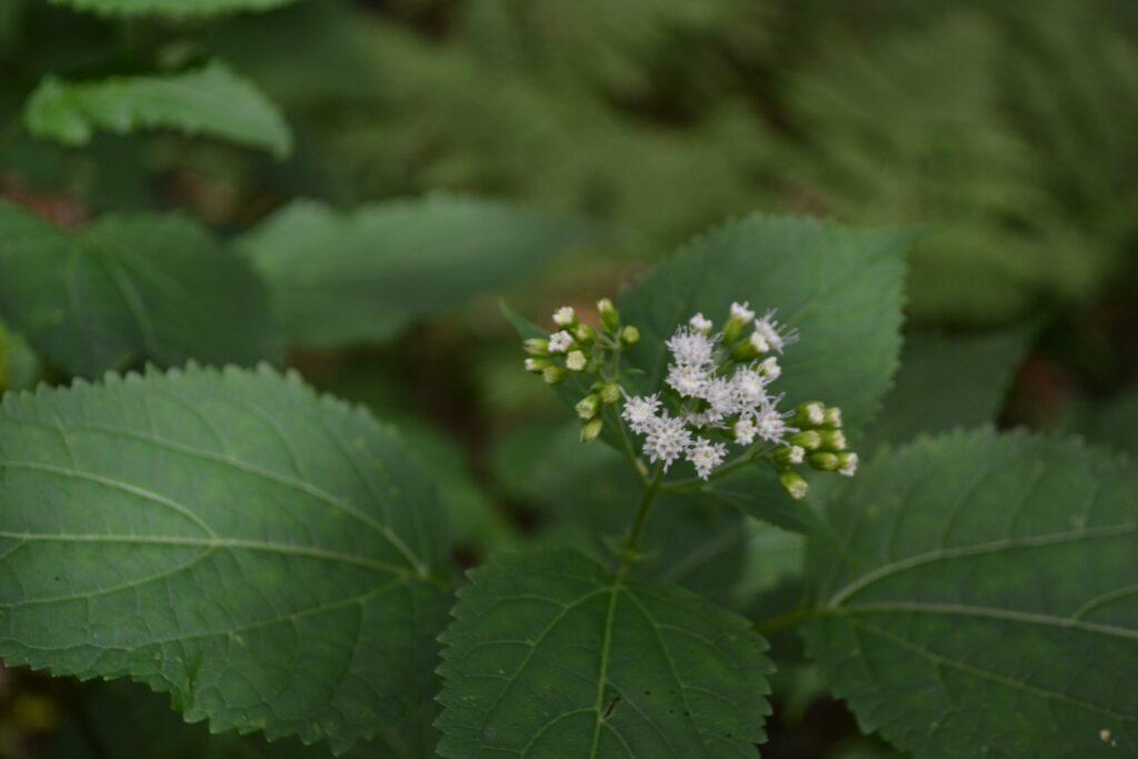
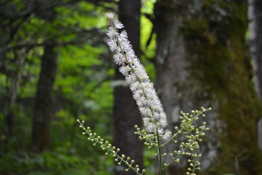
I had to cancel this spring’s plans for an annual hiking and camping trip with old friends in the Smokies, and missed the profusion of wildflowers. Yet as we ascended to higher elevations we began to encounter blooms, including white wood aster, sweet Joe-Pye-Weed, white snakeroot, and pink turtlehead.
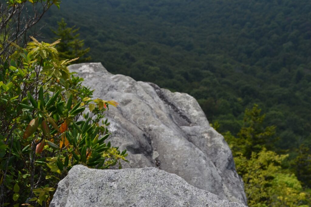
At the junction with the Cragway Trail, a relatively small Table Rock lured us up and out on its sloped top for a panorama. Ahead we would pass through coves filled with ferns, moss covered forest floor, and finally spruce/fir forest. We had also encountered our first other hikers of the day: a young man heading down our path but not oriented to where the trail led, and a young woman hiking in our direction whom we overtook upon reaching the ladders.
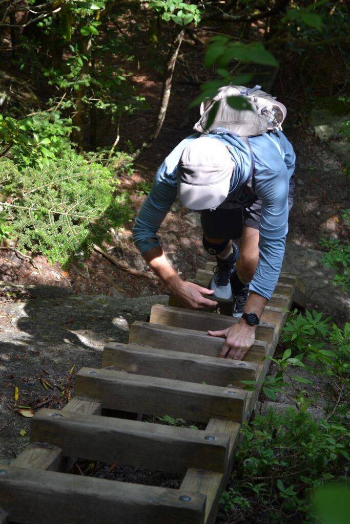
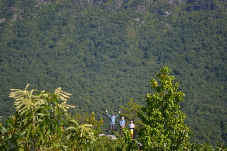
These ladders and cables assist hikers with ascending a steep rocky section prior to arriving at the summit of Callaway Peak. These helpful devices were built from sturdy treated four by fours, making the climb quite easy. There were two more sets above and the trail leading to the peak, a small rock clearing,We would linger here for lunch and conversations with other hikers, perhaps a dozen coming and going. Ray from Massachusetts, and a couple from Philadelphia with their dog (who climbed one of the ladders solo!) chatted with us.
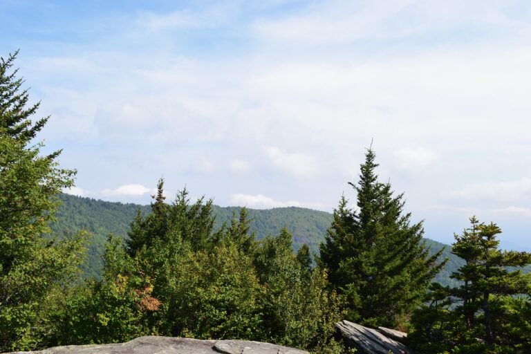
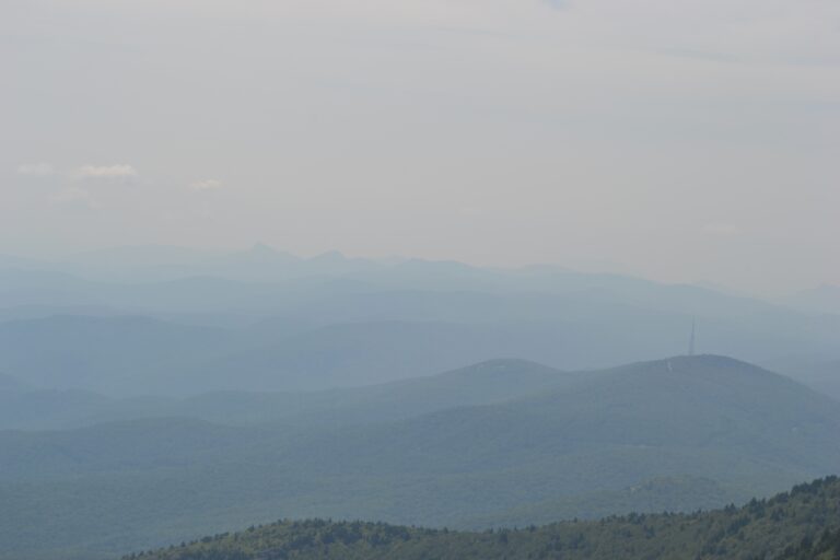
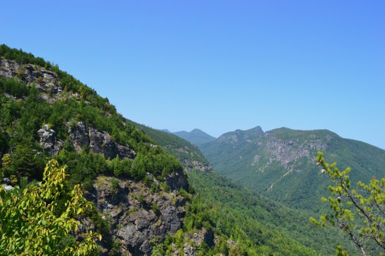
There were substantial views to the south and west, somewhat obscured by an overcast sky. I laid out map and compass on the rock for orientation. Far in the distance to the south southwest, jutting up through the haze, were the jagged cliffs of Linville Gorge, our destination for the following day.
On our return hike to the trailhead, we took the Cragway Trail down, and found fine overlooks to the north. At the Top Crag View, three people had stopped for lunch, and they mentioned in the past having full blueberry bushes (no berries on this day). There were stands of sand myrtle on the rock with a smattering of blooms. The large rocky slabs continued down the mountain requiring steep scrambling – a descent that would be much more challenging in wet weather. More overlooks awaited down the trail before we connected with the Nuwati Trail, a flat and easy path to the return on Kanawha to the parking lot.
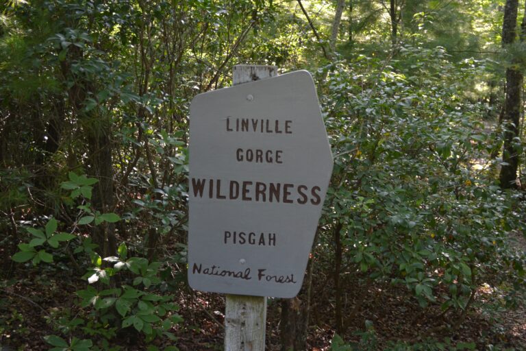
Linville Gorge had been my first backpacking trip in the mountains and in a wilderness area. The trip, fifty years ago, was most memorable and incredibly stupid in the flush of impetuous youth. Five college friends and I drove to the Gorge and arrived at night. The friend with knowledge of this area pulled a folding candle lantern out of his pack. After he installed a new candle and lit it, in single file we began our hike down Conley Cove Trail in pitch black, our only illumination the candle lantern. We made the hike down into the Gorge, somehow avoiding disaster, to a fine riverside setting where we set up camp.
With that unforgettable trip in mind, we embarked on a hike joined by another friend of Joel’s. Mark would match the high level of endurance of Joel, an Ironman and the senior member of our group. Our hike plan included the use of two vehicles, leaving a vehicle at the endpoint, the Pinch-in Trailhead, and returning with the four of us to our starting point, the Conley Cove Trailhead. Placing the cars involved a long drive on a rough dirt and gravel road. It seemed like a fine plan – a hike down into the Gorge to the Linville River Trail, a little over three miles to the Pinch-in Trail, and a hike up and out of the Gorge. I noted the sign at the Pinch-in Trailhead stating the three reasons Linville Gorge hikers needed rescue: dehydration, getting lost, and underestimation.
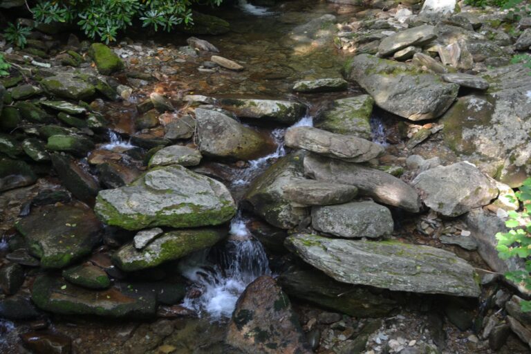
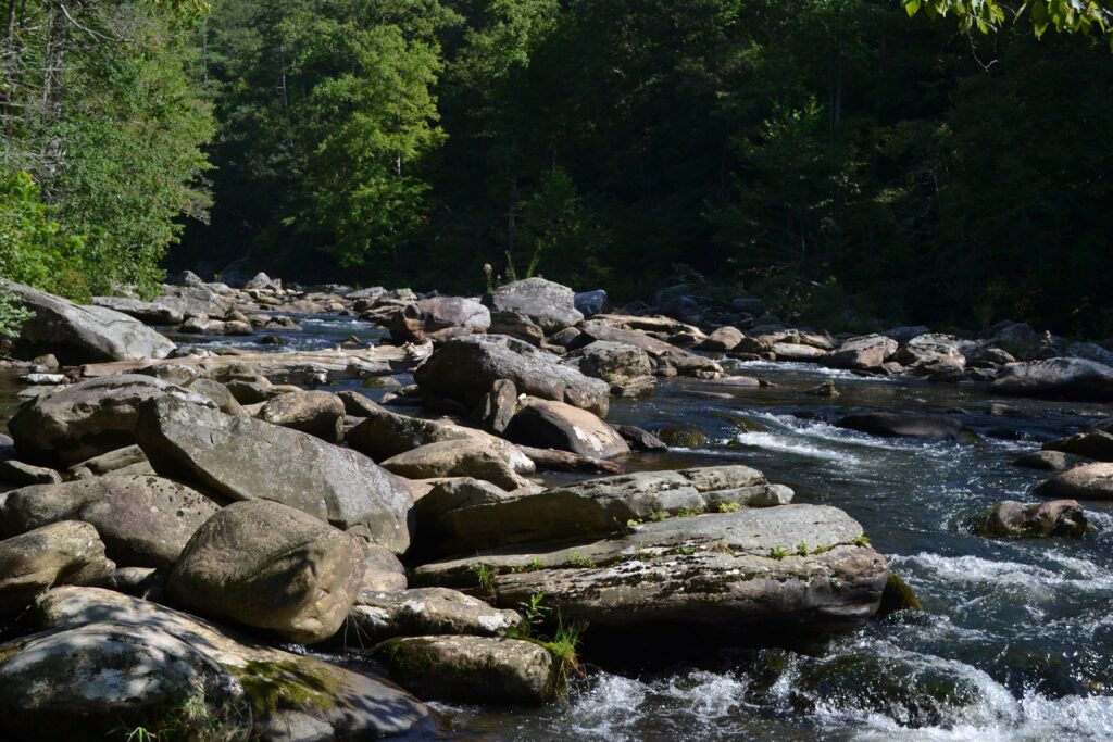
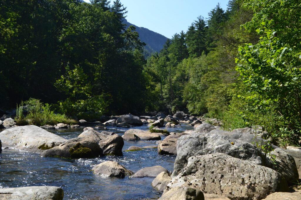
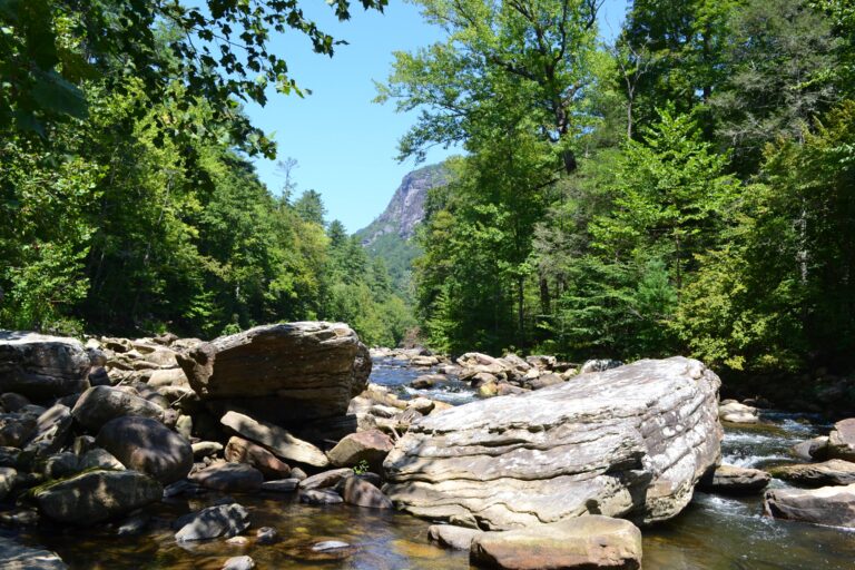
The switchbacks of Conley Cove Trail were imprinted in my memory, though there were several rocky segments where I wondered how we had traversed them in the dark. It did not take us long to arrive at the river and a large campsite where we most likely camped that night in 1972. The haze of the previous day was gone, and we were blessed with a clear blue sky. The river and the setting were stunning – the Cherokee name for the river, Eeseeoh, meaning river of cliffs, was most fitting. The waters had carved this pocket canyon, called by some the Grand Canyon of the east.
Walking this trail following the waters, we would hike up and down, periodically returning to the river and spectacular views of the eastern ridge of the Gorge. We were able to view peaks and rock formations including Hawksbill, Table Rock, the Chimneys, and Shortoff. After lunch along the river the trail meandered up the slope away from the water, though we scrambled down for one last stop at the river. I thought twice about using the energy for the scramble, but thankfully followed the others for moments of awe – incredible views both up and down the river to the eastern cliffs, and the puddling phenomenon of eastern tiger swallowtails along the river’s bank.
We marched on, and soon came upon the trail leading us out of the Gorge to the parking lot – the Pinch-in Trail. We had no descriptive knowledge of this trail, except that it was 1.3 miles long, and climbed over 1700 feet in that span. It was not long before we would meet the sharp incline of this path. The day was warm, and thankfully we had all packed plenty of water. Though not a heavy sweater, before halfway up I was sweating profusely.
Mark and Joel had sped ahead, and Mike and I labored together, stopping frequently not to admire the scenery, examine nature, or snap photos, but to take brief breaks and slugs of water. I complained about the nature of the trail, straight up a narrow eroded channel with frequent rocks and roots requiring high steps and climbs over the barriers. In retrospect I learned that the trails in a wilderness area are not improved (switchbacks, steps, etc.), and not meant to provide easy hiking trails for the public. It was quite a learning experience, and challenged my physical limits.
As Mike and I slowly ascended, we heard the calls of Joel and Mark, hopefully from the parking lot. No, they had found a fine promontory, and encouraged us to climb up and join them. Mike went, and after some hesitation I made the climb to those spectacular views, especially to the south where Linville Gorge ends with Lake James in the distance. I eventually climbed down and started again, slowly, on the trail leading out of the Gorge. Mark and Joel would pass me, and Mike and I continued our slog up the mountain.
Eventually we reached the trailhead, and slowly recovered from this hike. Tough, challenging – reading about it from hikers later the adjective “brutal” perhaps captured it best. We did not see another hiker throughout this wilderness area hike. I endorsed “underestimated”, probably related to the fifty intervening years since my first trip to Linville Gorge. Besides drinking more water, I longed to plunge into the river, especially after seeing such enticing swimming pools along the river trail. We all would sink into those cool waters back at our campground, continuing the recovery from this hike, which had been a mixed bag of awe, adventure and ordeal.
12 thoughts on “Following the waters”
Ronnie
Another great post Bob! I’ve done those Linville Gorge trails, and can attest to their rigor.
Hiking in the mountains is not for sissies.
I know the hard work is well worth it. I love that you’ve been hiking with these old friends for many years. Keep it going!
Fun to see the Tiger swallowtails too.
GInny Prevost
NOT me bubba!!! I’m too out of shape for that 🙂 I’ll stick to the LOW COUNTRY BUT… I vicariously enjoyed the beautiful hike. Thanks for sharing.
Loved reading about your hikes in NC, especially since we had just been there. The whole family did the relatively easy hike to viewpoint for Linville falls. Was going to post a picture, but can’t figure out how to do that right here. Our 3 year old granddaughter hiked all the way up by herself. She is a little mountain goat just like her dad!
I’m always fascinated by the geology, so enjoyed your comments on the rocks & formation. Kudos to you for tackling the challenging trails- those days are past for me!!
My best to Susan & family


Another great post Bob! I’ve done those Linville Gorge trails, and can attest to their rigor.
Yes, quite a walk out
Breathtaking and congrats on surviving the “brutal” climb!
Maybe beyond brutal
Hiking in the mountains is not for sissies.
I know the hard work is well worth it. I love that you’ve been hiking with these old friends for many years. Keep it going!
Fun to see the Tiger swallowtails too.
NOT me bubba!!! I’m too out of shape for that 🙂 I’ll stick to the LOW COUNTRY BUT… I vicariously enjoyed the beautiful hike. Thanks for sharing.
I was in shape but that last trail…
Loved reading about your hikes in NC, especially since we had just been there. The whole family did the relatively easy hike to viewpoint for Linville falls. Was going to post a picture, but can’t figure out how to do that right here. Our 3 year old granddaughter hiked all the way up by herself. She is a little mountain goat just like her dad!
I’m always fascinated by the geology, so enjoyed your comments on the rocks & formation. Kudos to you for tackling the challenging trails- those days are past for me!!
My best to Susan & family
I don’t think this comment section has a way to post photos. Glad you got up there too
Awesome! Love the details…l what an amazing trip, great pix!
Had a major fail when setting up tripod to photograph falls. Missing – the camera mount. Has fallen into a little black hole somewhere
Wow, thanks for the pictures & sharing your adventures. It brings back the memories when I was there 50+ years ago.