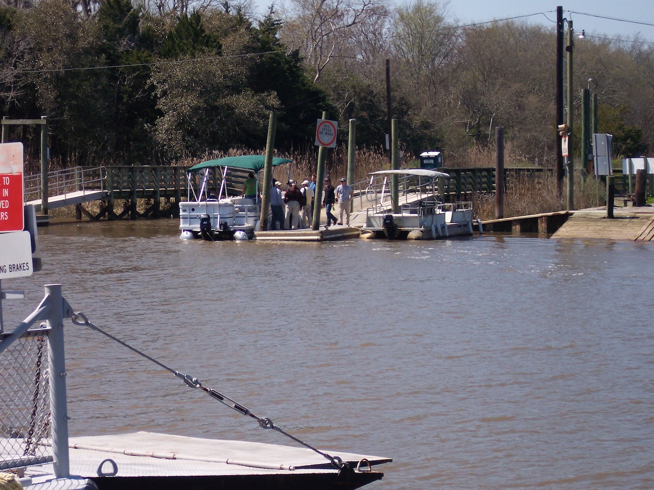
A slender ribbon of water separates the Intracoastal Waterway at the South Island Ferry from Cat Island. The original stream must have been slim before the dredging of the Estherville Minim Creek Canal in 1903. On this day, an astronomical high tide had overflowed the ICW pushing the water twenty yards up the boat launch landing pavement.
A small group gathered who would be taking the Yawkey Wildlife Center tour, and were rewarded on the cool windy morning with a flyover by an eagle. Initially, water separated us from reaching the floating dock, but it fell rapidly before the pontoon boat came across the Waterway to ferry us over to Cat Island. (Tours are free, and offered by reservation only – for reservations call Patty at 843-546-6814.)
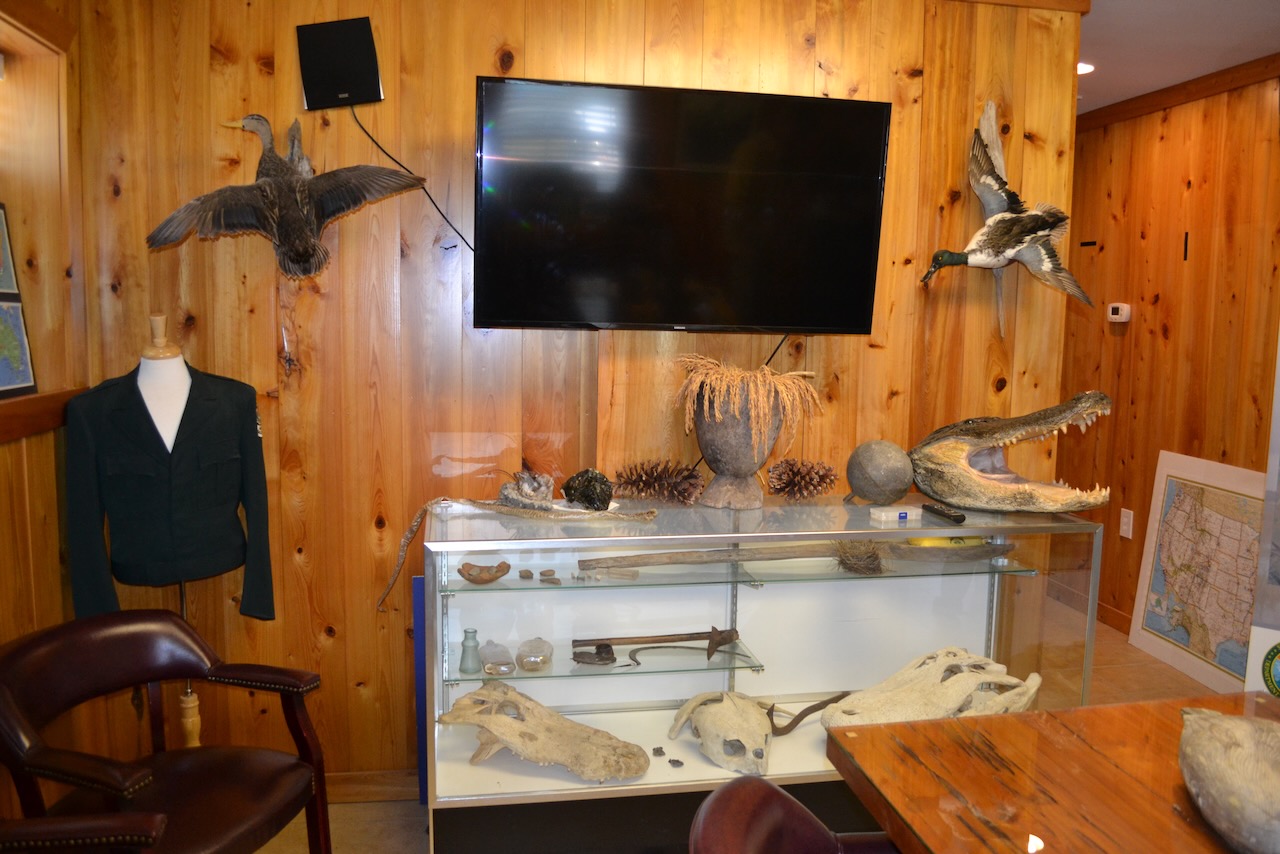
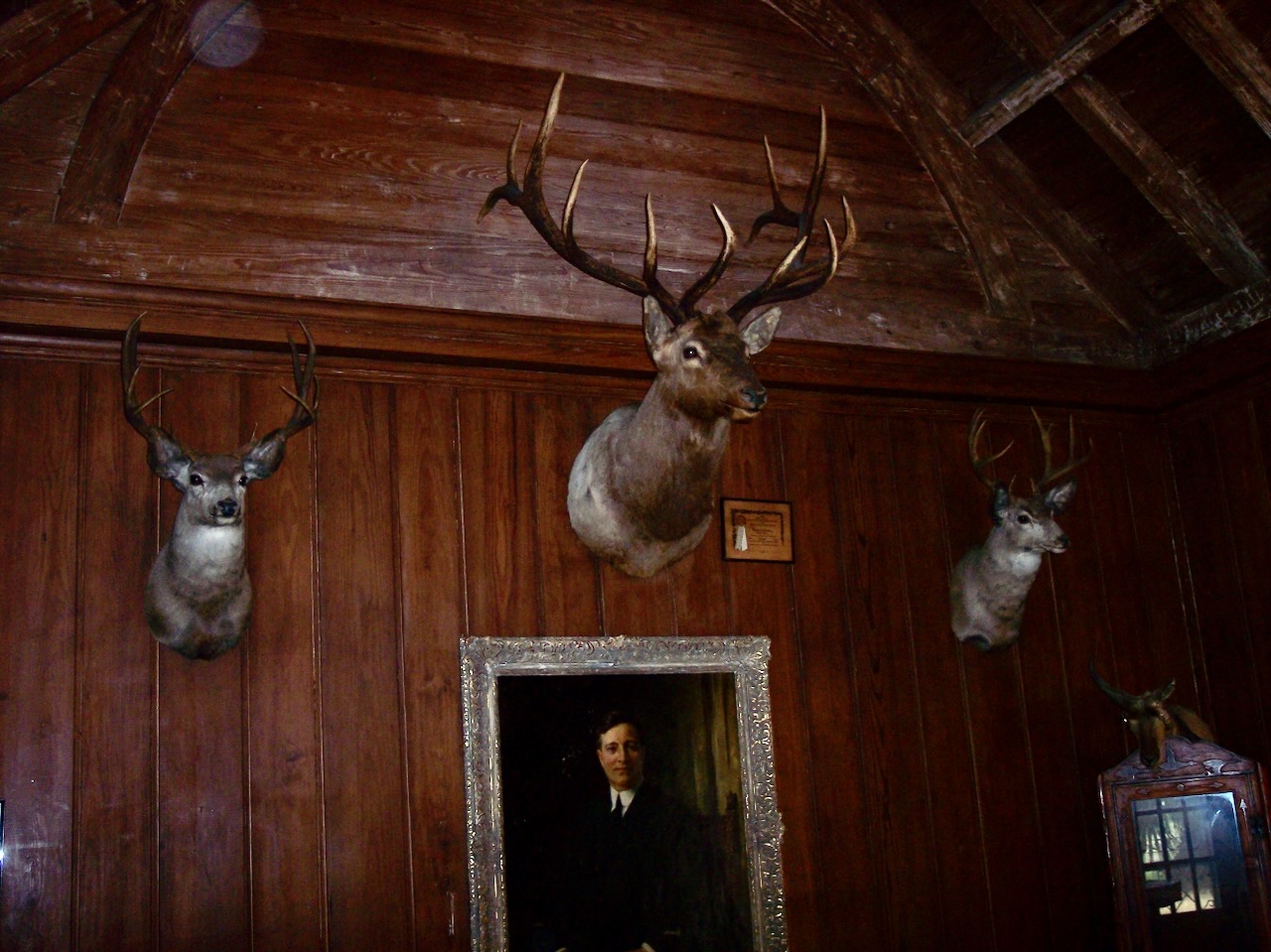
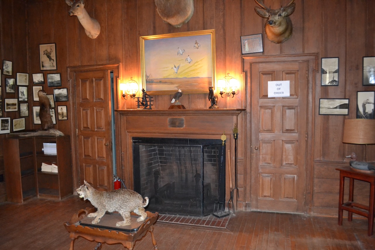
Jim Lee of South Carolina DNR would be our tour guide, and after embarking on a minibus we stopped at a small building adjacent to the landing for an orientation to the Yawkey Wildlife Center and our tour. The paneled room was lively with display cases, stuffed animals, photographs, and maps. Jim has been with DNR for 39 years, and at Yawkey for the last seven. He gave an overview of the Yawkey Center, and fielded the first of many questions.
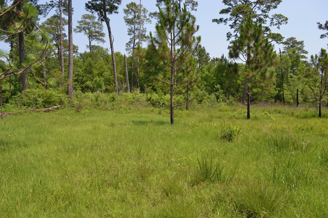
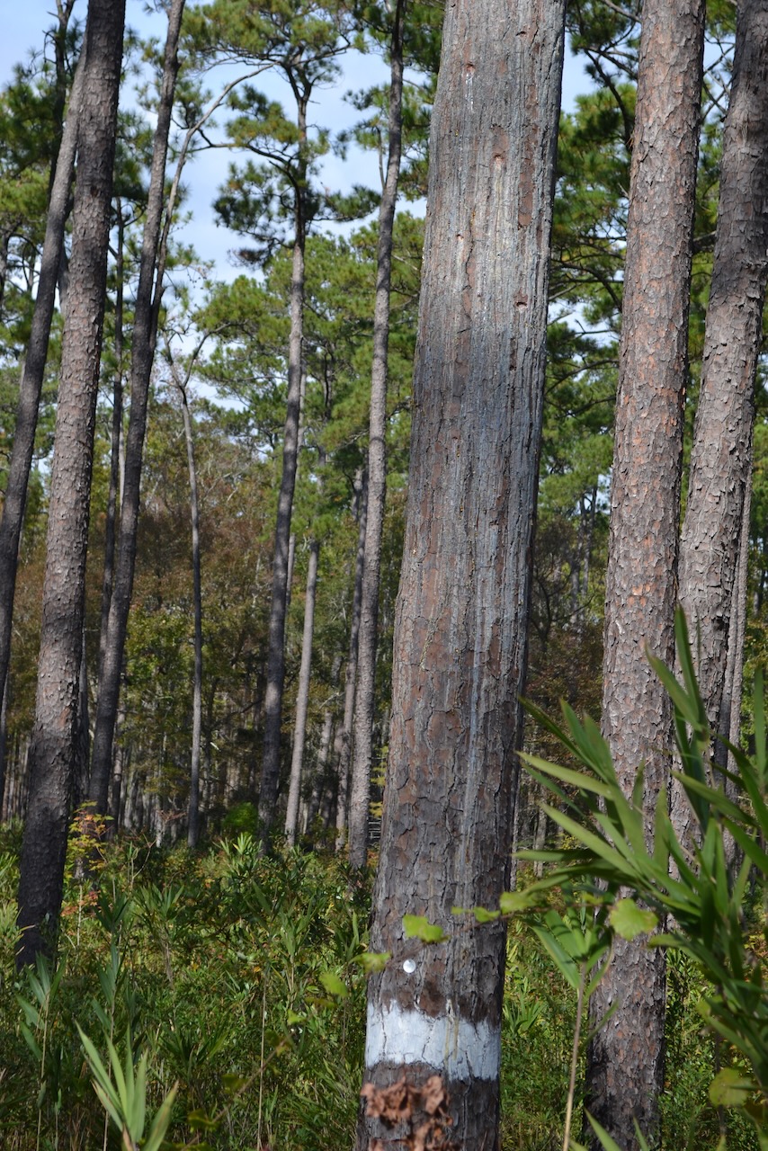
We headed out in the tour vehicle on the dirt road, and soon turned south, cruising down a Pleistocene ridge and through the longleaf pine ecosystem. These were mature longleaf pines, and Yawkey staff maintain these pinelands by controlled burning every three years.
As we turned to the left we came upon a familiar field I recalled from my last visit in 2011. Jim described this former baseball field and the resident local team, the South Island Hornets, who played against other local African American baseball teams. Some of the Boston Red Sox visitors would play here too, and the legendary Ty Cobb once took batting practice on this field.
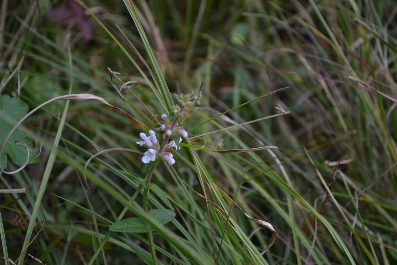
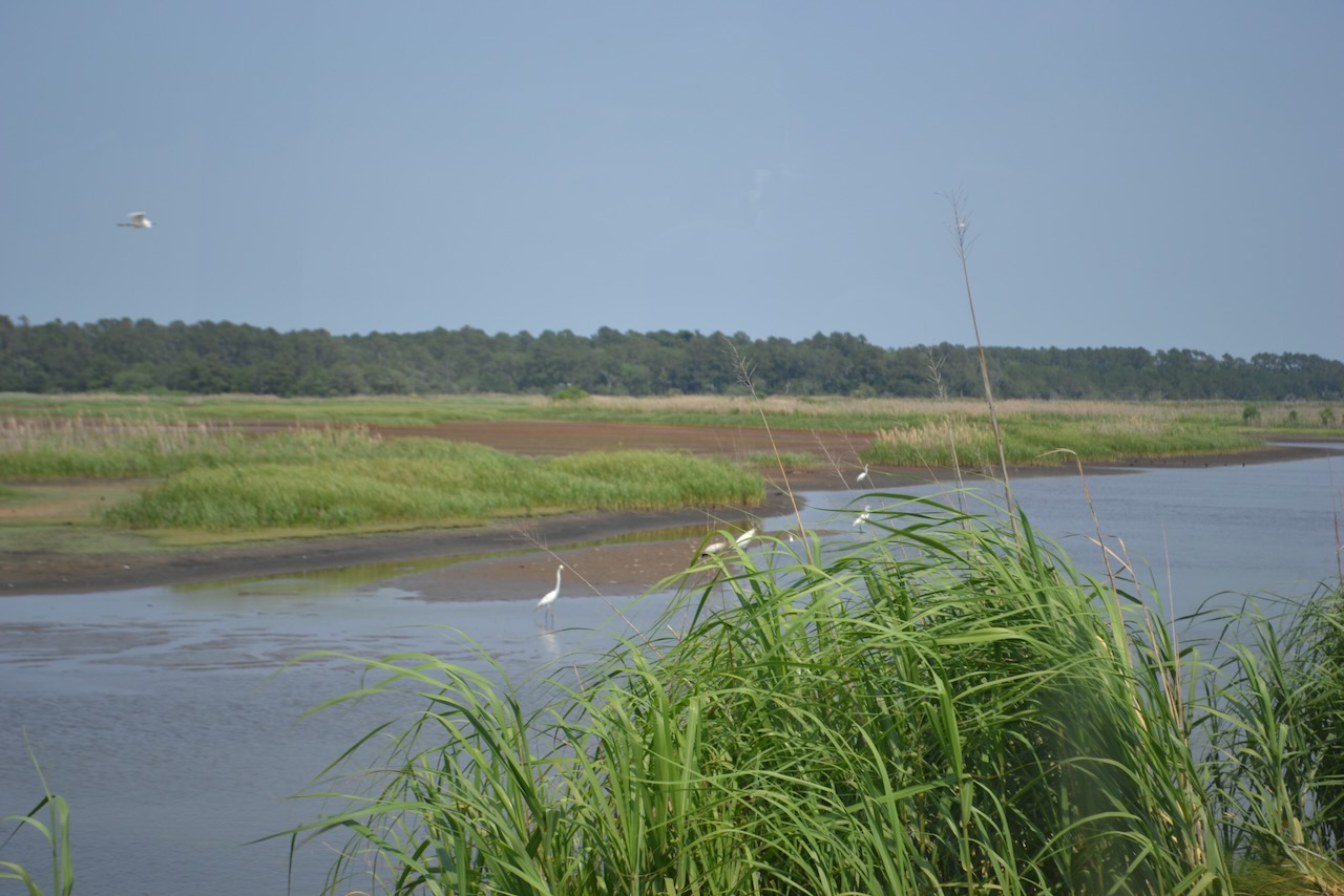
We learned that these Pleistocene ridges are separated by sloughs of cypress-tupelo swamp forest. We turned off toward a wetland, and an impoundment known as Hume’s pond; a creek and canal once connected it to the North Santee River, but the damming of the Santee increased the water’s salinity and killed all the cypress trees. The first of many great blue herons appeared on our left, and on our right we stopped to view a rare flowering plant, found only here and at Santee Coastal Reserve, Stachys caroliniana (first identified in 1977). Jim’s pointing out of this plant was one of the many gems he shared throughout our tour, and was just a sample of his extensive fund of knowledge. A few of the group got out to view and photograph this blooming Carolina hedge-nettle, and I took advantage of this and every opportunity to disembark. Despite the cool temperature and wind, mosquitoes appeared.
We motored past the site of a former plantation, Hume’s, and noted a small cemetery. Soon we arrived close to the North Santee, observing on our left a freshwater reserve originally used to power a water-driven rice mill, and on our right an old rice field, now a brackish wetland. The road traversed drivable dikes, passing through immense wetlands fully populated with wading birds. Migratory waterfowl would be moving in soon.
Our route transitioned to upland, and eventually reached the site of Belle Hall plantation. The plantation house was long gone, but another outbuilding with a black paint job highlighted the site’s other name – Blackout. The buildings received this treatment during WWII as a protective measure from potential German submarine attack.
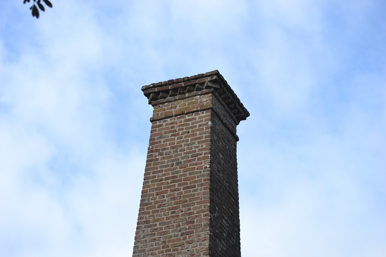
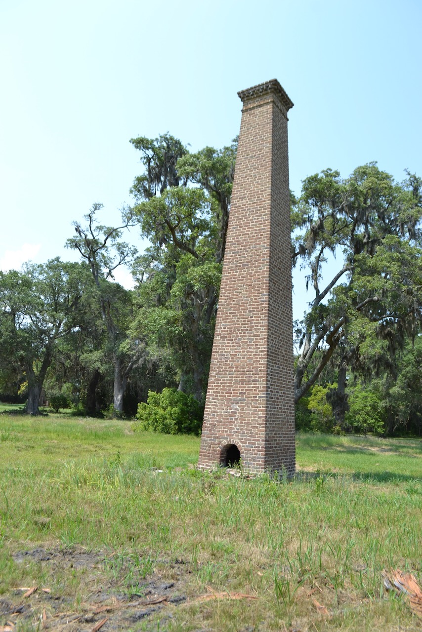
The most impressive feature of the land was the southern view out beyond the wetlands to the North Santee and Cedar Island in the distance. Along this edge was another structure, the chimney of a steam powered rice mill, and this handmade-brick tower had received a thorough restoration effort. Our group disembarked to view this nineteenth century chimney, and braved the mosquitoes which were active on the leeward side of Cat Island. Our return to the bus was accompanied by numerous mosquitoes that had entered the vehicle.
A modern house on this plantation site was currently being utilized as the temporary residence of SCDNR archaeologists actively working at Yawkey. I had heard of one specific project, and was disappointed that we would not be able to see the site of the excavation of a historic fishing village on South Island. Archaeologists had also been shovel testing throughout the Yawkey Wildlife Center for a duration of nine weeks, and finding artifacts everywhere they dug.
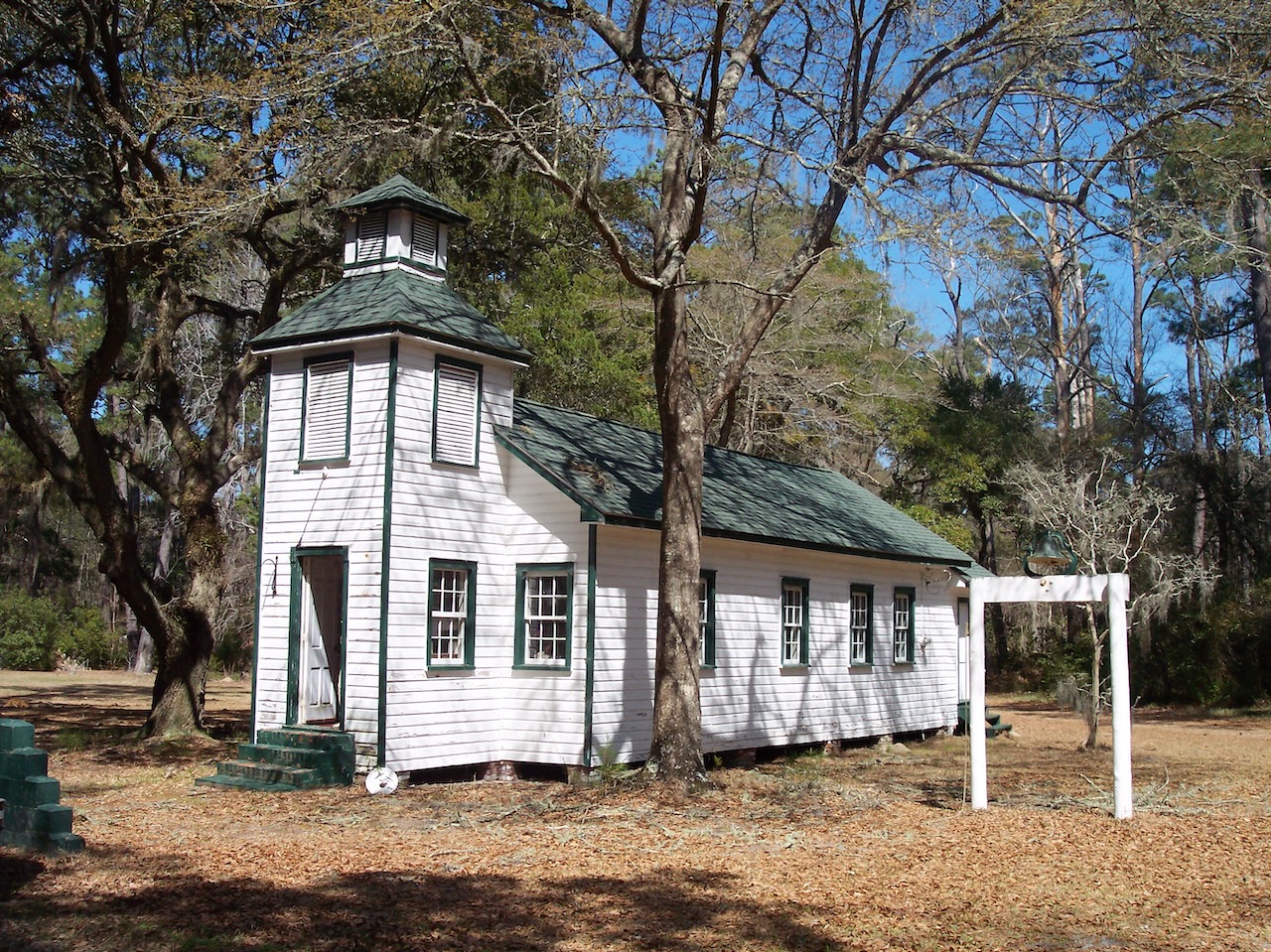
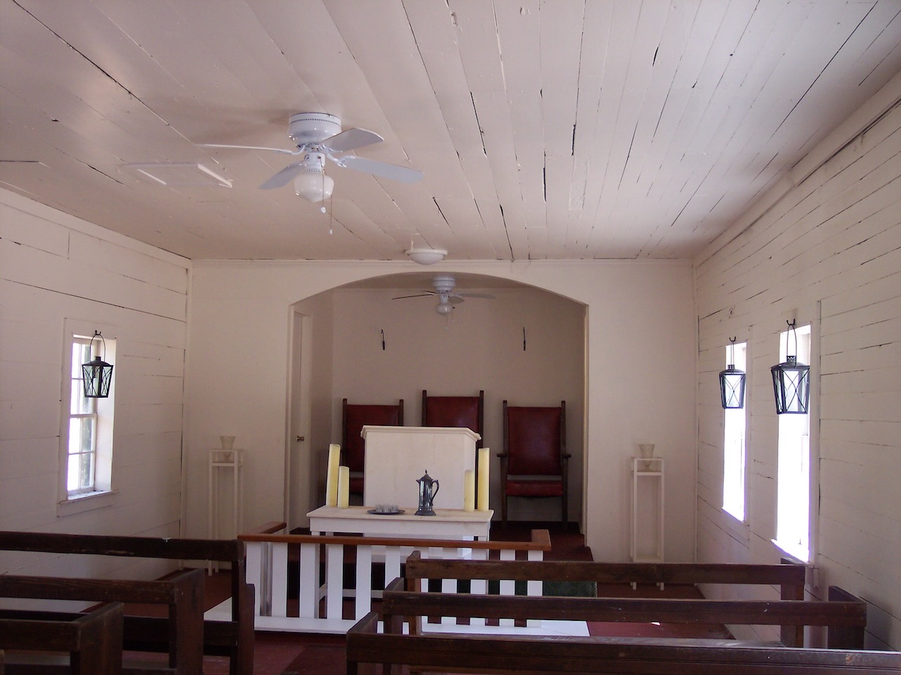
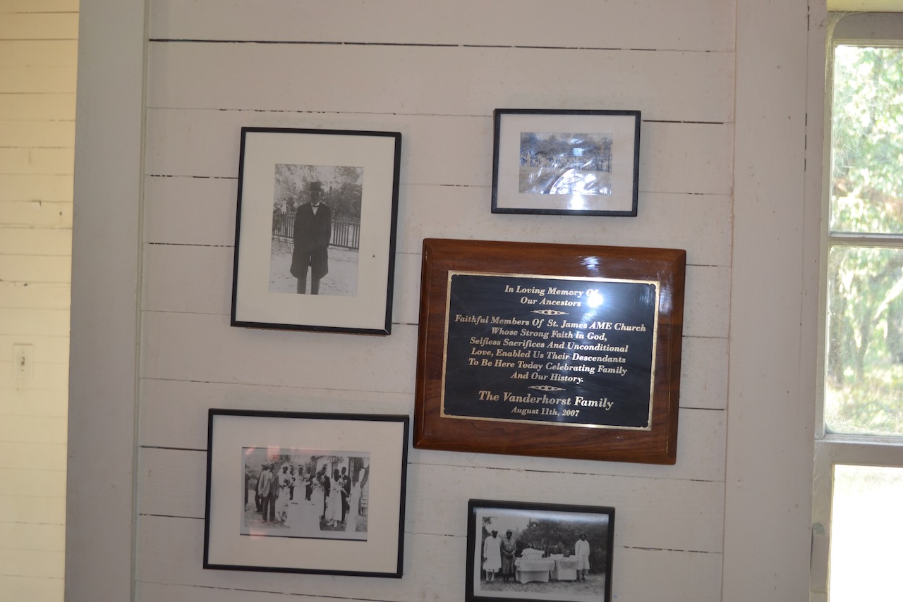
Continuing on Cat Island, our next stop was at a small church with several residences nearby. The location was Maxville Village, a former community of the descendants of enslaved people originally living at the Maxwell Plantation. We went into the church and sat in the pews while Jim spoke about the community, and highlighted the life of the matriarch Martha Sargent. The building of the church, St. Jame AME, was initiated by Tom Yawkey, who had approached the community and asked what they needed. Another community member profiled was “Tiny” Collingswood, who grew up here and went to work for SCDNR. All of the members of the Maxwell community have moved away, though the church is used occasionally for family reunions and weddings.
There was much to observe and learn when the bus was in transit. Jim spoke through the bus’s PA, and had a running commentary on the Yawkey Wildlife Center’s natural and human history. In passing through one section of long leaf pineland, Jim identified the white stripes on the lower section of some pines as markers for trees with red cockaded woodpecker nest cavities. This endangered woodpecker species creates nest cavities only in live longleaf pines. One tree was quite distinctive, with its bark smoothed down from resin streaming down the trunk as a barrier to climbing predators.
Besides the forest management work at Yawkey, there were multiple research projects. Phil Wilkinson, who was Tom Yawkey’s wildlife manager, had a long term alligator research program here, with a focus on nesting and reproduction. A Bachman’s sparrow research study was finishing up. The James Kennedy waterfowl research center was set up to study migratory waterfowl on an ongoing basis.
Jim Lee conducts the public education program at Yawkey, and since I first visited in 2010 the tours have greatly expanded – quadrupled. The tour offerings have evolved to include specialized trips – photography, birding, history, cemeteries, even painting at Yawkey (yes, Andrew Wyeth painted on Cat Island.) Since the tours are the only way for the public to visit Yawkey, the expansion has been most welcome.
We made our way from the upland into a large area of wetlands separating Cat Island from South Island. The view to the north allowed us to make out range markers in Winyah Bay – the southern vista was of the Santee Delta. The causeway elevating the road above the wetlands (with a few overflows from the earlier high tide) had been built with cypresses trees from the Santee laid side by side. The distance between the uplands of Cat and South Islands is substantial, and we were rewarded by numerous sightings of the abundant birdlife. I asked Jim to point out when we crossed Mosquito Creek, the historic waterway dividing the islands. When he did so, there was no water to be seen – it was completely filled in with tall grasses, and looked walkable.
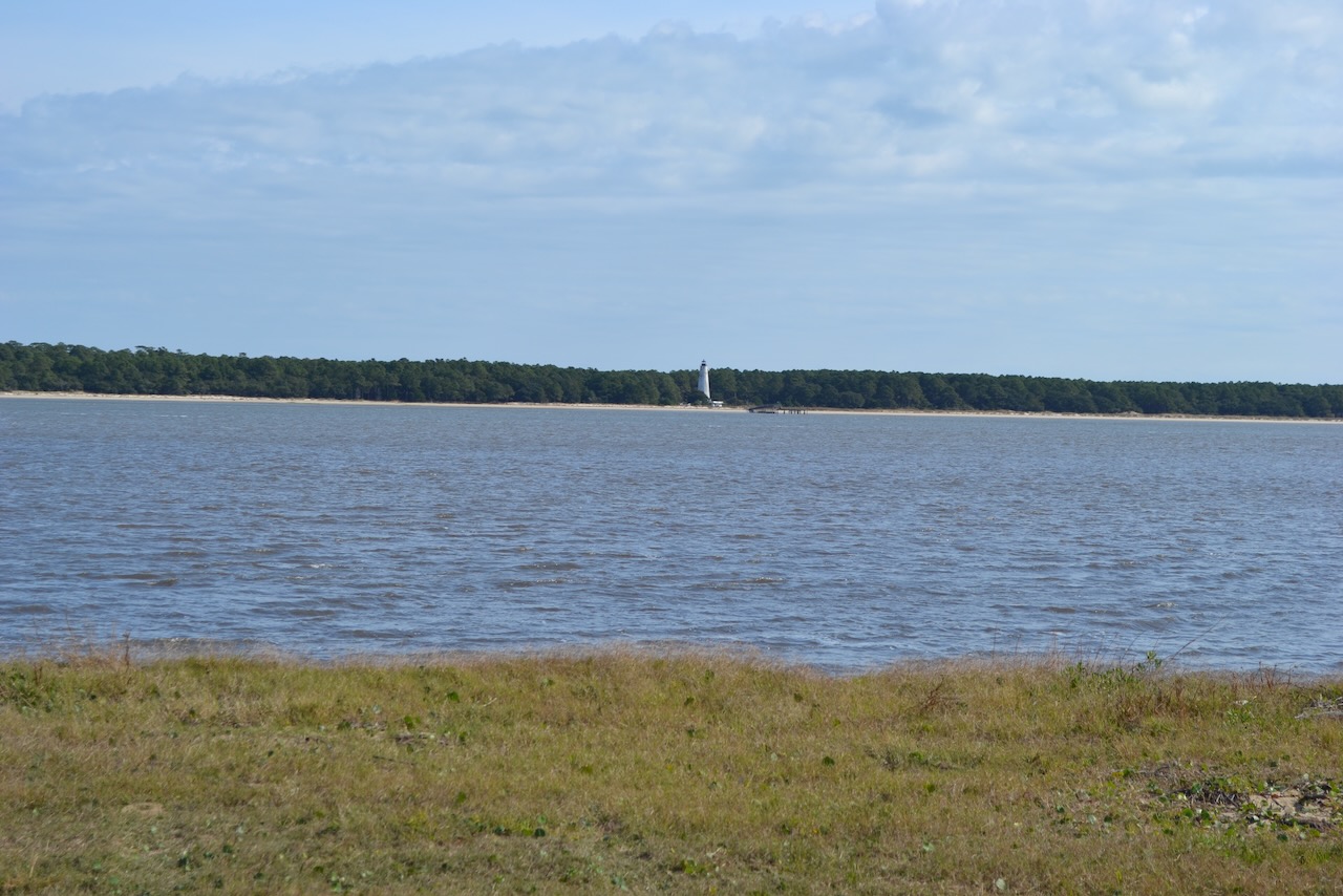
Our time on the geographically smaller South Island began with the view across Winyah Bay to North Island, the other landmass in the Yawkey holdings, featuring the North Island lighthouse. I recalled my sail out Winyah Bay in 2015. (See Studying a Bay.)
Our main time on South Island was spent in the building known as the “Playroom.” The open ceiling to the timber framing the roof was one of a number of features in this room packed with Tom Yawkey memorabilia. Various aspects of his life were covered – Boston Red Sox, the Yawkey family, hunting, and travels. The richness of this “room” was in contrast to the humbleness of the mobile home he utilized for his residence.

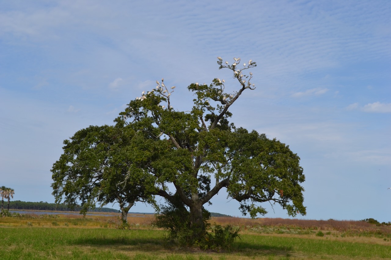
Our return trip to the landing traveled back over the causeway and a straight shot to the dock. The viewing experience was not over, and a live oak covered with ibises with the background of wetlands was an iconic image. A pair of raccoons ran ahead of us, occasionally looking over their shoulders, and Jim slowed down to trail them as long as possible.
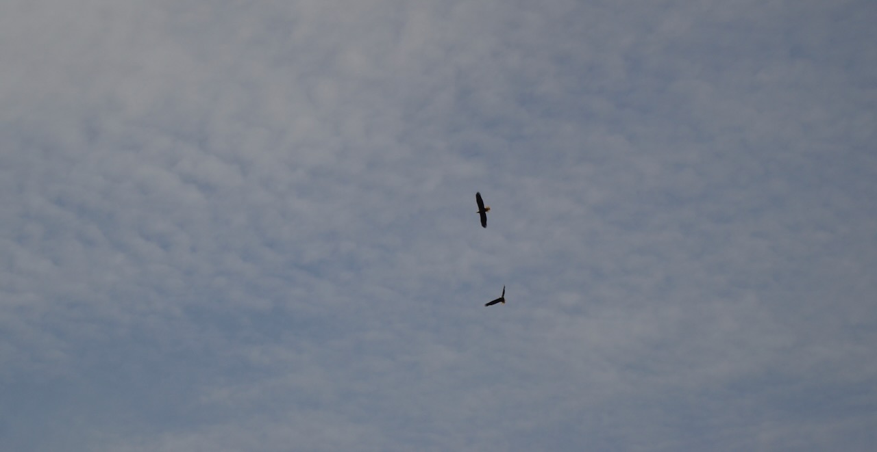
Another wildlife pair greeted us at the landing – the eagles were perched on a pine limb along the Waterway. Due to distance and sun position, I declined to attempt a photo. As we embarked on the pontoon boat for the crossing, I joked with Jim about continuing in reverse to set up a photo, and as I looked up the position had become excellent. While I fumbled to change lens, the eagles took off, and the moment was gone. As we motored across, the eagles’ flight was a fine flourish to our visit.
Excellent description of an outstanding tour of a world very few are aware exists. Hopefully anyone reading this will be determined to take a tour, I have before but will again this winter.
Thanks George. Check out some of the speciality tours listed on their page I linked to on the Public Access to the Santee Delta.
Bob,
So good to receive this from you. I was very happy to read of your upcoming book. Please keep us up to date on its publication! Also, the information regarding public access to the Santee Delta is an excellent resource. I have kept it as a handy reference.
And your piece on Yawkey was delightful. Jim Lee is such a man of knowledge and character. Your description of your day has reminded me to get moving on reserving a spot on that bus!! I have always enjoyed that ride!
Thanks for continuing to keep a line of communication from the Low Country, streaming to all the rest of us not living in your paradise!
Will do Scott to keep ’em coming.
Bob, you are/have been a busy fella’. Having visited Yawkey w George Geer and friends, I second his comments 🙂
Yes, everyone should put it on their to-do list.