The weekend morning following Thanksgiving was dazzling, the creek’s brilliance a function of the reign of high pressure. The waterway is currently known as Andersonville or Anderson, but on a chart from the 18th century was labeled “Sewee”. The above normal high tide pushed rafts of Spartina into the waters shared with the dark bodies of dolphins. A great blue heron stood tall back in the marsh; along the bank a kingfisher perched on a state shellfish sign. The light northeast wind and outgoing tide carried us out into Bulls Bay toward our destination, a small sandy isle about a mile to the north of Bull Island’s northeast point. The wind died en route, and considering the possibility of being swept out the inlet I began paddling. The isle did not stand out, most likely due to the high tide; during the paddle to the north it finally appeared. The northwest side appeared the best approach, and I paddled around for the landing.
The island was occupied by a mature bald eagle on the side of my approach.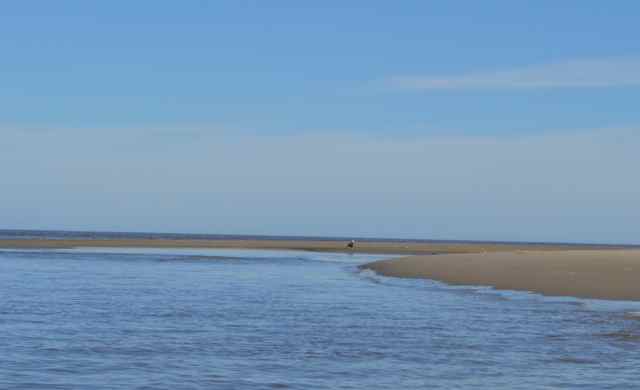 I was only able to capture a distant shot before the bird of prey flew off; three white pelicans came into focus in their flight from the opposite direction.
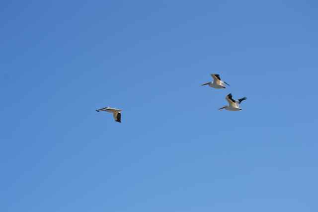 I completed the landing, and pulled Kingfisher up on the shore, tying off to one of the Closed Area signs. I had seen a carcass across the island, and a first order of business was to inspect. It was clearly a fresh kill – a brown pelican body opened, bloody, and disemboweled.
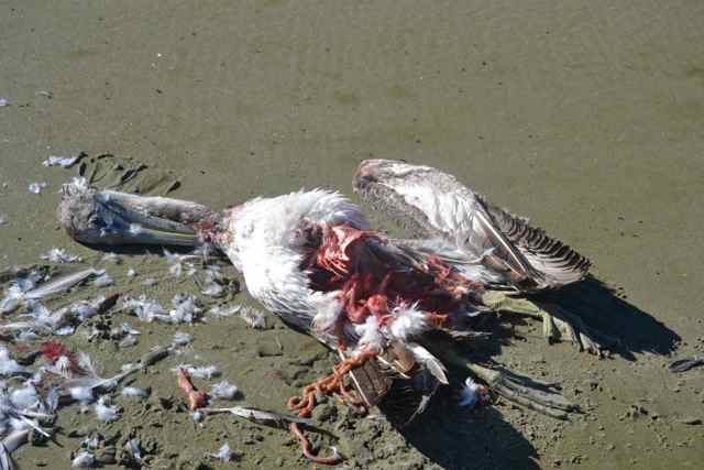 It was below the high tide line, and the evidence pointed to the eagle as predator. Jim Elliott of the Birds of Prey Center took a look at the photo and felt my hypothesis was plausible, recalling the kill of an egret by an eagle. Will Christenson, Coastal Expeditions captain, had seen an eagle chase a snowy egret for 20 minutes over the island earlier in the month.
I have been visiting this tiny isle for a number of years, watching it grow and erode, and though not on any maps or charts it seems worthy of a name – Skimmer Key.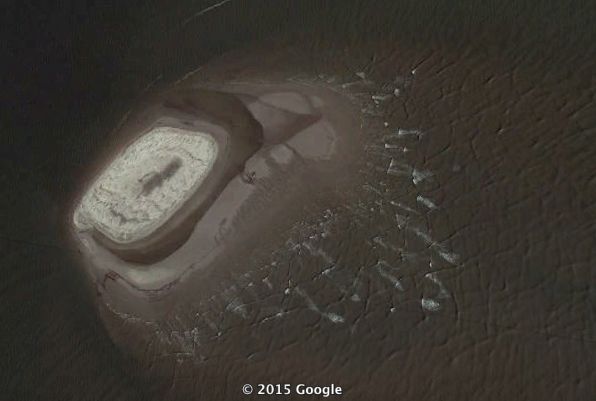
Google Earth screen shot image of “Skimmer Key”
This island, utilized by colonies of nesting birds particularly black skimmers, is closed during the nesting season. (Similar to Crab Bank off Shem Creek in Charleston Harbor, and several other small islands in the Lowcountry, the closed areas must be respected in the nesting season.) These accreted sands of this isle have become part of the Cape Romain archipelago, a constellation of islands in constant change in response to the elements. [Addendum: According to Felicia Sanders from SC DNR, eighty-four black skimmers and a pair of oystercatchers nested successfully here in 2015.]
I began a survey of the island, exploring the growing world. The center rise, surrounded by the piles of Spartina, was on its long axis 140′, and short axis 60′. Small waves broke on the east side facing the ocean, though protected from the larger ocean swell by distant shoals – Bull Breakers.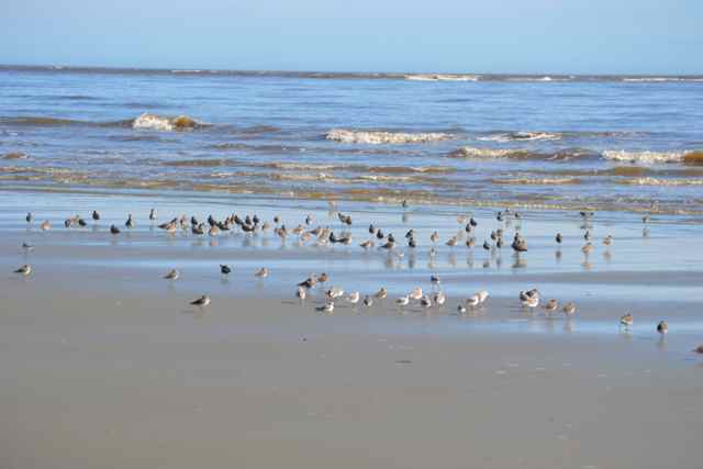 Shorebirds worked along the water’s edge, and collected on the growing intertidal area. Looking to the south, the northeast point of Bull Island and maritime forest beyond rose prominently across the inlet; walkers on the beach were also enjoying this beautiful day.
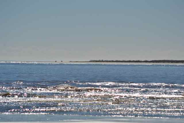 To the southwest, the smooth waters of this end of Bulls Bay stopped at the marshlands, the Ravenel Bridge towers appearing in the distance. Cormorants and gulls appeared along the north side of the isle in the view to the Bay waters, now as slick as a mill pond, stretching out to the north and mainland.
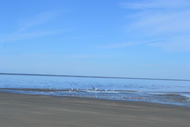 The island no longer contained the wreckage of an abandoned 26′ fiberglass inboard, but had made way for another piece of human debris – a sand bag deposited most likely from its original site at Wild Dunes on Isle of Palms miles away.
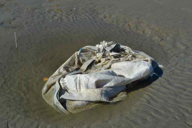
Somewhere along the point across the inlet was the historic location of the 1670 encounter between colonists off the Carolina and Sewee Indians. On that day, one of the Sewees, his name lost to history, pointed to the most important landscape features and named them: the bay “Sewee”, and the island he stood on “Onisecaw”. (The change of the island’s name to Bulls, after one of the early colonists, reminds me of the tallest mountain in North America – McKinley – and the return of its rightful Native American name, Denali). These are but a small spattering of words we have left from the Sewees, and most of those are place names. And there are other peoples before the Sewees whom we know little about, their names and language gone. Their prehistoric coastal existence is tangible at impressive sites like the Sewee Shell Ring. With the disappearance of those people and their words, we have lost a view and understanding of the world that diminishes us all. Perhaps more of their words and overall culture will be unearthed, for surely we have lost great appada “friends”.
* * *
I returned to Hampton Plantation in late June for another day of participation in archaeology. The project was part of the field work of College of Charleston students, and led by David Jones of the SC parks system, and Martha Zierden and Ron Anthony from the Charleston Museum. 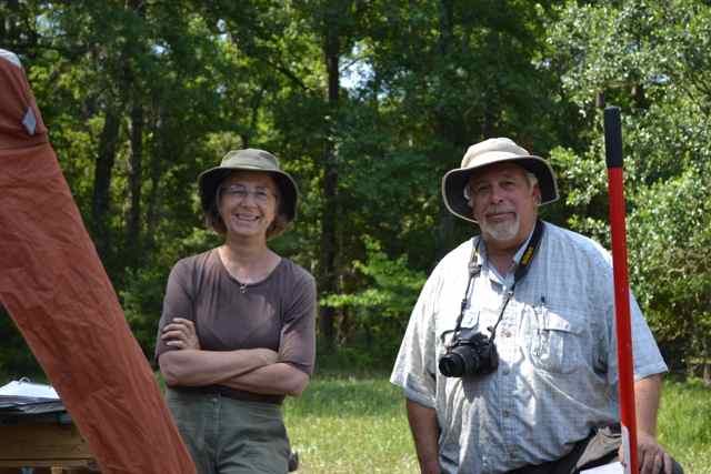
Martha Zierden and David Jones
I received my invitation from Martha, and anticipated the chance to look at a perhaps older slave street identified by ground penetrating radar and shovel testing. I arrived early, noticing blue birds perching near the parking lot, and Mississippi kites soaring in the blue skies.  The site was on the other side of the plantation from the slave settlement dig of the past few years, and in a field dominated by spreading live oaks.
 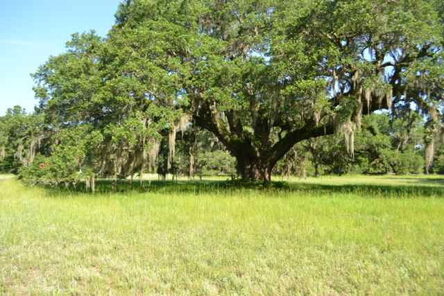 The archaeologists and students arrived on one of the last days of field work. The ambivalence of the students was apparent, both ready to finish up with the drive to Hampton and difficulties of field work, yet not ready to leave the lively camaraderie at the site. I took my usual position at the screen to sift artifacts, and gradually learned that this site had surprises. Evidence from the site, including historical Native American pottery, and postholes arrayed in an arc indicating a round building, suggested the possibility of a Sewee structure.
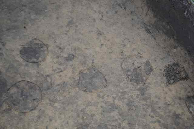 It was speculation, for sure, but fascinating. A main Sewee village had existed along the South Santee River a little to the east of Hampton. The possibilities for learning more about this coastal tribe, through archaeology and other disciplines, was promising.
* * *
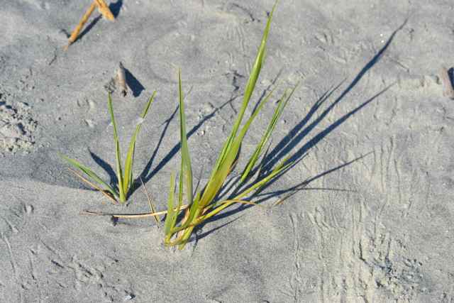
The marine forecast failed me – the Bay showed no signs of wind.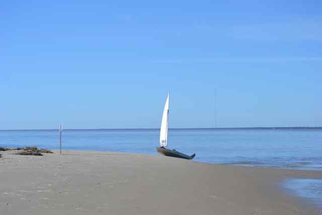 Without wind, the conditions were balmy on the isle. A swim crossed my mind, but I did not take the plunge. The outgoing tide cancelled out my schedule return sail, so I decided to survey further. As Einstein said: “Look deeply into nature and you will understand everything better”. Returning to the island’s peak, I found plants making a stand: new starts, and older rooted plants stretching up through the storm-piled sands.
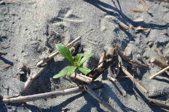
 I had seen a ghost crab earlier, and the many burrows and tracks marked their strong foothold on this territory.
 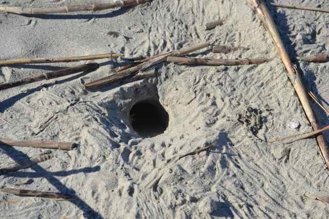 The island continued to grow by acres to the east where the intertidal flats were exposed by the outgoing tide. More shorebirds took up positions, the numbers swelling to hundreds.
 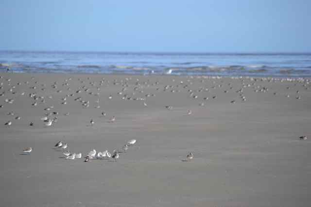 The water’s edge was littered with the bodies of marine worms.
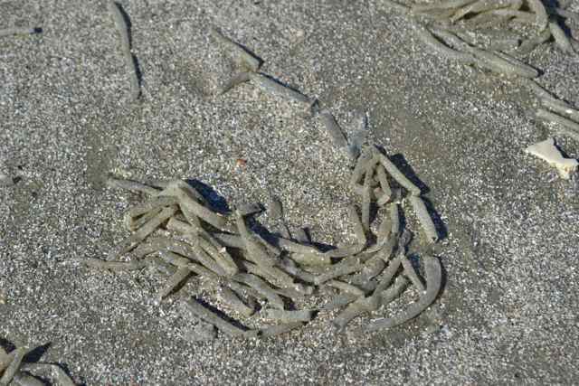
Several streaks of wind had entered the Bay, enough to spur the launch for the return sail. Progress was quite slow against the outgoing tide as measured in the passing of crab trap floats; in response I steered away from the channel and more into the shallow waters toward the north, and pulled out the paddle. I took inspiration from Bishop and Slocum, and utilized the core technique acquired from my paddling friend Ian Sanchez. The sustained effort yielded progress, and ahead appeared what I thought was the cormorant covered point coming out of Andersonville Creek. It was instead the black mud flat formerly known as Bird Shoal, once a colonial nesting island. I recalled my trip out to this shoal on a negative tide in August of 2010 (Walking across the bay). The shoal did not stretch out so far as on that day in 2010, but enough to provide an excellent roost for a group of white pelicans, brilliantly contrasting with their black perch. Their numbers were doubled by a group dropping in from above.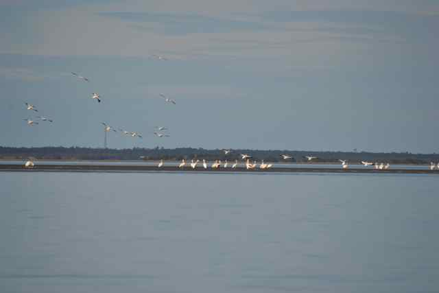 As I paddled on past this shoal in the Bay crossing, the white bodies continued to shine in the distance, paired with the muffled roar of remote surf.
From the distance came a light southeast wind, enabling sailing again. Entering the creek, the oyster-covered point to starboard was occupied by a dozen oystercatchers taking advantage of the exposed bivalves. I hugged the creek bank to avoid the last of the outgoing tide. An oystercatcher stood along the edge as an adult bufflehead swam by with two ducklings, another vivid image of the rich bird life in Cape Romain. 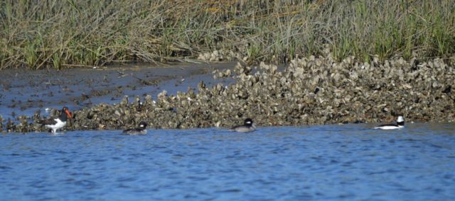
Bob this is the most beautiful thing you could do with your life. Thank you so much.
These are most beautiful and inspiring places, and am glad I have this venue to share them.
🙂 As always Bob, this “issue” was beautiful and informative. G
Thanks Ginny, I like the term “issue” much better than “post”.