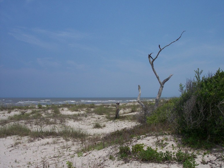
It had been awhile since I had entered the interior of Bull Island, and certainly not since the heat had cranked up in the Lowcountry. This Monday was a day off for me, and came on the days before the July 4th weekend. The conditions were favorable for a sail out to the Northeast Point, and a return later in the afternoon: low tide at 3:30 PM, and winds to pick up from the southwest from 15-20 knots. It had probably reached the high of 94 degrees when I cast off a little after noon, running out Andersonville Creek in a northwest wind. Once at the Shark Hole, with the sightline out to the bay, the wind dramatically shifted around to the southwest, with a corresponding increase in velocity. Sheeting in, we close reached across the bay to the Northeast Point – 45 minutes from dock to the island’s tip.
After cooling off and securing Kingfisher, I dressed for a walk around Jacks Creek outer perimeter. A brief walk brought me close to the entrance to Lighthouse Road, and I followed the ATV track made by the daily loggerhead crew surveying the beach for nests.
I pulled on a long sleeve shirt to go with long pants, preparing for a potential onslaught of biting insects. I was surprised on this walk with just an occasional deer fly, and rare mosquito.
Once at the main road, I continued straight ahead on the Old Fort Road (to consult map, click here). I was soon viewing the wide vistas offered by the Jacks Creek dike – across the impoundment to the south, and the bay to the northwest.
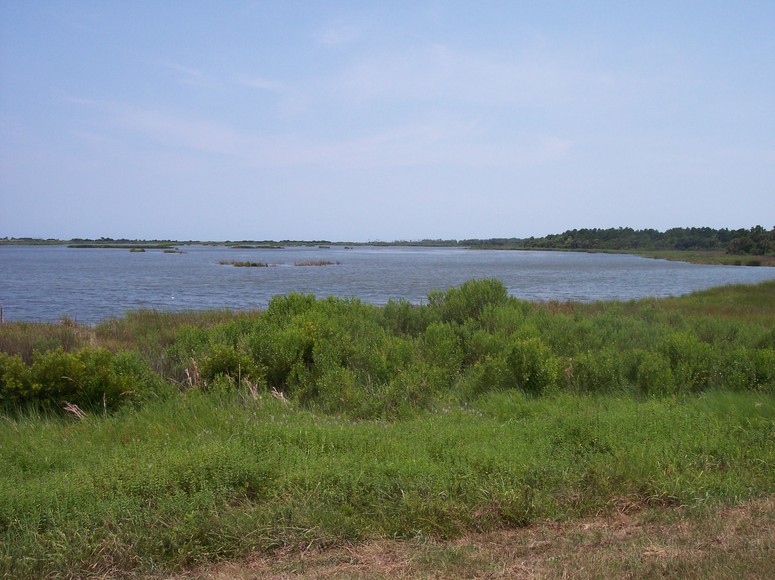
Part of the ambience of the scene was the sound provided by the incessant territorial yipping of a pair of black-necked stilts. The area around Jacks Creek is the only place I have ever seen one of these distinctive shore birds. They accompanied me across the dike until I entered the maritime forest again, passing by the Old Fort site and by the water structure connecting the impoundment with the marsh. This is often a place heavily populated with alligators, but they obviously were elsewhere on this hot day.
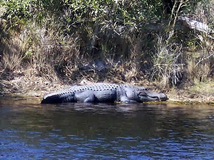
Not seeing the usual gators there, and after making the turn onto Alligator Alley, I pondered the question I have considered for the past several years – where is Alligatorzilla? (Those not familiar with this legendary alligator of Bull Island may want to read the PrologueTracing the Cape Romain Archipelago for some background. The photograph below was taken on my first encounter with this massive alligator in February of 2006.)
I planned to stay alert for the possibility of a sighting, but the heat was already beginning to sap my energy, and I soon realized I was not up for any extra effort or detours on this walk around. I recalled a search with Chris Crolley across the Old Fort Road to the salt marsh. A visitor to the island had seen this massive alligator crossing the road in this direction, and he made his own estimate of its length – in the eighteen-foot range.
Sweating profusely in the debilitating heat, and drinking from an increasingly hot bottle of water, I walked by pool 1, and stopped at pool 2 to read the interpretive sign about alligators. Largest reptile in North America. Also loudest. And included in varied diet are smaller alligators. After reading the sign I looked up to see a five-foot alligator on the middle of the dike within 20 feet. It was also surprised to see me, and picked up its body to sprint raptor-like (on 4 legs) into pool #2. The speed was nothing I could match even with an adrenaline boost in the enervating heat.
Passing pool #2, the road turns ninety degrees to the left, and after a short distance, cuts back ninety again to the right. At that turn, one can look out to Jacks Creek to the left, and note a well-worn reptilian path coming out of the impoundment. One connection from this gator highway is a ditch running parallel with the raised road. Walking past the end of the ditch gave me a perfect view of a nine-foot alligator lying across it in the mud.
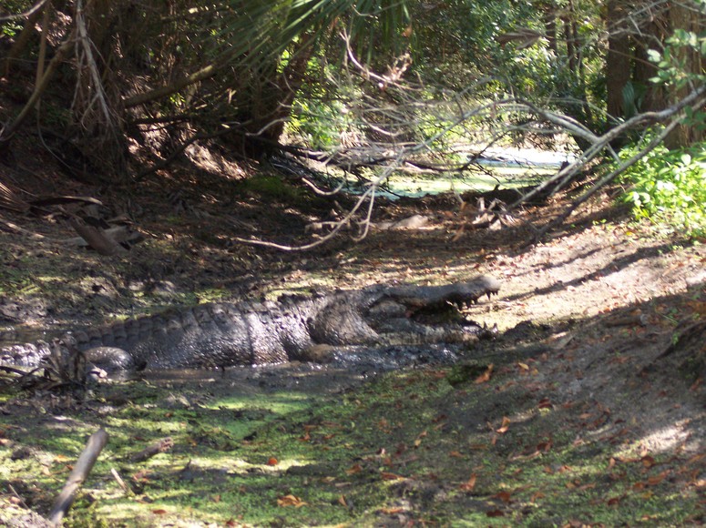
This sighting was unusual for several reasons. It was the first alligator I had seen out of the water on this day (except for the sprinter moving from one pond to the next). But most unusual was the position of the jaws – they were open. I wondered if the open jaws had anything to do with the heat, but I learned the reason when I walked on the road past the alligator. Jutting out of its jaws was the prey it was eating – another alligator, at least three feet long.
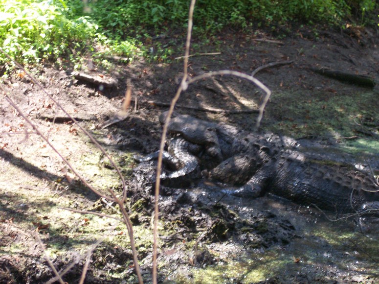
This fact confirmed what the interpretive sign had described about the diet of alligators. This frozen drama in the sweltering heat transfixed me, and there was not a twitch of movement from either reptile the entire time I viewed the scene.
I had snapped several photos already, but was not happy with my capturing of this Kodak moment – my best view was marred by my position relative to the sun, and foreground vines fuzzing up the subject. I contemplated circling around to the other side where the sun would be at my back, but the lack of a path through waist high brush in a low area next to the ditch was not inviting.
Past pool #3, I reached the junction with Lighthouse Road, and continued on with the circuit walk. I briefly stopped at a pond, the site where Alligatorzilla had been observed on several occasions, but did not see a single alligator there. I considered the path to the Boneyard as part of the walk, but the heat and fatigue pointed me toward a shorter circuit. Once out on the eastern dike of Jacks Creek, another pair of black-necked stilts greeted me. The breeze out on the open dike was welcome, but the promise of a cool-down in the ocean ahead was tantalizing.
I detoured past the direct route to the beach to walk around the short inner dike on the lookout for roseate spoonbills. I did not spot their pink plumage, but three more pairs of the black-necked stilts kept me company. Finally stepping on to the beach, I shed my sweating clothes, and lounged in the water. From this viewpoint, the tidal creek cutting across the beach had dramatically changed its course in the last year. Instead of leaving the marsh and heading straight out to the ocean, it curved along the beach toward the north and stretched perhaps sixty yards prior to making the connection with the ocean.
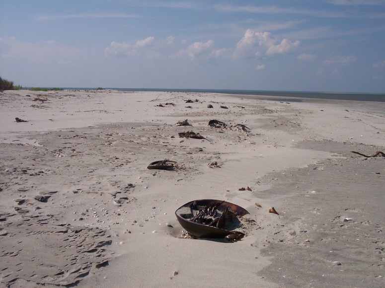
The walk to the Northeast Point was uneventful. I had finished the last of my hot water, and anticipated the cold water chilling in the cooler on Kingfisher. An array of dead horseshoe crabs littered the high tide line near the point.
Kingfisher was alone without another boat in sight.
Preparation for the sail home included enjoying a snack and the deliciously cold water. The brisk southwest wind supplied the energy for the close reach across the bay. Hiking out to keep Kingfisher flat, my body was continuously and pleasingly sprayed on this brisk sail, keeping me cool with the ongoing exposure. The excitement seemed contagious, with pelicans appearing to make their dives even more exuberantly and with grander splashes then normal. We were all flying and splashing across the bay that afternoon, feasting on it all.