What was it about that day, August 9, which gave me such a bounce in my step and oozing anticipation? A series of marine and atmospheric conditions had converged: the new moon, with the accompanying larger range of tides (spring tides), with a low tide at 1:45 PM; marine forecast for east wind at 10-15 knots; and high pressure with fairly clear skies. I have been considering a return to Bird Banks Shoals, with a 2008 exploration of this off-the-beaten-path location in mind. (For an account of my 2008 trip read the story Bulls Bay Bird Banks Shoal).
These shoals are extraordinary considering how much of Bulls Bay they consume. A satellite image from Google Maps gives one an idea of their scope. Charts of the bay do not display the expanse. My 2008 trip gave me a glimpse, but I wanted more, and the day’s complexion fit right in with the idea of a more extensive exploration.
We sailed out at 11AM in the northeast wind, and beat up into Venning Creek for the course to the bay. The outgoing flow was significant with the spring tide, and in the bend to the east the wind began to veer to the same direction, which meant sailing further to windward. It did not take long to get to the mouth of the creek looking out into Bulls Bay.
I had earlier determined my course to make a landing on this shoal. I had more than two hours before the low tide as I set out toward the southeast, but I wanted to make the landing before the shoaling waters would stop me. The wind had picked up, and the bay’s chop splashed me regularly.
I saw signs of the shoal, but was not confident about my course the farther out into the bay I sailed. I abandoned the course and tacked, heading to the north to find a way to the biggest bump of sand visible. After running aground several times, and making a few tacks, I sailed in through shallow water, and walked Kingfisher to land. The inches-deep water was populated with horseshoe crabs, pushing along the bottom. It dawned on me that there was still plenty of outgoing tide, and unless I got Kingfisher to deeper water I would be stuck here for hours. Dragging the craft was not easy, and it was soon a race against the falling water. I lashed my towline on to the mast for greater pulling power, but it took all the strength I could muster to make headway, about six to eight feet at a time. I walked ahead to survey where the drop-off began, and had about twenty more yards to go. Making the destination, I set up two anchor points, since Kingfisher would now be floating freely, and the prospect of her floating away if she came loose was grim. The anchor points were an old pool cue (taken along as a spare spar), and my paddle, both shoved down into the sand-mud bottom.
Confident the anchor points would hold, I grabbed camera and cooler and headed for the highest point of the sandy bump for lunch. It was clear that this top elevation would be underwater at high tide, and the reason I missed this bank on previous sails. I began my walk-around after lunch, perhaps an hour before low tide. There were few birds on the shoals that afternoon – nothing like the colonial nesting rookery, Marsh Island, several miles to the north. A few wading birds worked around the edges, probing the mud, and an osprey flew not far overhead looking for a fish in the shallows. Horseshoe crabs were stranded, and were using their method of burrowing into the mud to survive a drying out from the sun.

Many water-filled holes in the shallows appeared to be places where the ancient arthropods, Limulus polyphemus, first appearing in the Devonian era, had taken similar protective measures; the rotten hulks of others marked less successful individuals. Though birds were sparse, the little white least terns were here, with their distinctive high-pitched “zwreep”.
I walked the east side first, starting from the southern end. Points of the flat extended out into the bay.
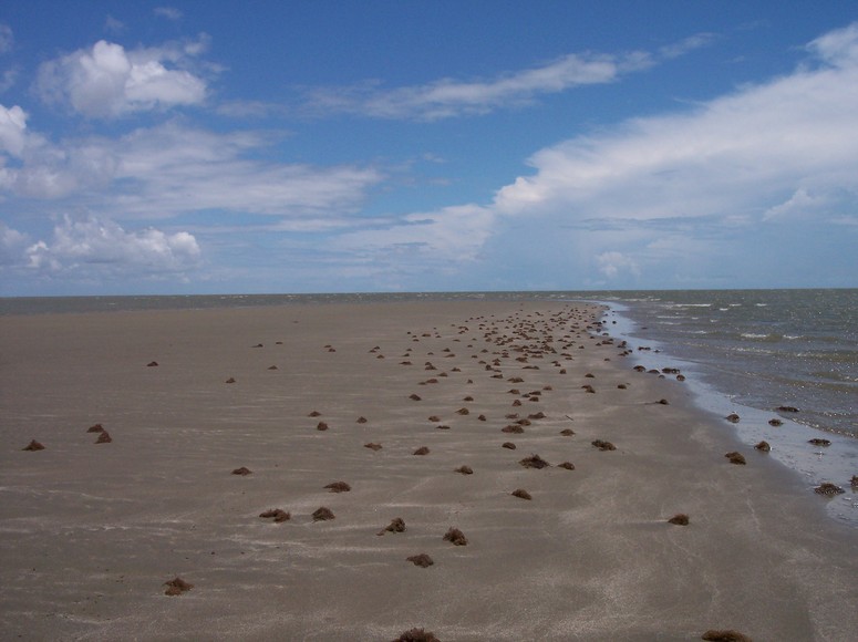
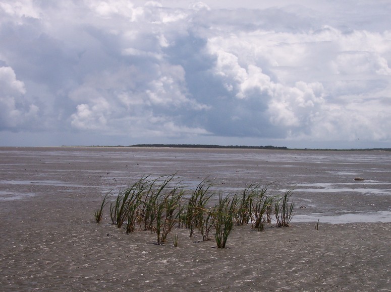
No shells littered these shores, but instead chunks of seaweed. There were no more bumps as I continued north, but large stretches of intertidal flats extending into the distance. I was walking miles, and continued to make progress to the north, feeling like I was walking to McClellanville.
For a while I could spy Kingfisher’s mast, but I passed the point of maintaining visual contact. I maintained the faith in my anchors as I pushed north.
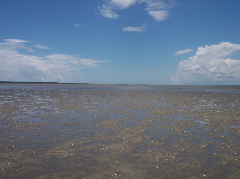
I reached a channel that passed completely through the shoal. It was a relief, for I had reached my turnaround point, having traveled several miles north. I walked into the narrow waterway (about 25 yards), and sinking down found that it was over my head.
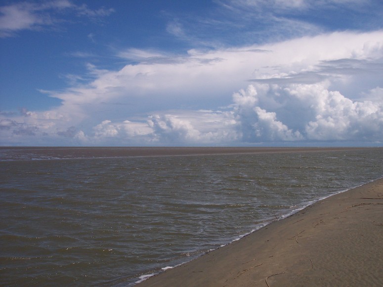
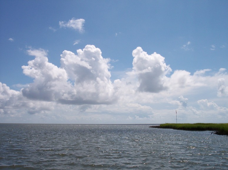
I wondered what baymen knew of this channel, a very narrow strait that would not be visible with higher tide. Throughout this walk, the atmosphere blossomed with spectacular cloud formations having the capacity to mesmerize.
I followed the channel to the west, and planned to walk back along the western side. This plan seemed to go awry when it appeared that the waters were closing in ahead. The tide had turned, and I again realized that I was walking across land only inches above the low water. I shaped my path back cutting to the south, and picked up the pace. There was a large flat as far as I could make out, and no Kingfisher. Several small features appeared ahead: an oyster cluster growing on a derelict crab pot, and farther on a clump of grass, the only vegetation seen colonizing this shoal. This was not any grass, but Spartina alterniflora, smooth cordgrass, the creator of all the marshes around the bay. I wondered if this grass would continue to colonize here, and transform this intertidal flat. The geologist Miles Hayes has suggested that this shoal could be an embryonic barrier island.
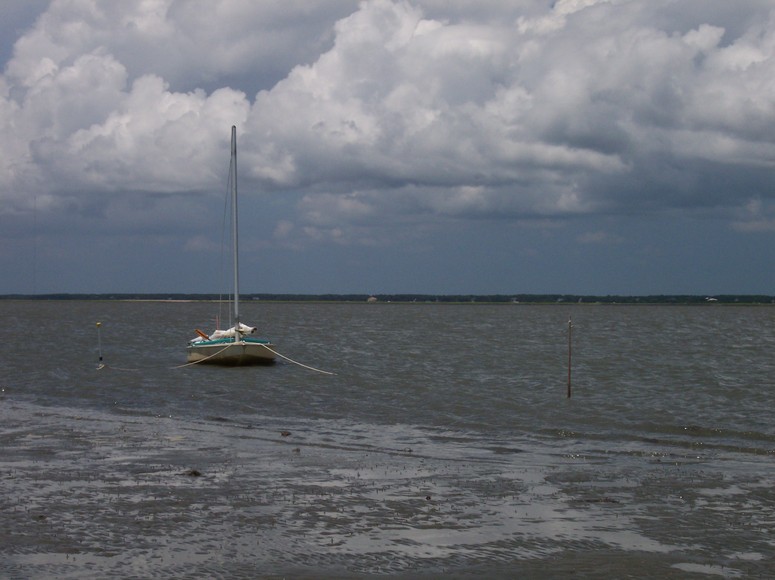
Kingfisher was now in sight – a welcome relief. Recovering my cooler, I pulled up the anchors, raised sail, and began sailing across the still quite shallow waters. Fortunately the wind blowing from the east was taking me away from the shoal, but even fifty yards away a crab pot half exposed by the shallow waters brought me bad news. The rudder was only half down and dragging, the daggerboard was completely out, and Kingfisher’s bottom was scraping along. I heeled the hull to windward to work to keep the boat sailing off, but with no depth in sight on my course, I brought it around and headed to the south, seeking deeper water. We finally picked up onto a plane, and I could get the rudder down and some daggerboard. We jibed, and headed toward the marsh, seeking the mouth of Venning Creek. A johnboat was on the edge of the marsh, and appeared to mark Venning. I had seen this craft earlier in the same place, and as I passed they were throwing the cast net and pulling in a couple of crab pots. Once in the creek, I rounded up into the wind, jumped overboard to cool off, and when back aboard bore off to head home.