On May 10 I was driving from Tinton Falls, New Jersey toward the coast, riding the edge of a front that had been dumping rain over the east coast for the past 24 hours. Blue sky was trailing and being pulled toward the coastas I prepared to make a hike postponed from the previous day. All looked promising as I turned on to the road along the beach in Long Branch and continued up through Seabright. 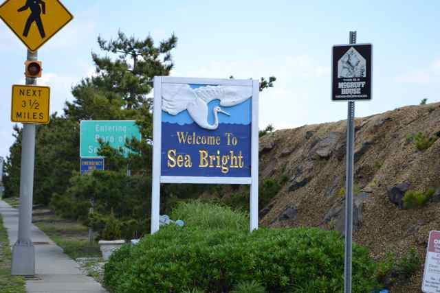 This is the beach I knew growing up, a transformed and hardened strand with major sea walls, long-ago removed sand dunes, and intermittent jetties designed to snare sand – the New Jerseyization of the coast (phrase coined by the coastal geologist Orrin Pilkey). I was heading for a conserved and protected strand – Sandy Hook, one of the units of Gateway National Recreation Area, part of the National Park Service.
Sandy Hook has been on my radar for a while, and a destination on my occasional visits to the area where I grew up. I was visiting my father, and the physical demands of making this trip led me to make this walk on my own so I could access a designated trail – the Old Dune Trail. What intrigued me about this walk was its path through a maritime holly forest. Amazing how this particular ecosystem had eluded my consciousness until this day. While a particular section of the forest was closed, I learned from the staff person at the Sandy Hook Visitor Center that I would encounter plenty of this maritime forest on the trail.
I parked at the visitor center prior to their opening, and walked across the road to a boardwalk and observation area right on Spermaceti Cove. Along the boardwalk I was greeted by red-winged blackbirds, and several ospreys hung above the cedars on the northwest wind coming across Sandy Hook Bay. 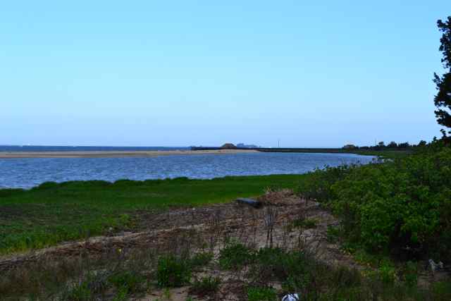 This body of water connects with Raritan Bay to the west, and with the Lower and Upper Bays between Staten Island and Brooklyn, where the Hudson River discharges and mixes with the Atlantic Ocean to the east. Spermaceti Cove is now closed to boaters (all forms) due to the sensitive wildlife, including annual visits from harbor seals, though none appeared on this day.
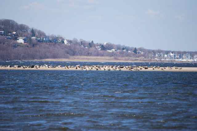
Photo courtesy of Douglas Raynor.
Beyond the cove out into the Bay a sailboat appeared outward bound in the morning light, along with fishing boats. Across the narrow body of water to the mainland rose the Atlantic Highlands, the highest point on the eastern seaboard south of Maine. 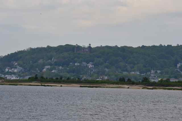 It was from that vantage point on 9/11 that many people watched the towers of the World Trade Center burn and collapse.
Back across the boardwalk and trail, I found the entrance to the Old Dune Trail and began this walk. (View map of walk. Note: time and distance not accurate). Familiar plants appeared along the trail, including sections of prickly pears, and the plant with leaves-of-three – poison ivy. 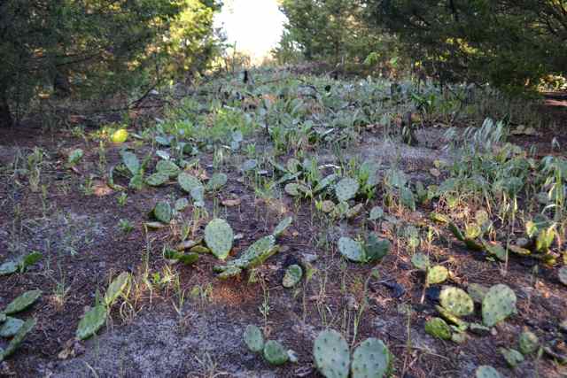
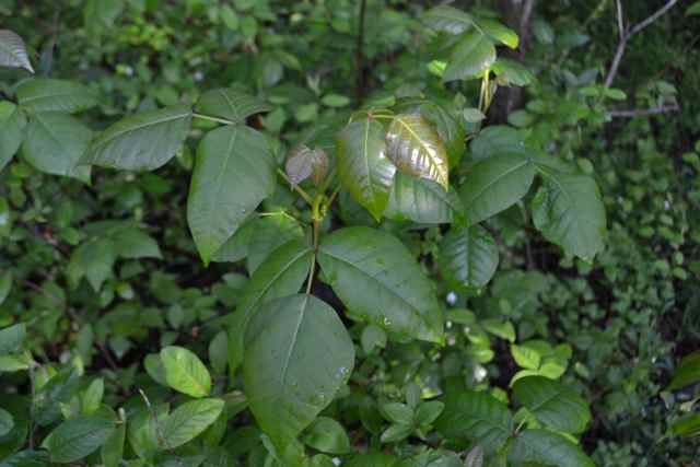 It not only grew everywhere, but in places was in shrub form. The trail wound through the maritime forest, in places dominated by red cedars, in others by hollies.
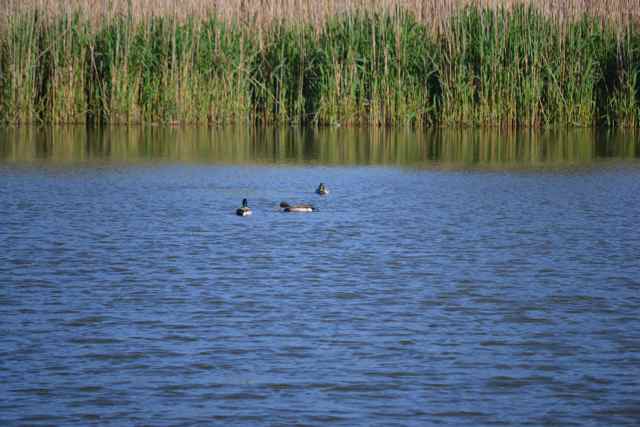
 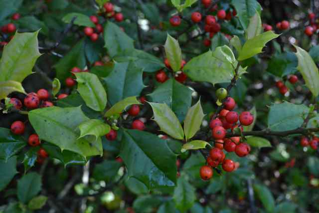 Other trees included in this forest were pitch pines and wild cherries. The forest and the day were both beautiful, blue skies reigning after the front moved off the coast. Wetlands were formed in the swales behind dunes, and I visited one pond with a blind; mallards and a goose swam on its surface.
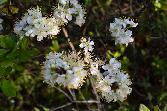
  One plant with white flowers not seen in South Carolina was the abundant beach plum.
WInding through the maritime forests and old dunes, the trail abruptly came to a chain link fence. The trail bent to the east, paralleling this rusty barrier. 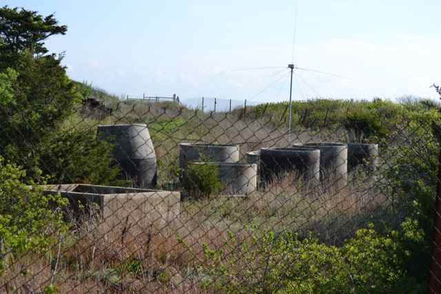
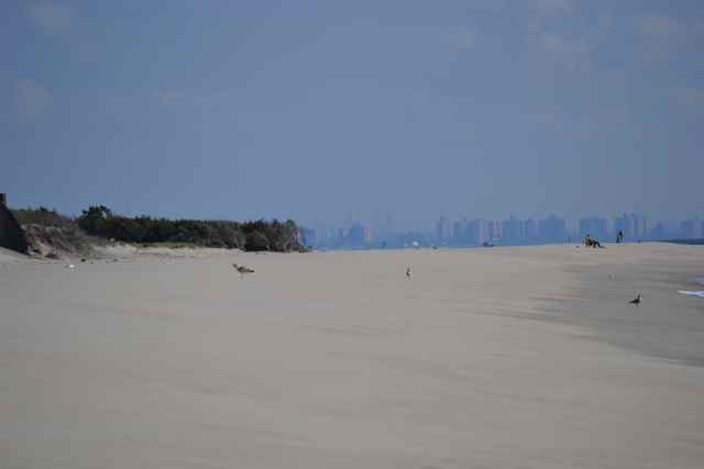
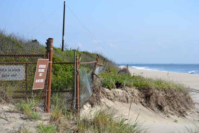 Behind it were the remains of a Nike Missile facility, a vintage Cold War site circa 1954. These missiles were the surface-to-air variety, designed and armed to destroy enemy aircraft threatening the metropolitan area, with a range up to thirty miles. Another abrupt transition spilled the trail out on the beach. Major erosion here had removed large sections of the dunes. From the beach the view north showed the New York skyline.
  Artifacts from the missile facility – antennae, concrete structures – were scattered in the dunes and maritime forest behind the fences. A large erosional scarp revealed a stratigraphy of junk – a former dumping ground.
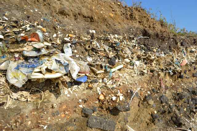 These missiles became obsolete after the introduction of ICBM’s.
The dynamic results of erosion revealed at this place are significant elsewhere around Sandy Hook, and reflect some of the dynamics of Cape Island In Cape Romain National Wildlife Refuge. While some parts of the barrier island are eroded away, other places are accreting: the northern end continues to grow to the north. This is the result of a northward-moving longshore current, a situation existing also at Cape Island. The new breaches of Cape Island have also been seen with past breaches at the southern end of Sandy Hook: while it is a peninsula barrier beach today, at different times in the past it has been a barrier island. (See Shifting Sands of Sandy Hook).
I continued up the beach past the old facility’s fence and picked up the resumption of the trail. I came to a good example of the mature maritime holly forest, and stepped off the trail briefly under the canopy of large hollies. 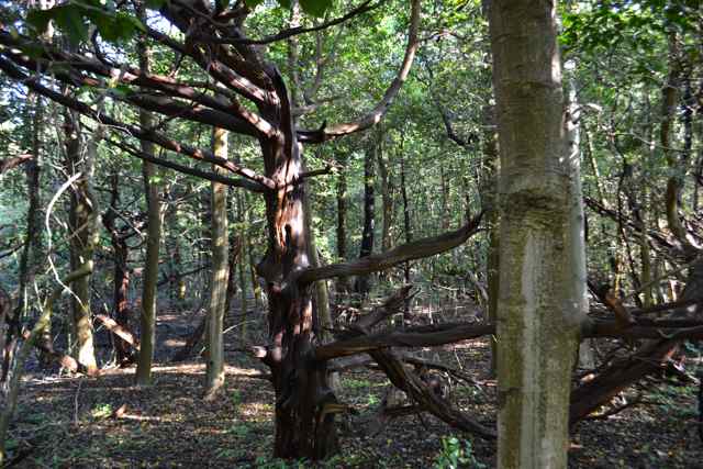 The trail crossed a road, and several vehicles parked there were an indication that this was a surf fishermen’s access. The trail stretched on to the north, and I eventually took a spur to the east and the beach again. A surf fisherman with a strong East European accent had hauled his gear up from the road access to have this spot for himself, though had not had any luck as yet. I continued a little further north on this bend in the beach toward the north, noticing the large gulls on the strand. Prominently standing tall in the distance, viewed above the lower structures on Brooklyn, was the skyline of Manhattan, and tallest was the new Freedom Tower, still growing up into the sky.
 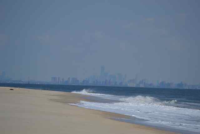 The building it had eclipsed in height, the Empire State Building, also stood distinctively uptown to the right.
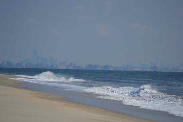
I had earlier planned a loop back through the maritime forest, but the beauty of the day and the lure of the high tide line shifted my walk to the south down the beach to the Visitor Center. Along the way I spotted some familiar shells from this part of the coast. 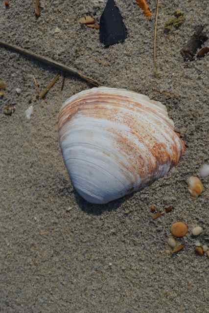
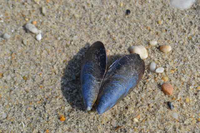
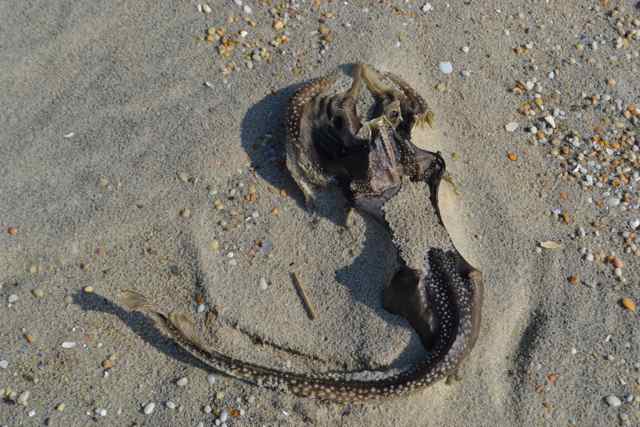 Bodies of skates also littered the beach, and my old companion the horseshoe crab was also represented on the strand.
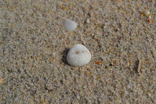
 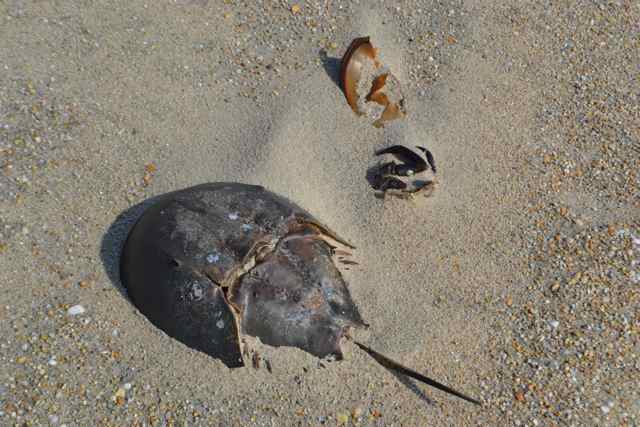 Some objects seen all along this Sandy Hook beach but absent on the South Carolina sands were quartz pebbles, artifacts from the glacial period which also created the Atlantic Highlands to the west.
The next surf fisherman was near the beach access. He had landed a ten pound bluefish earlier, but was in search of the preferred striped bass. He did land another fish while I was there, the despised (for surf fishermen) skate. The erosional forces of nature had killed off sections of young pine forest, and exposed a fire hydrant,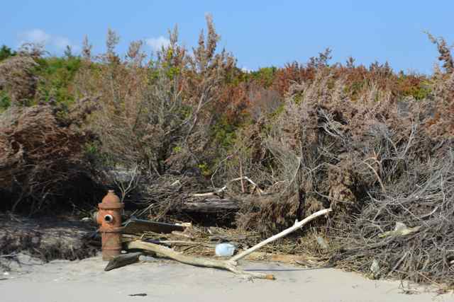 and even more dramatically a bunker originally covered by sands.
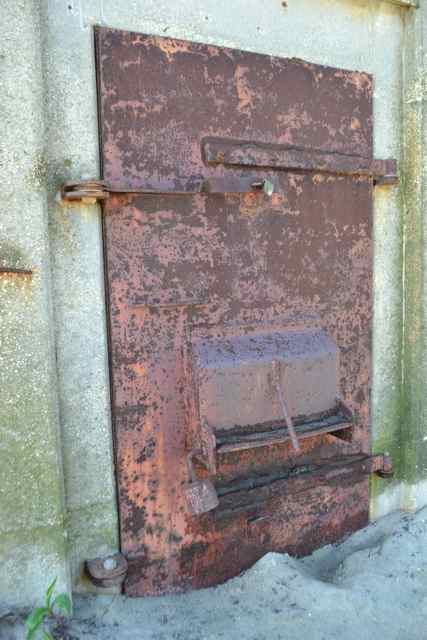
 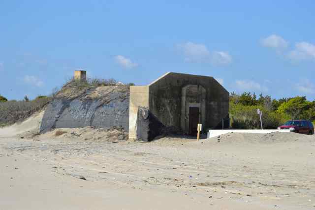 Its huge metal door and padlock gave it a sinister look.
  The northwest wind, marking the cold front that had moved offshore, was blowing moderately, and provided a fair breeze for the sailboat seen earlier in the Bay that had rounded Sandy Hook and now headed south in the ocean.
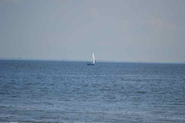
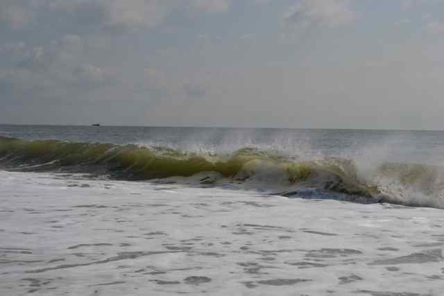 The offshore breeze gave a nice shape to the moderate surf.
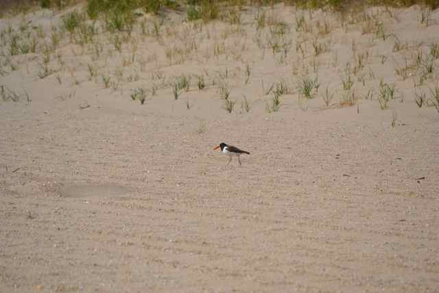
The Visitor Center presented a distinctive form above the dunes, and was framed by the Highlands in the background.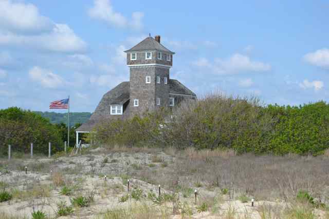 There was also a closed area for shorebird nesting; earlier in the week at Belmar I had seen another closed area for nesting black skimmers, least terns, and piping plovers. This area right off of the dunes by the Visitor Center was occupied by an oystercatcher who ran out of the roped off area, and then back in toward the dunes.
  The weathered shingles of the Visitor Center sheathed this restored US Lifesaving Station at Spermaceti Cove.
 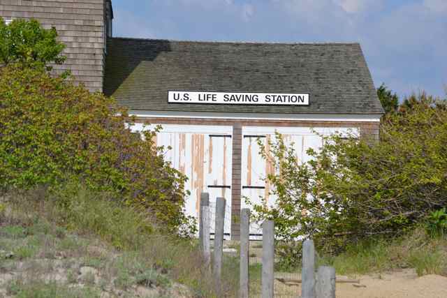 Inside there were displays and exhibits of this historic lifesaving operation.
Sandy Hook Gateway National Recreation Area describes its attributes as “Nature and history preserved”. People come to Sandy Hook for many reasons. The historic fortifications, spanning from revolutionary war to Cold War, arrayed around Sandy Hook attract people interested in these coastal defenses. Natural history was my draw today, and likewise for many others particularly birders. Access to open public beaches is the attraction for many, and for a sizable group getting naked on the beach is a main incentive: Gunnison Beach at Sandy Hook has been named the largest nude beach on the East Coast in recent years. Ferries shuttle people between the East River in New York to Fort Hancock and back in the season. For a growing number Sandy Hook is a bicycling destination, facilitated by the Multi-Use Pathway separated from the road.
The Sandy Hook lighthouse at Fort Hancock is also an attraction for many, and about six years ago my father and I visited and climbed to the top. I looked forward to sharing stories and photos of this trip today with him, an age-peer of Pete Seeger, on my last day before heading home to SC. Wanting to share more than the vicarious experience, we spontaneously headed to a nearby access to the ocean – the boardwalk at Ocean Grove, just to the south of Asbury Park. 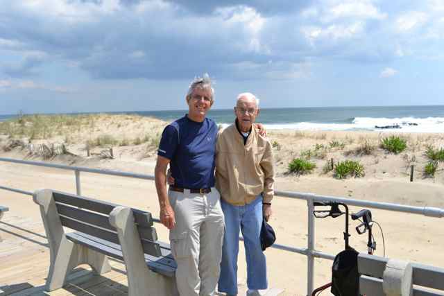 The ocean and surf remained beautiful and the day glorious as we enjoyed those moments on the Jersey shore.
Thanks Bob for a walk down memory lane. I spent many summers in Highlands and frequently was at Sandy Hook for the oceanside beaches. There were other times that I was there as a teacher for professional training.
Although you didn’t point it out, I spotted the Twin Lights on the hillside in Highlands in one of the photos. That is another historic site well worth remembering.
The Twin Lights is a fine historic site. At a higher elevation of the Highlands is the Mount Mitchill Scenic Overlook (not be to confused with NC’s Mt. Mitchell). Monmouth County’s 9/11 memorial is located there. On clear days the views to Manhattan and out on to Long Island are spectacular, as well as a bird’s eye view of Sandy Hook.
Hi Bob.. have never been there so enjoyed the introduction and tour 🙂 Also glad to see the photo of Charlie. He looks good. Glad you got to spend time with him. he is one of our favorite people! xoxo
Sandy Hook is a gem on the Jersey shore.
Great article on a wonderful national park area… I’ve “been there” only offshore rounding the “hook” heading south on my friend’s yacht destined for winter storage. Great to see your dad… looking good! Great to go on tour with you!
The “Hook” has been the point of departure and return of many a voyage. Flying Cloud, 1851, for instance, 89 days and change, Sandy Hook to San Francisco.