I made my preparations for heading out to Bull Island early one Sunday morning. In my yard the leaves of oak trees were still; the reverberation of the island’s surf wafted through the air. Both were indications of no wind as yet. Kingfisher’s deck had a substantial layer of dust and pollen from disuse. I took the time to hose and sponge the deck off. It was not until out in Bulls Bay did I realize I left my lifejacket on a sawhorse in the yard, moved there when hosing the deck.
The landing displayed a calm waterway, but when raising sail the hint of the south wind came. The sailing was very gentle initially, KIngfisher quietly slipping through the water with surf still sounding in the distance. A strong outgoing tide took me into Andersonville Creek and a surprising freshening breeze. It was starboard tack all the way – not a tack was needed in sailing the tangents of the creek’s bends or crossing the Bay. The point of sail and wind brought Kingfisher up close to a plane. We arrived in surprising quick time at the Northeast Point. A fishing craft was anchored just off the strand as I secured Kingfisher, and began a walk.
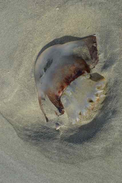
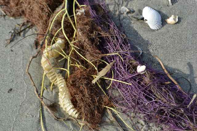
The bay was smooth and gray stretching out toward the north. A relatively new feature protruded from the waters, a snag on the curve of the point. Along the high tide line, no footprints depressed the sand. Many objects were left on this falling tide, and quite a few of these marine animals were soft-bodied. 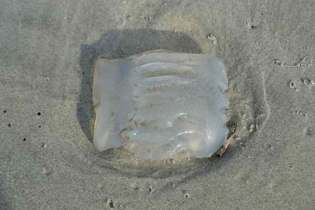
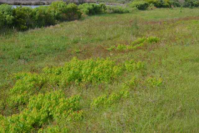
I picked my way through the dunes and into the maritime forest, heading to the Old Fort Road. Mosquitoes slowly found me, and my dressing in long sleeves and hat was well-founded. Reaching the open dike, the breeze helped disperse some of the bloodthirsty mob.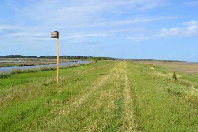 Large wax myrtles had been removed from this earthwork, and been kept trimmed. Dewberry vines created a lacework along the surface, and several patches of Chinese tallow popped up.
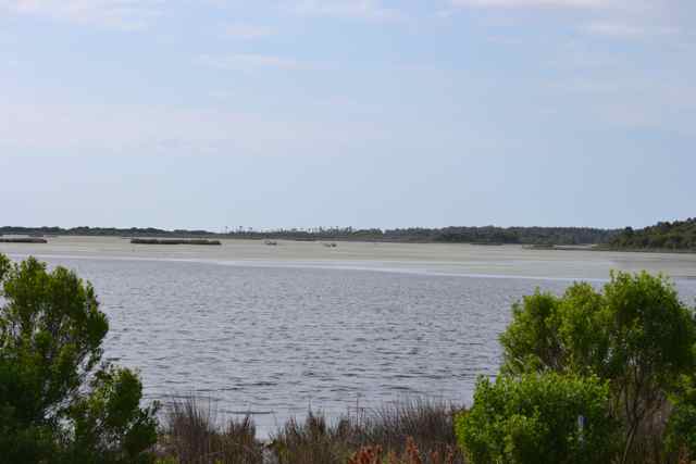
 Birds traveled to and from the salt marsh on my right and the brackish marshes of the Jacks Creek impoundment on my left. A lack of rain had the water levels in the island’s impoundments low and the salinity high; a large flat lay exposed above the waters.
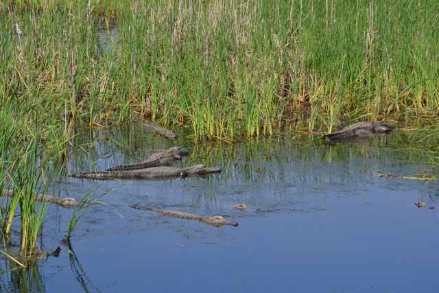
An array of alligators appeared basking along the canal between Jacks Creek and the water control structure. 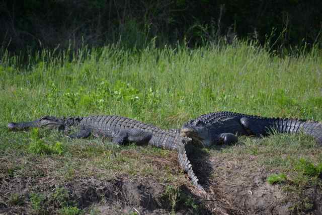 Most stayed on the bank as I took a closer look and walked by, their black bodies contrasting vividly with the green grass.
 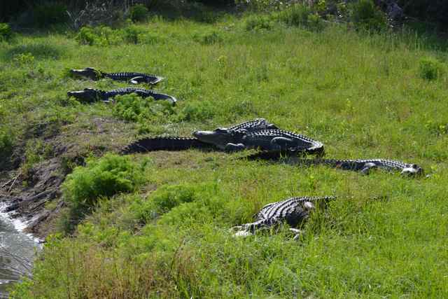 Pressing on, I turned onto Alligator Alley and began the walk past the three pools. Pool #1 had black necked stilts and several alligators. Coming around the bend before Pool #2, I experienced the usual wave of anticipation of what would be around the corner. I would not be disappointed. The same alligator occupied its territory immediately on the right of the dike.
 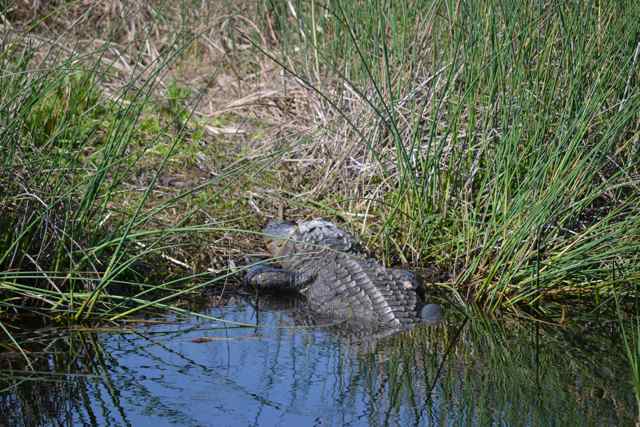 Glossy ibis took to the air, and a pair of black necked stilts walked in the shallows.
 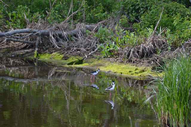 Alligators basked throughout this pool, in several places in dense clusters.
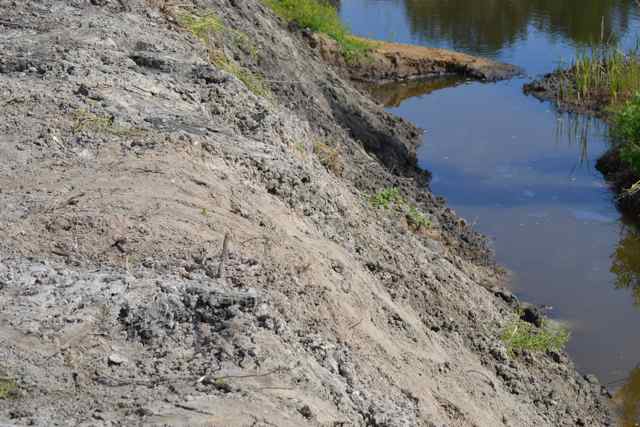
  Two alligator “walkways” had been constructed across the dike to prevent the wearing of deep grooves with the heavy traffic, but in an area of great steepness of the dike a regular path was occurring despite the climb.
Past Pool #3 and on to Lighthouse Road, I headed north toward the Boneyard. I stopped to check a pond extending off Jacks Creek. A large familiar alligator,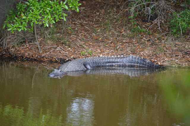 bigger than any seen earlier, basked in a usual spot, but around the corner was something else – a really massive gator.
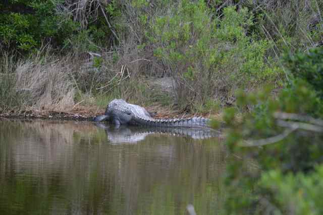 Its tail seemed to keep going and going without end, and this reptile dwarfed its consort. I had not seen it in years, perhaps five, but it had to be the individual known as Alligatorzilla. (For an account of my first encounter with this alligator, read the Prologue from my second book, Tracing the Cape Romain Archipelago).
At that moment a man was walking toward me from the north, carrying a tripod with a long lens, and swatting mosquitoes. He had come with the group from Island Cat on the Bulls Island Beach Drop. He looked across and commented “That is a big gator”, and I replied “Well, take a look from this angle at a much bigger one”. He reacted as others I have seen viewing this specimen for the first time. He took some shots with his long lens (500mm), as did I. He asked me about other spots on the island, and the prospects for more mosquitoes, and I filled him in.
I decided to take a closer look at these gators, and stepped across to a narrow hammock on the edge of this pool. I immediately came upon a skeleton, the bleached bones in a pile.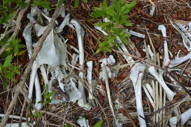
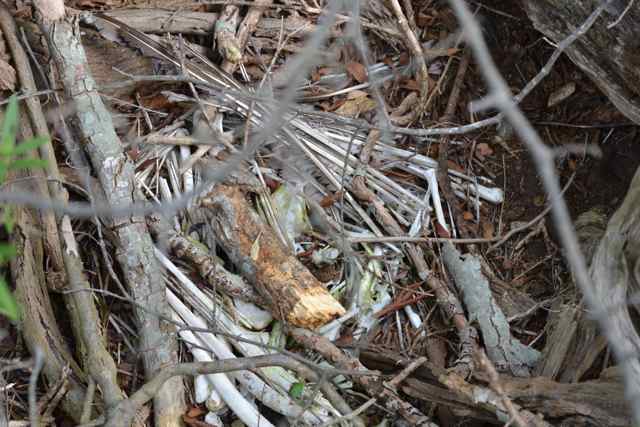 I was to find at least two more of these on this little island as I picked my way from side to side, and along the center ridge. Later, several biologists identified these skeletons as pelican, and speculated they were the prey of a bobcat. At the time, the bones gave the isle the aura of a cemetery. On the pond side, I got a closer view of “Zilla”, and took several shots. Going further, I climbed a small tree to catch another view, and took an image through the leaves, capturing the massive head.
 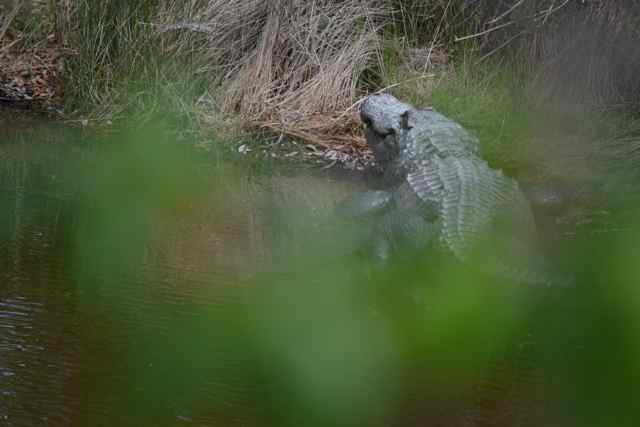 To be in the presence of this fantastic creature again was thrilling.
Returning to the road to head to the Boneyard, I realized my glasses were not on my face – prescription glasses I have had for a year and have come to depend on. I retraced my steps, but without my glasses my chances of seeing them became apparent – quite slim.
I completed the walk to the beach at the Boneyard. On this day it did not have its usual magic. I could not see as well, but I was also looking through the prism of negative thinking, frustrated with my loss. My first pair of prescription glasses – gone. The day had also clouded up, but it was my internal filter that was really off. I forced myself to sit down for lunch, and to search for some perspective on this problem. I settled down before walking back down the beach toward the Northeast Point.
I had seen some of the Beach Drop people at the Boneyard, and more appeared ahead. Others were dispersed along the strand; there was a group gathered from four johnboats, two up on the beach, and two more anchored outside the surf. They fished in the surf, as did another group further along. It seemed like a Fourth of July weekend. I stopped and chatted with several of the groups before continuing on around the point to Kingfisher. Island Cat was anchored not too far off the strand. After rigging and heading out, I sailed by to say hello, and to borrow a PFD for the trip home. Captain Will graciously obliged (after taking a photo), and I pointed my craft home. 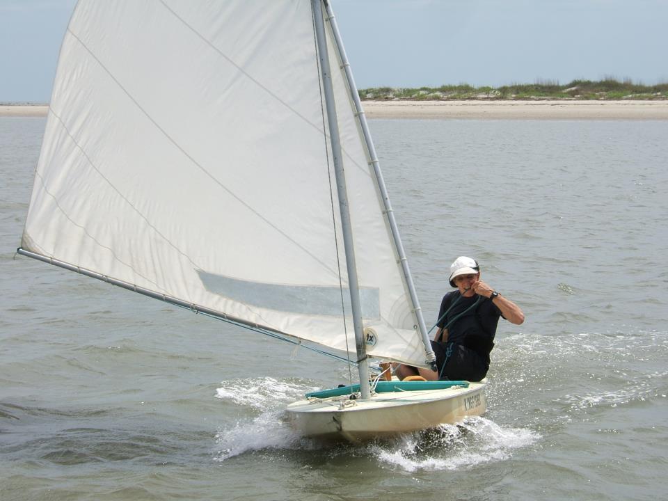
Photo courtesy Will Christenson.
Across the Bay, and heading into the creek I passed a tandem kayak paddling out into the more open water. WIth wind and tide favorable I made it home in a fast passage.
Six Days Later
I had a mission – to search for my lost glasses. I had replaced them, but I thought I could now find them with my new eyeware. The sail would be longer than the previous trip – an east wind necessitated tacking out Andersonville Creek and across Bulls Bay. The windward work was fine – a warm steady breeze facilitated this moving meditation. A strengthening outgoing tide helped, but it still took an hour and fifteen minutes to round the Northeast Point and bear off to head south toward the Boneyard. Having arrived in the ocean there was more of a swell than I anticipated, but we reached through an area of lumped up waves without problem. Landing through the surf would be another matter, and I surveyed from outside the small breakers potential landing sites. I searched with difficulty for a spot between the tidal creek cutting through the beach and the Boneyard, looking particularly for a sandy beach (not marsh sediments), and no trees or snags in the surf zone. I picked my spot after a larger wave passed, yanked the daggerboard out, and surfed in, spotting an exposed snag and steering around it. In stepping out I found myself in a marsh sediment zone, a pock-marked moonscape; after dropping sail I pulled Kingfisher down the beach until I found a suitable sandy spot also containing snags on the beach for securing the craft.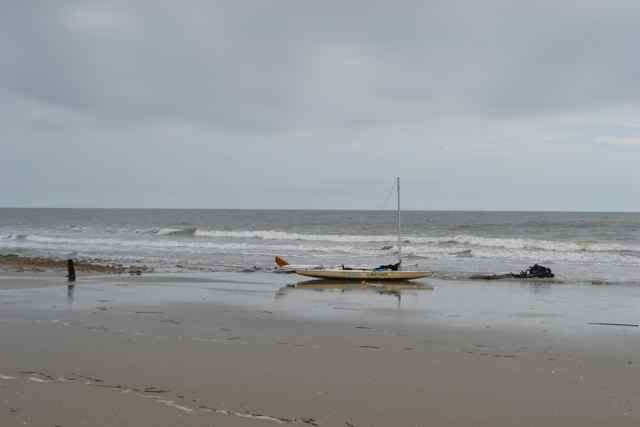
I had selected this spot since I would not need to wade the just passed tidal creek on my way to the Boneyard and my search beyond. I noticed at that creek the forming of ranks of birds, a phenomenon I had dubbed back in 2003 the “Waiting Beach”. In taking a closer look, I noticed that a large contingent were black skimmers, a distinctive shorebird. 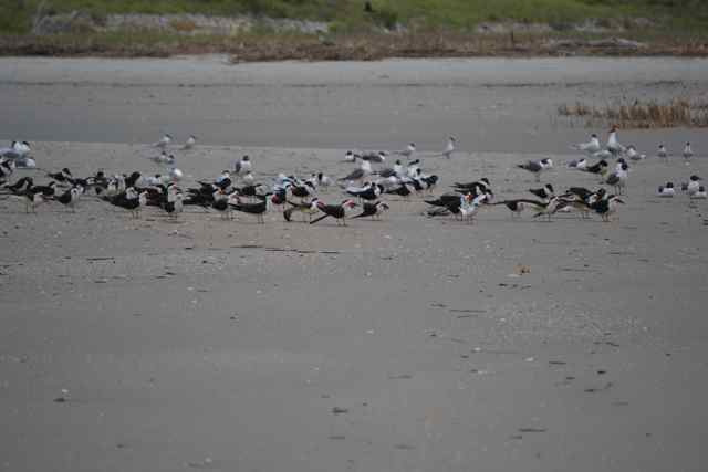 Being on a mission, after donning walking shoes and long sleeves, I made it to the Boneyard, and stepped up onto the beginning of the road system.
There were a few more deer flies today as I made the short walk to my search area. Reaching the pond, I looked around the banks, but saw no basking alligators. Stepping back onto the little isle, I began my survey, retracing my steps slowly. I squatted as I moved, scanning the ground, tree litter, bone piles, and vegetation. In one area where I squatted I found myself standing in a fire ant mound, and was able to brush off the insects before any bites. At the end I found a large blue crab claw, and when I retraced steps found another. Getting back to where I started, I stepped off and left the isle, returning toward the Boneyard.
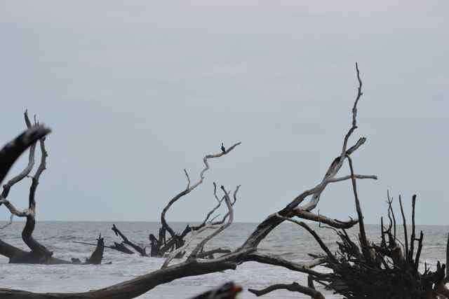
No glasses, no Zilla, no problem. I was satisfied that I had made a good attempt; no, even more than that, so satisfied that I found myself grinning. And when I reached the path to the Boneyard, the anticipation of its magic was alive again. 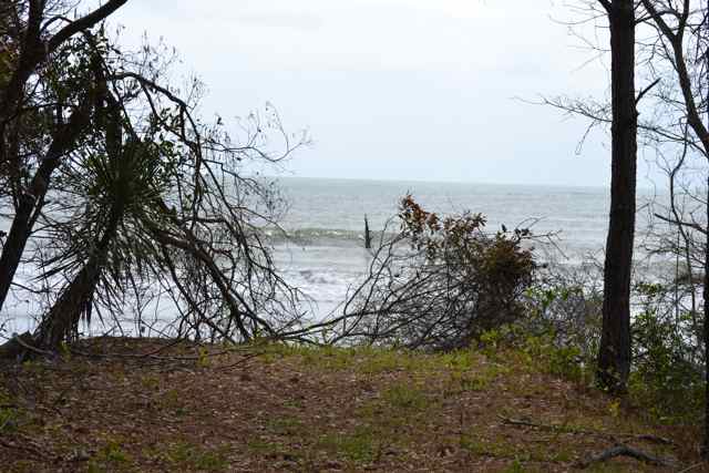 Beach, surf, bleached trees, and a classic cormorant pose on a tree out in the water.
  Retracing my steps, I came upon the only people I would see on the island – a group of adolescents with notebooks sitting around a kneeling leader, most likely teaching about barrier island ecology. I walked by with a wave, not wanting to disturb the class.
Past the Boneyard to the north, the beach all the way down to the large maritime forested area past Jacks Creek was backed with marsh and the dike containing the impoundment. 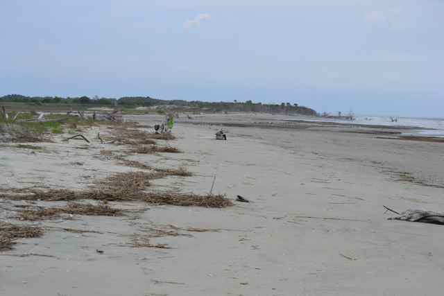 The strand here has no dunes, and is overwashed by abnormally high tides. Cape Island has large sections of its beach now with this same profile. My gear bags were exposed hanging on a bleached tree ahead. I packed up most of the gear, and prepared Kingfisher for launch.
The outgoing tide required me to drag the hull along the sand until reaching water. Prepared to get wet, with only shorts and lifejacket on, I raised sail and waiting for a good spot in the surf. I pushed the hull though the waves and climbed on, getting wet up to my chest. We reached down toward the Northeast Point, finding an area of cresting and breaking waves off the beach that we surfed through before turning the Point with a jibe. The sky was darkening everywhere, but the wind from the south was solid and promised a swift passage even against the last hour of falling tide. Pulling out lunch on the deck, I set course across the Bay for home.
GOOD STORY :>) Sorry you did not find your glasses !
Nice adventure. Jealous! I like your journeys.
One of these days, get yourself down here and we’ll go for a little stroll on the island.
Your accounts of your treks tend to “take me away” as I imagine being there to see and experience what you are writing of. I was one of the hikers on the day long trek, in the spring, where you had pneumonia and were only leading for part of the journey. (That was a wonderful day – I love Bull Island and it was fantastic to learn so much about it!) Thank you for sharing your observations with us, and doing it so eloquently!
Part of the motivation for getting out there is to be taken away. Another is to share with appreciative people like you.
Great entries Bob! Thanks so much for sharing them. “Classic cormorant pose” made me smile. What is the orientation of the map (the compass diagram is cut off in my browser)?
You must mean the rotating header that comes up occasionally as the Bull Island map. You can alway open up the full Bull Island map (go to Maps tab to find it), open it (should do so in another window), and then be really oriented. My friend (and former boss) Hal Currey wants me to GPS map it and share those. Working on it…
We came to S. Carolina from CA in the spring. We were lucky enough to get to Bull’s Island with you when you were recovering from pneumonia. Love to read of your adventures on Bull’s Island, that very special place. M-m-m, well maybe the mosquitoes aren’t so appealing! We were lucky enough to miss them that spring day, 2012. Thanks for posting your lovely trips. Can’t wait to get on the water there this fall!
Mosquitoes are an essential part of the Lowcountry, along with wood storks, alligators, lettered olives, wax myrtles, dolphins, etc. I’ll take them over DDT any day.
I currently have reading glasses strategicallly placed in every room in the house! Great post!
Is it possible to paddle out to the island and which launch point would be best? We have 10ft Hobie’s with mirage drive.
People paddle out to the island all the time. I am not familiar with the capabilities of your craft. I would recommend the ferry route from Garris Landing to the public dock on the island. This is more protected. Planning your trip with the tide helps. The trip out to the Northeast Point going across Bulls Bay can get rough, though the last section toward the public dock can act up too. Have a good plan, and good luck!
Glad to know that Gatorzilla lives! I remember seeing him with you 5 years ago. Let me know if you get Skalko down for a beach walk. I’ll try to join you.
Yes, I remember the day you (and my daughter Sara) were “Zillified”.
Skalko? Now that would be a reunion, wouldn’t it?
Bob,
As usual your writing makes me yurn for another trip to the Island. It is a magic place and I wish I were there right now. I would even invite the biting insects for a quick trip down the beach to find sand dollars again. I think it is time for you to write another book Bob.
Thanks Ron. I’ll remember those kinds words, and they will help motivate me to work on my current book project about the Santee Delta.