Kingfisher had not been in the water since November of last year, and the deck was coated with a thin layer of dirt. I used the sponge to clean the area around the cockpit before I raised sail and headed out Andersonville Creek. The wind was out of the north and the tide falling, conditions quite favorable for my plan of heading out across the bay to the Northeast Point of Bull Island. The light wind and smooth water made for a peace in the marsh, the quiet broken only by the distant voices of oystermen and the tapping of their culling hammers. Still the noise of traffic from the distant mainland was heard until it faded as we passed the Shark Hole, and disappeared heading into Bulls Bay.
The Bay was placid, and the sail across easy. 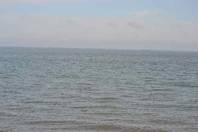 A couple of crabbers were working, and the number of crab trap buoys had increased since my last sail in the bay. The wind swung around a little toward the NE as predicted, and I surveyed the beach of the NE Point while approaching for a landing, seeking a buried snag in the intertidal area. I found none, and ran in for the landing. It was 9 AM, and I would have an hour more of outgoing tide. I pulled Kingfisher up to a place where the water would not reach until early afternoon, and buried a piece of timber to fasten the boat for security.
 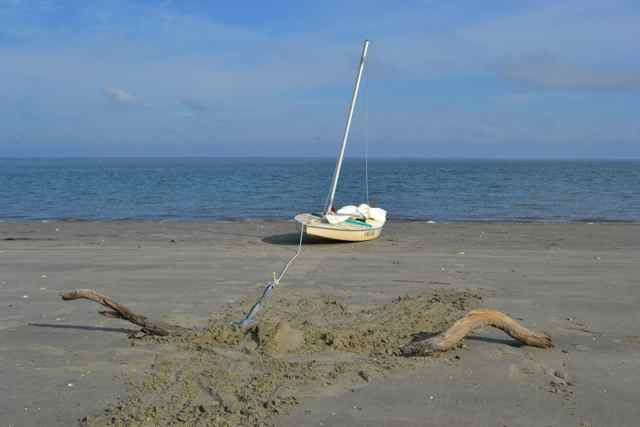 With shoes changed and gear packed, I began my walk.
It was a beautiful morning on the island. The ocean was peaceful with a tiny surf. The high tide line stretching out on my path awaited me. 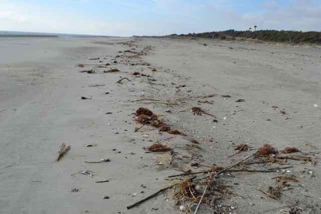 It seemed that there was more – an anticipation of something special. This was a familiar walk to me, starting from the Northeast Point, making my way through to the Old Fort Road, then across Alligator Alley, out to the Boneyard, and back along the beach (see map). I would reverse the direction today. I could not put my finger on it, but the anticipation was palpable, and merged with a feeling of happiness of being here on this day.
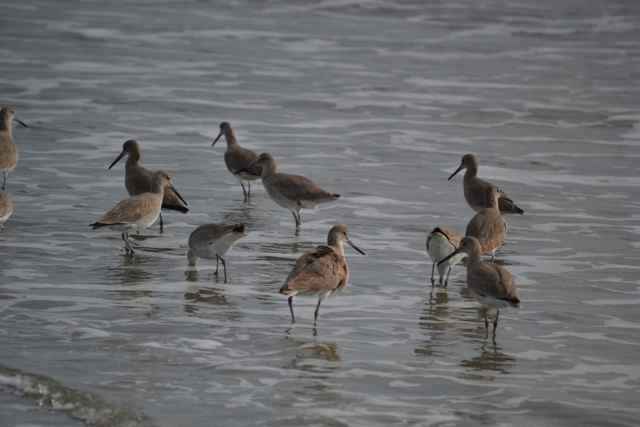
Traveling relatively light except for my camera, I only picked up a few small shells – moon snail, lettered olives, tiny whelks, all with hard exoskeletons that would not break in my pocket. They produced the satisfying sounds of clacking, similar to those remembered from marbles in childhood. A horseshoe crab appeared upside-down and alive, and I returned it to the water.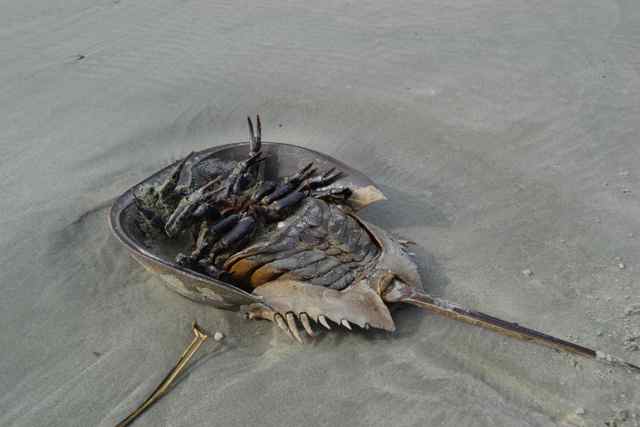 Shorebirds worked along the strand. A group of willets were feeding at the water’s edge,
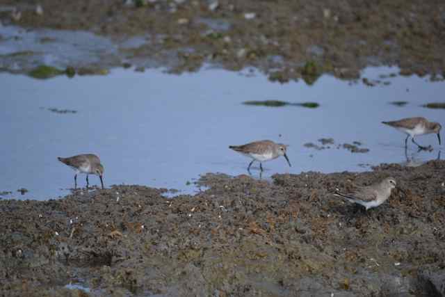
  while dunlins probed old marsh sediments for invertebrates.
  Sections of old marsh jutted up from the sands as if mountain ranges.
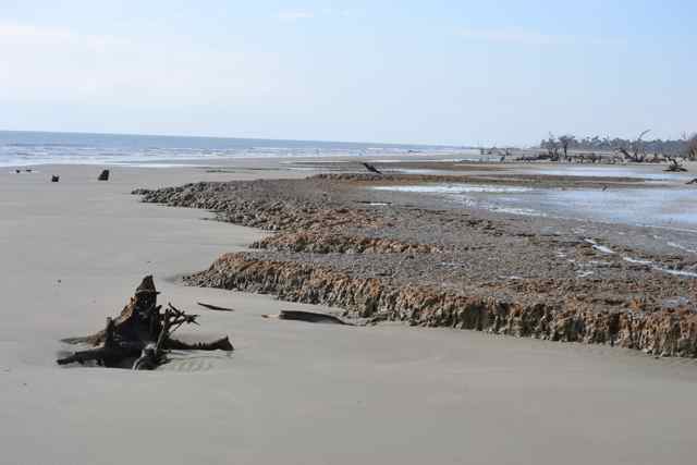
At the secondary dike to Jacks Creek more geology was evident. The growing tongue of sand continued its march through the old dike breach, almost touching the secondary dike in the inexorable process of joining Jacks Creek to the ocean. 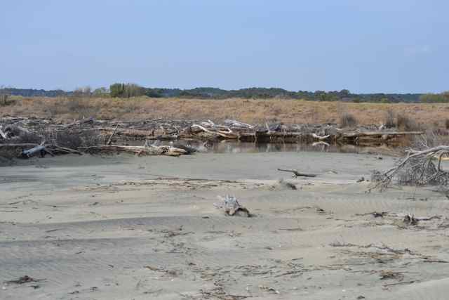 The old tidal creek draining the marsh between the beach and the dike was still filled in at its old location, but I found in a few minutes that it had reformed closer to the Boneyard. This was my first encounter with this new beach feature, and I took a look at the newer creek along its length.
 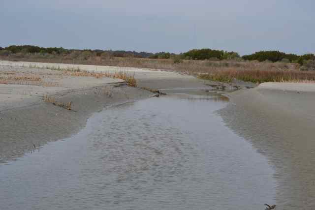 It was now dead low tide, but there was no place to cross without getting in the water. I took the opportunity after shedding my shoes and socks to feel the cool water with my bare feet.
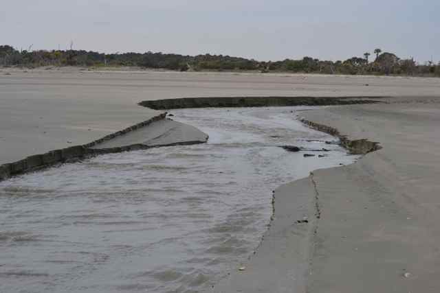 I continued the walk without shoes until the Boneyard.
Stopping at a log to sit and replace socks and shoes, a bird of prey flew by, the white tail signaling without doubt a bald eagle.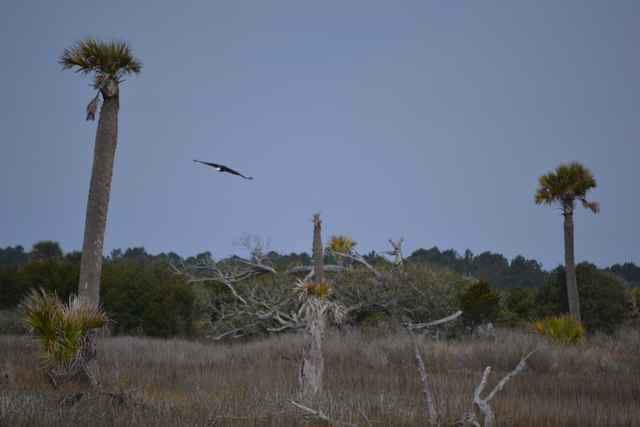 I watched its flight until it landed on a dead tree near the dike, and I retraced my steps to get a closer look and photo.
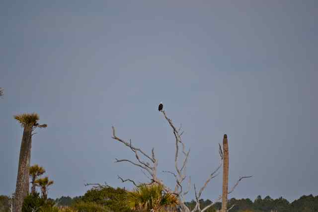 It finally spooked and took off before a nearer approach. Back at the Boneyard, an old tree jutting out of the water provided a roost for cormorants that appeared in the light to be stems out of the main branch.
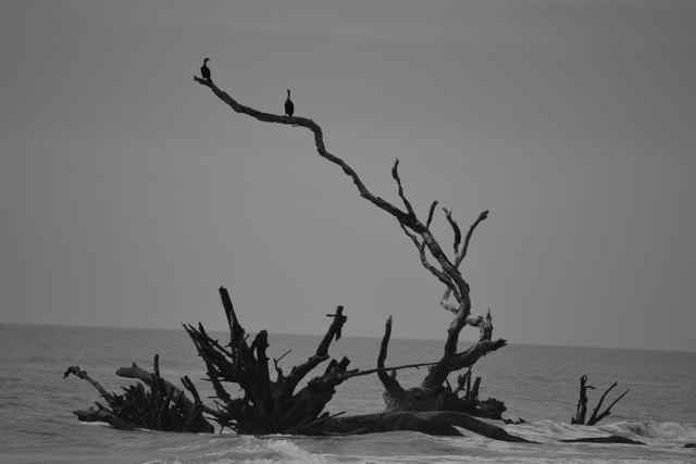 Leaving the Boneyard, I left a gray and placid ocean devoid of wind.
The grassy road led me past Moccasin Pond, and at the water control trunk an eight-foot long gator stretched out on the bottom of the dike.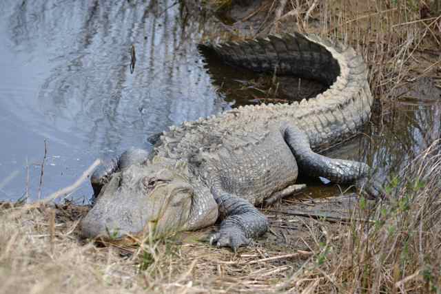
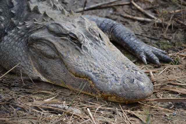 Despite my proximity, the reptile did not move an inch. At the small pond ahead where the legendary alligator “Alligatorzilla” once resided, a good sized gator but not the big one lay on the bank.
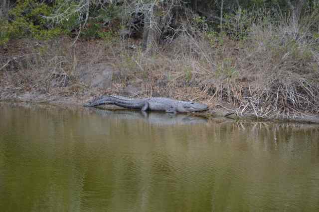 From here it was about a fifteen minute walk to the most dense alligator pond on the island – Pond #2. There were several small alligators climbed up on aquatic vegetation, and a larger adult pulled up on a mud bank.
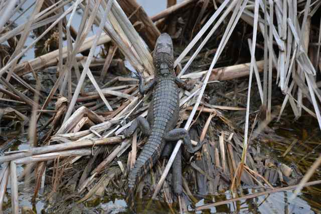
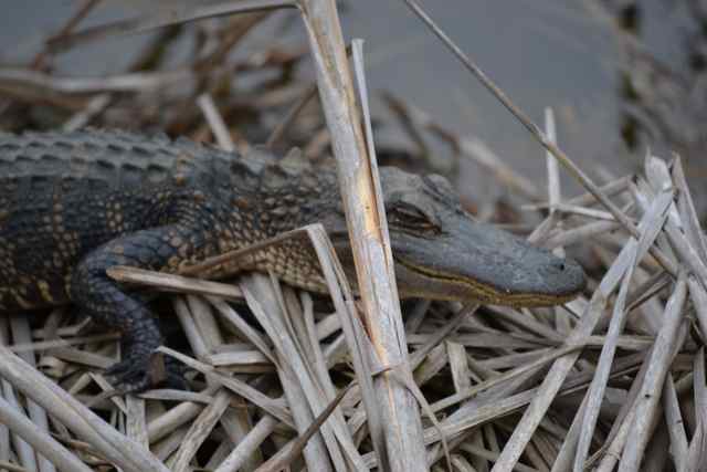
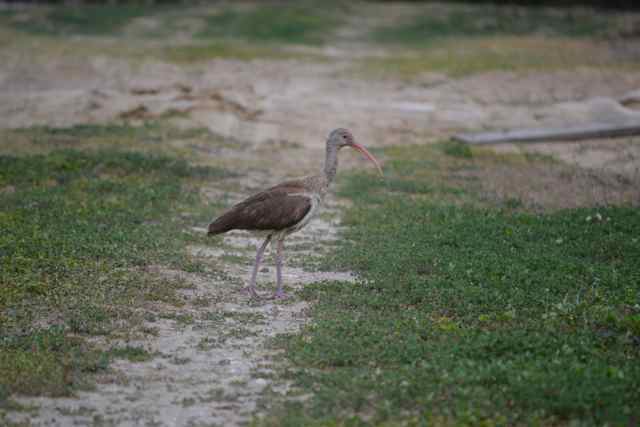
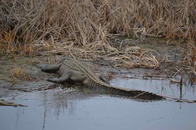 A wading bird provided a close look both in the marsh and on the dike, and I later identified it as an immature white ibis, though it appeared neither immature nor white.
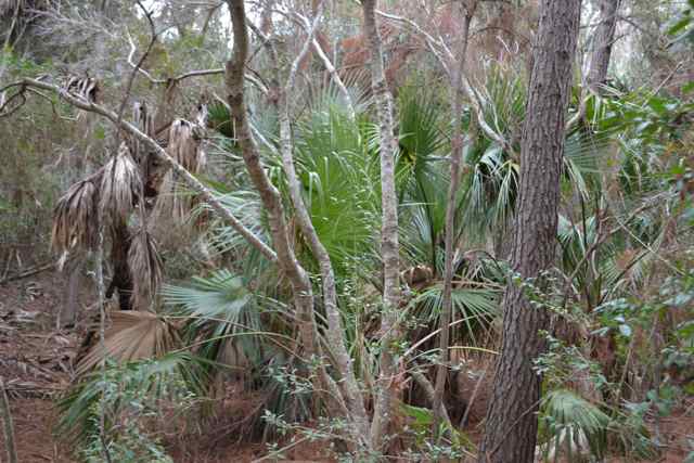
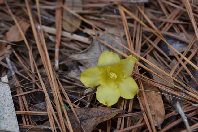
Back in the forest, the unseasonably warm winter had generated a profusion of yellow jessamine blooms, trailing up pine trees and erupting in clumps at the tops of other shrubs.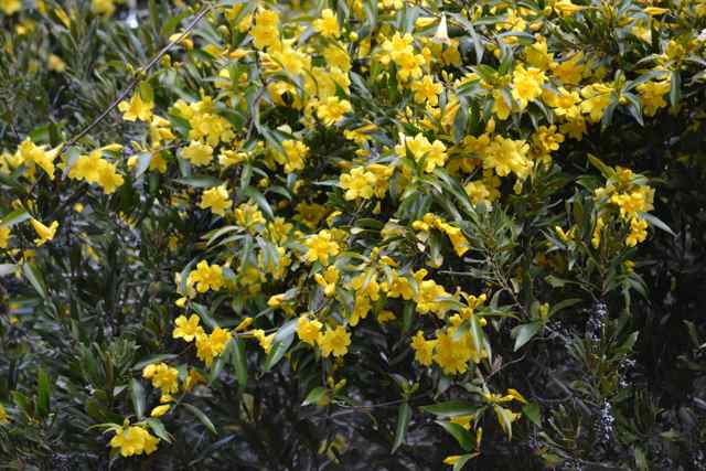 Once around to the Old Fort Road, and heading north, the maritime forest dominated along and over the path. The forest floor was a mix of the greens of the palmettos and bays, and the cinnamon carpeting of fresh pine needles, highlighted in places with dropped jessamine blooms.
 At the water control structure and canal into Jacks Creek, no alligators were present. A fox squirrel appeared ahead at the next bend, but warily slipped off into the forest before I could get a closer look. A contract worker on the island told me a story from this winter that occurred on this very road. He was driving one afternoon along this stretch heading toward Jacks Creek, and in passing a large live oak he became aware of a disturbance. A fox squirrel was running along this tree with a bobcat in hot pursuit, and suddenly their path was blocked by the oncoming pickup truck broadside to their path. In an explosion of action, the fox squirrel went one way, and the bobcat the other. It was a moment of great drama he recounted.
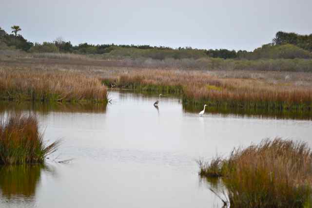
Out on the open Jacks Creek dike, the view toward Bulls Bay pictured a couple of fishermen casting along the marsh, and the smooth waters without visible wind beyond.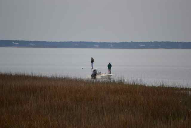 To the right the Jacks Creek impoundment stretched out into the distance, and a great blue heron and a great egret stood with matching profiles.
 I found the turn for the path to the beach, and picked my way through the dunes and the walk around the point back to Kingfisher. On the way, I put two objects together for a photo – they shared the fact that they are illegal to remove from the refuge: loggerhead rib, and Native American potsherd.
 Arriving at the boat, my estimates had been excellent, since water was just beginning to lap under her stern. Passing right along the shore heading outward bound at this time were several dolphins, and I watch them easily swim against the tide as they passed. By the time Kingfisher was rigged and the gear stowed it took little effort to get her floating again.
The wind had died and become variable earlier, but was behind us again as we ran back across the Bay. I used my paddle to keep the boom full out with the wind so light, but was startled when an object came steaming by – actually a crab trap float appearing to move but really displaying how fast the flooding tide was pulling us. The Bay was so smooth and the tide so brisk that it would have been easy to make the trip in a canoe. On the way into the creek, I passed through much floating Spartina, washed out of the marsh by high tides. The relatively slow passage gave me the opportunity for contemplation. Reflecting on that earlier anticipation, I recalled my observations of the island’s environment and wildlife, the feeling of happiness, the ease of the trip, and those many moments I was present for.
You tantalize, Bob, with your vivid descriptions of life on Bull Island. I can’t wait to see you & the island next week.
You made me feel like I was there. Thanks.
What awesome pictures Bob, I want to go sometime before I leave Charleston!! Sadler
Oh, you should. This is a wonderful time of year on the island, although I like every month there.
thanks for the map. a great addition. a map freak cannot visualize things fully without an image. for example i had no idea that after the boneyard one would be turning almost due north to return to the northeast point. one might want to call that the north point.
You could make a case for North Point, but since the long axis of the island is more NE to SW, Northeast Point is more fitting. Names don’t always get it right, though: it is not exactly a point. Kingfisher always lands on the north side of the “point”.
Excellent reptile shots!
Thank you for such a wonderful posting! Because I visited Bulls Island for the first time last fall, I can visualize some of where you were. However, as someone stated, your photos and your colorful descriptions make it come alive. I can’t wait for my next trip to the island in a month!
Oh my! And I get to meet you and visit the Island with Ann this weekend! Now that is truly a reason for anticipation. Thank you so much for the post & pictures, I can hardly wait. Additionally I ENVY you your ‘neat’ boat! Scottie.
Enjoyed the land and sea photos of your favorite
sail and walk around the island. Maybe you deserve
a remembrance of some sort for your many sojourns
around the island.