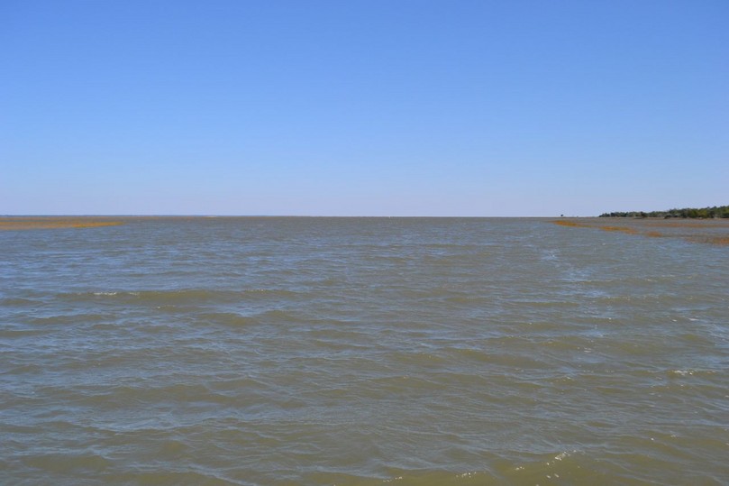
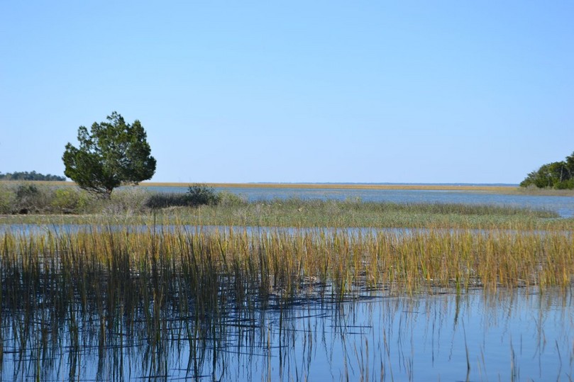
Cool fall weather, a brisk northeast wind, and a huge high tide awaited me at the landing. I aborted a planned trip the previous day – poor conditions eroded my determination. This sail was to reach through the creeks and across Bulls Bay to Bull Creek, run down into Summerhouse Creek, and land at the public dock. I anticipated the return sail to be more of a challenge. With the tide so high we rode above the marsh grass, and with this rare perspective I viewed boaters fishing back in creeks usually not accessible. The visibility was impressive in all directions, and the colors of this salt marsh landscape were brilliant.
The reach across the Bay was spirited: the fetch across this shallow body of water allowed for the northeast winds to build up the waters into a swell and ragged chop that on this day kept the shrimp-baiters in the creeks. We paralleled the edge of the marsh on the Bay’s southwest edge, though in places the edge and the adjacent marsh were covered with the waters of the high tide. Kingfisher rode over the rough waters well on this point of sail, and I steered as dry a course as possible (not completely – there was a creeping dampness under the rain gear). I thought I was all alone, but saw an outboard between me and the marsh. What he was doing there became clear – a small johnboat with three passengers was up in the flooded marsh, pushed by the wind and waves. They had found the dreaded lee shore, and I watched their vain efforts to get off. I was glad this other boater was there to provide some relief, since Kingfisher and I could not have provided more than moral support in these conditions.
We came through the last of of the waves passing the point, and jibed into the smooth waters of Bull Creek. Ahead the two towers of the Ravenel Bridge stood out in the distance, and in the foreground rose the dorsal fins of dolphins. The creek had mushroomed in size with this high tide which was still pushing in strongly.
With wind and tide behind, we approached at a good clip the public dock, surprisingly occupied by two boats. I prepared quickly to drop sail, and rounded up to closehauled to get a little distance to windward of the dock. The sail dropped, and I swung Kingfisher round, but things were moving much faster than anticipated, and the possibility of fouling the docked boats loomed ahead. A sharp turn of Kingfisher toward the dock, and quick strokes with the paddle, got us in safely. I filed this situation away for future reference. I did note that the dock to dock trip was around forty minutes – outstanding.
After pulling Kingfisher around to the marsh side of the dock, securing her, and changing clothes for a hike, I set out, greeted by a pair of kingfishers flying out across the creek and broadcasting their rattling cry. The gangplank between the floating dock and the fixed pier was inverted due to the high tide, and water was covering sections of marsh I have never seen under water.
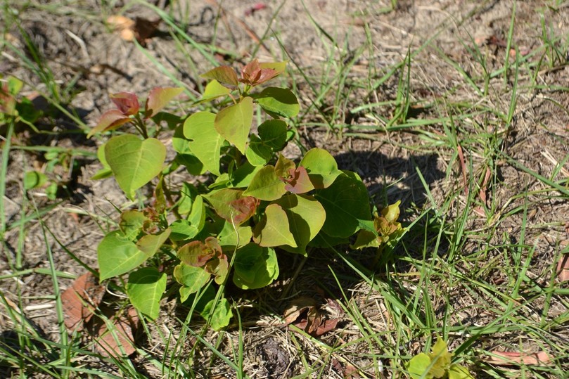
These waters exposed the road from the dock as a raised earthwork sticking out like a narrow peninsula. I noticed a sign announcing the closure of the island four days previous due to the aerial spraying of the herbicide Clearcast, used for the ongoing battle to eradicate the aggressive invasive species Chinese tallow.
The weather was superb for a walk, and I shed a layer as I warmed up along the Old Fort Road, on the meandering path to Big Pond Road, Sheepshead Ridge Road, and Alligator Alley. Fall colors exposed Chinese tallow in the woods, and sprouts even popping up in the middle of Big Pond Road.
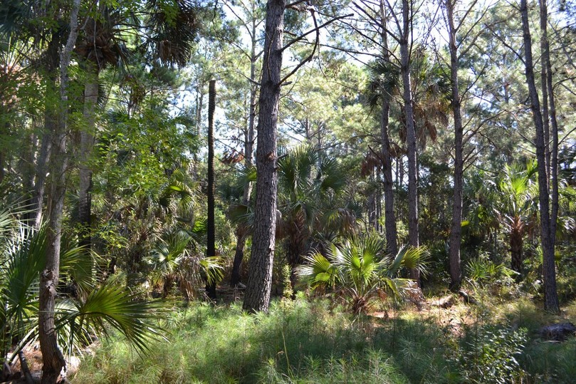
The sumac, wax myrtle, and yaupon holly were ripe with berries. Loblolly pines continued to reach higher each year, working on replacing the ninety percent that were destroyed with Hurricane Hugo. A harrier flew across my path, and in looking to track it and spying a winged shadow, I found instead a turkey vulture soaring on the breeze. With full sun, and a cool night (35 degrees during an early morning run), I anticipated a large turnout of alligators, but only one in Pool Two was out in the open. There was a similar low mosquito count, and this seemed to be a fair trade-off.
I made the turn on Lighthouse Road to the right, departing from the usual visit to the Boneyard. It would have been spectacular, but without a beach, so I walked south through the maritime forest, impressed with how beautiful all the parts fit together.
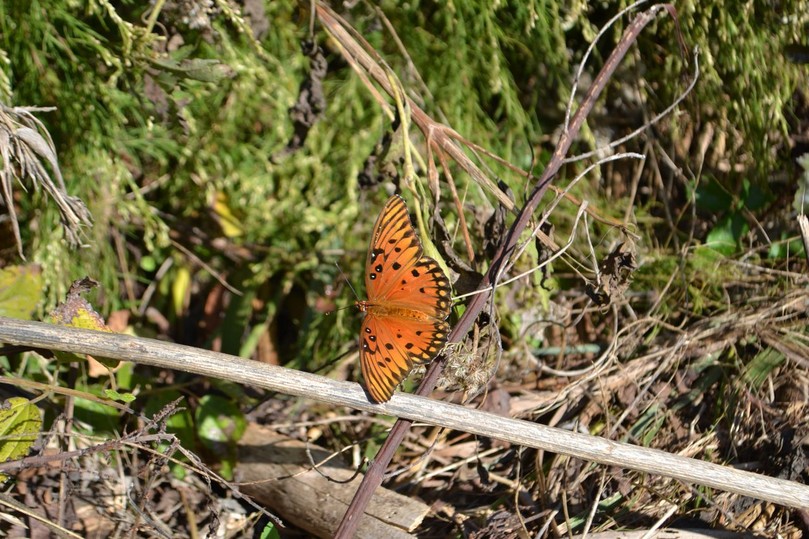
A second hawk, this time a red-tailed, flew through my vision across the road to another destination on the island. I had seen one of these beautiful birds released at the Birds of Prey Center the previous day. Brilliant Gulf fritillaries flitted around the edges of the roads.
At the intersection with the Big Pond Road, I turned left to take the extension to the beach. In the last section before the strand, yellow flowers thrived – wooly golden asters.
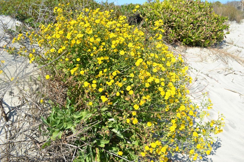
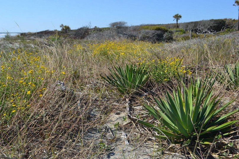
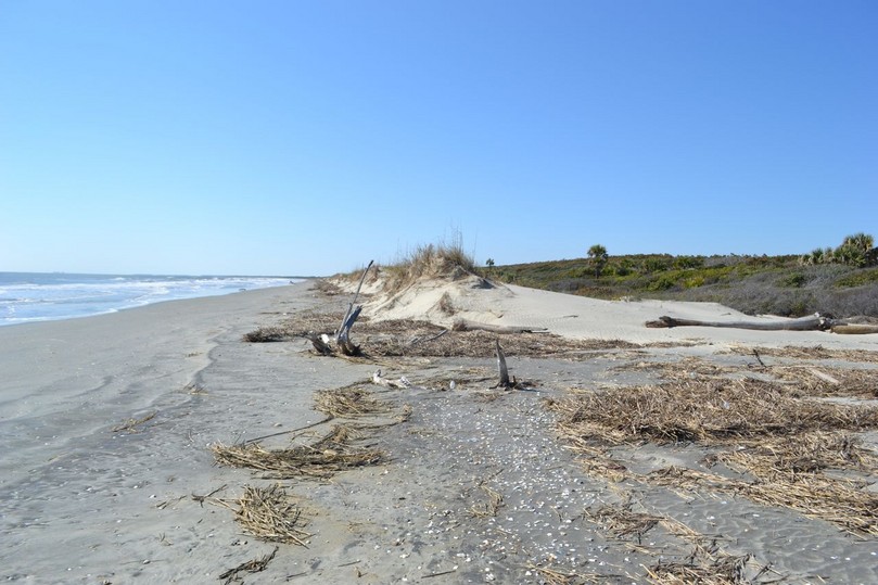
I was to see many more of these golden blooms in the area between the beach and the shrubs pruned by the salt spray. Even two hours after high tide, there was little beach, and the dunes were missing. The winds and surf from Hurricane Irene had impacted here, and in places there were just piles of palmetto trunks where dunes formerly were. It was not until about forty yards from the entrance to the Beach Road that the dunes were again substantial.
On the walk back across the island, the movement of people appeared in the distance down the dike separating the lower Summerhouse Pond from Big Pond. I passed this family that included a toddler and an infant at the picnic area. Numbered campsites were set up here for the archery hunts scheduled in November and December. At the dock, the waters of the high tide were pulsing out of Summerhouse Creek, and this tidal flow opposed against the wind was creating swells bunched together and cresting right across from the dock. The family was returning to their outboard at the dock, the only craft there except Kingfisher, when I cast off. I cranked in the sheet to closehauled, and immediately was in the zone of piled-up waves. Speed and steering brought us through cleanly, and a little more effort permitted us to pass the point and bear off into Bull Creek toward the mainland via the ferry route.
We were against the tide, but the strong breeze allowed for fine progress. In the turn to the north at the opening to Sewee Bay, we were favored by the anticipated tide reversal (now with us), and an unanticipated veer of the wind to the east. Farther on, when heading up the fork of Andersonville Creek to the east, sailing to windward was boosted by the tide flowing toward the Bay. Past the Shark Hole, we turned toward the mainland in the other fork of Andersonville, and found the opposition of the tide to be no problem. The masts and occasional sails of snowbirds were seen over the marsh. In coming out into the Intracoastal Waterway we sailed to windward of a southbound sloop sporting their genoa before I dropped sail for our landing.