I stepped onto the public dock on Bull Island at 8:30, briefly talking to Wayne Tucker. He had spent the past two days working on the island, and was waiting for his boat ride back to the mainland and out of the cold. My relative warmth was a function of what awaited me on the island. Wayne would be the last person I saw until leaving the island hours later.
The solo early start for my walk was serendipitous after I turned on Big Pond Road. Within a short distance a bobcat stepped out onto the road about fifty feet ahead. The cat did not initially detect my presence. My camera was still in its bag over my shoulder, and I attempted to retrieve it as discreetly as possible. The moment passed, and the bobcat was soon across the road and off into the forest. I recalled a past conversation with ferry captain Will Christenson about missing a photo of an eagle one day, and his reply was something like “This is the Wild West – you’ve got to draw and shoot!”
This island was one of the “hunting islands” described in South Carolina’s early days. When John Lawson spent several nights here at the end of 1700, the accompanying Seewee Indians went out to hunt, and brought back on the first day two deer, and on the second two more deer, two wild hogs, and three raccoons. It was a demonstration of the Seewee’s hunting prowess, and close relationship to the natural world. The Seewees knew this island as “Onisecau”.
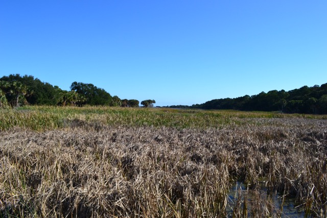
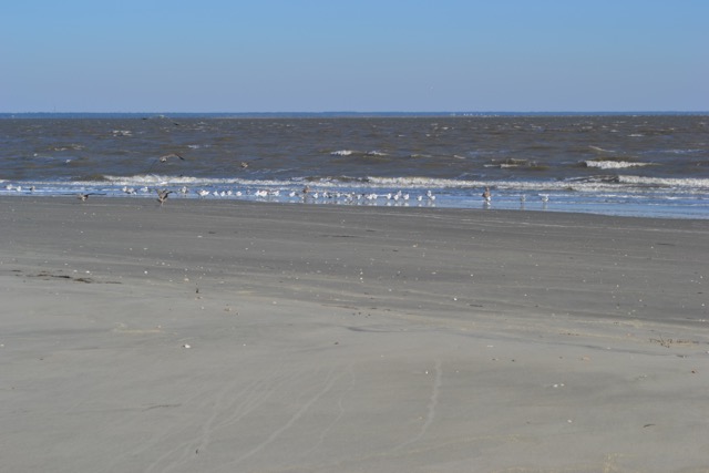
My morning mission was an island exploration, and I continued east on the Big Pond Road all the way to the beach. It was less than two hours before high tide, and with above average tidal height I knew I would be pushing it to pass the Boneyard dry on the beach. The first hundred yards made it plain that this would not happen. I gave little thought to backtracking for a different path, instead removing shoes and socks, hanging them from my pack, and rolling up my pants to continue on. The walk had warmed me up, and the coolness of the incoming ocean water was pleasant.
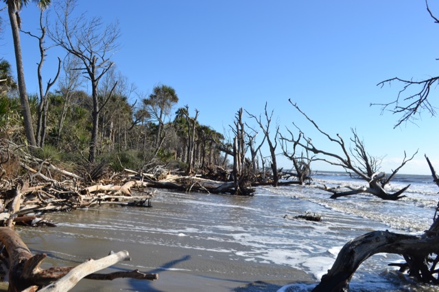
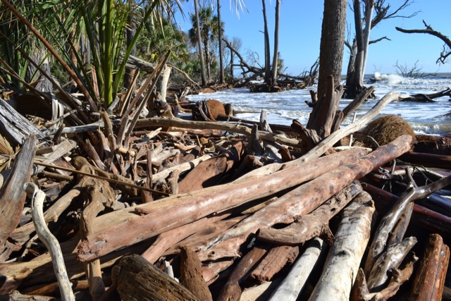
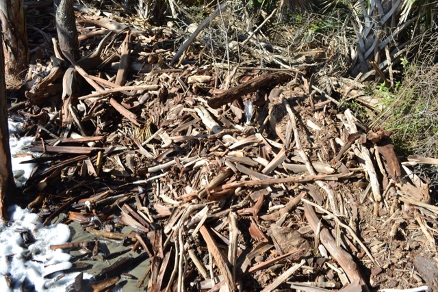
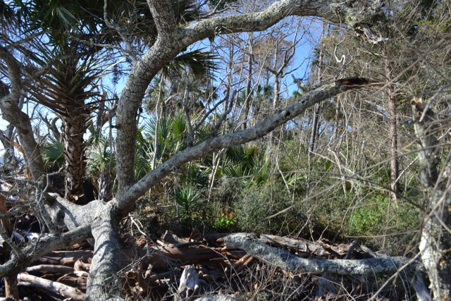
I had walked this island section before the Boneyard many times, but the tide made it all new. There was enough surf to push water up the beach, and I dodged those surges. Entering the Boneyard required climbing over and under trees until I ran out of beach. I began walking on the tidal wrack, which at the Boneyard was a jumble of driftwood from small pieces to logs. This path required extra care in bare feet. Fortunately the flotsam and jetsam was relatively clean, with occasional plastic trash, not the debris including used syringes seen in October along the Delaware River in Philadelphia.
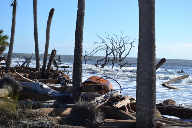
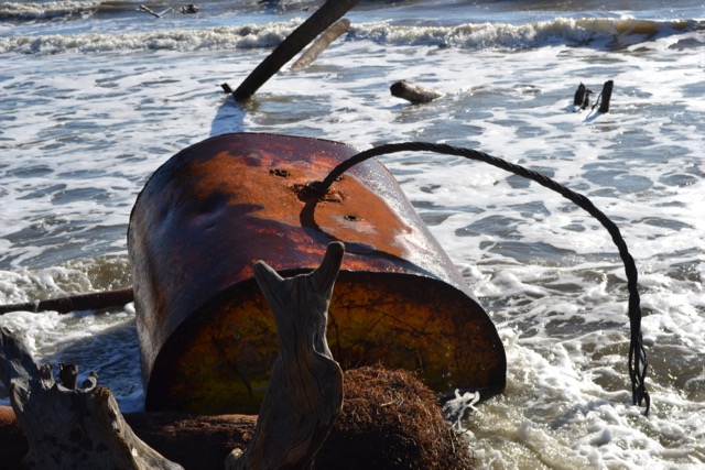
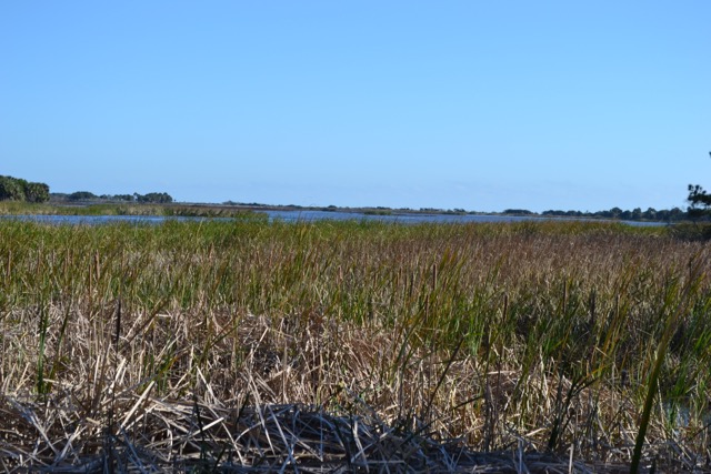
I finally reached a reprieve from this dodging and balancing on driftwood – the open sandy cove at the outlet of Moccasin Pond. In that stretch the paw prints of what looked like a bobcat appeared, though Billy Shaw later identified it as coyote. In the distance I noticed a large floating object, red and undulating with the tidal surge. As I approached it I saw the broken cable of this commercial buoy, perhaps from a dredge operation. I sat nearby on one of the many palmetto logs lining the beach, replaced my shoes, and ate lunch. Reviewing a photo later I took of the buoy, I saw something I missed at the time. The skeleton forest of the Boneyard transforms downed trees into many forms, and one was a feline-like doppelgänger of my bobcat sighted earlier.
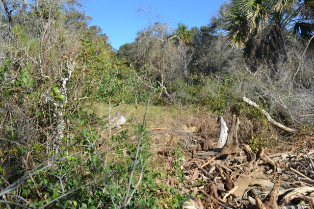
Continuing on, surging waves covered the beach at this point of the Boneyard, and my path was now a bushwhack through a palmetto jungle. I anticipated a short section before the first open path leading to the road system, and I was relieved to avoid the sharp spears of a yucca. The sea level rise and impact of storm tides has eroded this path on a raised dike perhaps 50% in the past fifteen years.
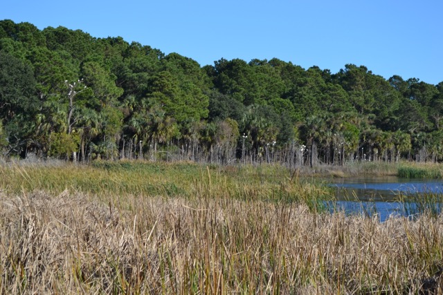
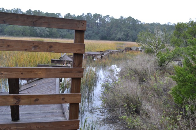
I chose an alternate walk compared to recent ones; down Lighthouse Road and on to Alligator Alley, the mowed road leading me across dikes with views out to fingers of Jacks Creek. There were more wading birds than alligators, and egrets roosted in trees along the impoundment. Close by the dike, coots splashed off through the marsh grasses as I approached.
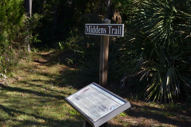
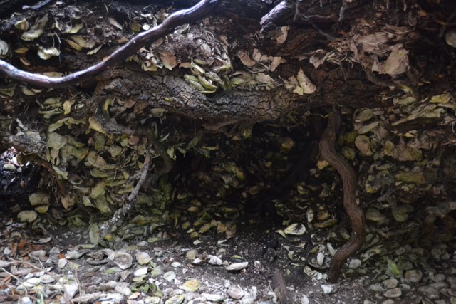
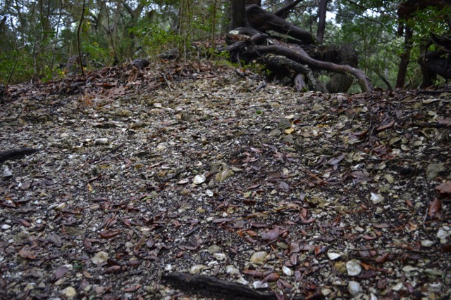
Prior to reaching the public dock, I veered off on one of the designated trails on the island, the Midden Trail. This short path takes one along the edge of the salt marsh, and has shell deposits known as middens. I have viewed these traces of indigenous peoples here before, but on this day a fresh coating of pine straw obscured any sighting of the shell and potsherd remains. I have seen a number of sherds on the beach: it is important to remember that these antiquities are protected and unlawful to remove.
If one wants to see middens, the Sewee Shell Ring in Francis Marion National Forest, adjacent to the marsh off the Intracoastal Waterway in Awendaw, is a place to visit. Technically this is not a midden but a shell ring. The raised boardwalk at the shell ring has been destroyed by coastal flooding, and encroaching sea level rise threatens this phenomenal site. There are middens throughout Cape Romain National Wildlife Refuge and the Lowcountry, and in fact I have some on my property.
There are a limited number of historical records of interactions with the Seewees, and several occurred on Bull Island. There are John Lawson’s accounts cited above. And then there was the historic landfall in April of 1670 of the Carolina, the frigate bringing the English settlers to found the initial South Carolina English colony. A party of colonists rowed a boat from the Carolina, which was anchored off the Northeast Point, and encountered a couple of Indians on the beach where they landed. Those Seewees addressed the Englishmen in Spanish, a reminder for us of the significant presence of the Spanish in South Carolina in the sixteenth and seventeenth centuries. The Seewees’ greeting consisted of Spanish words “Bony Conraro Angles”; loosely, good English friends. They did speak two indigenous names, as they pointed out important features to the English: the island they stood on – “Oni-se-cau”, and the body of water to the north – “Seewee”. Those words were spoken over 350 years ago.
In the European practice of replacing names, Onisecau became Bull, Bulls, Bull’s Island (even Bulling’s Island), and Seewee became Bulls Bay. Stephen Bull the immigrant was one of those settlers on the Carolina, and through some transference the renaming took place, despite the fact that Bull never owned the island. The name Onisecau has had various spellings: Anisecau, Onesecan, Onisecau, Onisecaw, Oni se cau, Oni=se=cau.
A number of people have wondered about the meaning and pronunciation of Onisecau. I consulted Eliot Raynor, my son and a linguist, on the pronunciation. Conducting an exercise in historical phonology, Eliot reviewed a number of the spellings in the historical record. His conclusion: ah-NI-suh-CAW.
Another of the hunting islands also received a renaming: Timicau (Dewees Island). From a local perspective, so much has been lost of the coastal tribes’ heritage. Knowledge of the natural world. Cultural practices. And language death. Many indigenous sites have disappeared through the works of modern development. It seems important to recall indigenous names, it being November, National Native American Heritage Month. These place names resonate into the twenty-first century. The name – Oni-se-cau – deserves more frequent use, not just in November.
Interesting and wonderful history Bob. Thank you and may you and Onisecau have a Happy 2021!
I’ll be visiting Onisecau in 2021, you bet.
Thanks for the article Bob and would 100% on the naming – its not like Mr Bull added a lot the history of the region and perhaps nor Mr. Dewee. Do you happen to know where the name Avendaw originates?
Actually Stephen Bull did contribute quite a bit, and his family – they formed a Lowcountry oligarchy. Both son and grandson were William Bull and William Bull II, and Lieutenant Governors of the colony. Awendaw is an indigenous place-name.
Bobcats and Indians
On the coast with Raynor
Oni se cau
Thanks for another adventure.
Love your descriptions and history of our Home!
A Dana haiku? Wow.
My next post will be much closer to Home!
What’s your favored pronunciation of Onisecau; which syllable gets emphasized?
owny see COW
owny SEE cow
OWNY see cow
Is there any record of the meaning of the name?
These are very good questions, Starr, and ones I have pondered. The various historical spellings give us clues. I would go for “caw” instead of “cow”. Right now I would give the second syllable the emphasis, but I do have a linguist I will consult. And there is no record of the meaning, except for it represented the island place-name.
As always I learn so much from you posts! Also enjoyed the comments and questions from fellow followers of Raynor on the Coast. Happy new year and GOOD HEALTH to all in 2021.
Thanks, and yes, good health to all.
Thank you, Bob…..always interesting and stirs up memories of my visits on the island. I’ve been away too long and it’s past time for a return. This post was particularly interesting historically…these stories do need to be retold. Keep ‘em coming😊.
OK, Scott, I’ll keep ’em coming.
Hi Bob,
I find all of your posts interesting but this one especially so. As you mention, so many times we neglect to consider the history of our beloved coastal haunts, or – egregiously in my opinion – bury it under the pavement of progress. Keeping this history alive requires thoughtful reminders like your well written post. There is much we know about the history of Bulls Island, and still so much to be learned. Thank you for this timely reminder.
Thanks, Will. Yes, we do have a buried history, and much more to learn about Onisecau.
By the way, “Wil” is Captain Will, ferry captain, marine biologist, and renowned educator on Caretta; and Will of “draw and shoot” quote. Your comments are not just thoughtful but prescient for my next post.
On the other hand, how about drop a haiku like my friend Dana for your next comments?
Always a pleasure to read and enjoy your journey with you.
Thanks, more to come.
well done – always important to recognize native american names and give them their due
Do you have any local Oregon islands with indigenous names?
Thanks Bob — enjoyed reading about the history and maybe next time you can capture the bobcat on film! Happy New Year!
Pam
Thanks Pam, and to you! No promises about that bobcat photo.