I have long pondered sailing Winyah Bay to explore its waters, seen only from a distance by this sailor. In certain respects the conditions appeared favorable on this day in early June: low tide at 10:30 (at the landing on the Sampit River); an early west wind predicted to swing to southwest, our faithful sea breeze; and little chance of thunderstorms. Other pluses: the opportunity to use this Monday for the trip without other obligations, Kingfisher in decent shape, and a spare tire to go with the one-year-old trailer. A fine plan, though a fickle wind and a one-hundred-degree day would provide plenty of challenges.
The preparations had a glitch – the realization on the drive north on Highway 17 that the chart was left at home. I would have to rely on my eyes, channel markers, and other landmarks to help me navigate. I had chosen the Georgetown County landing on the Sampit River, adjacent to the bridge crossing that river, and across from the International Paper Company mill.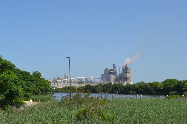 It was a landing named after Carroll Campbell, the former SC governor, and probably the largest and most underutilized in the Lowcountry.
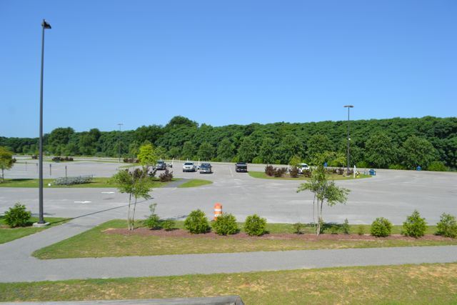 When I arrived there were only five vehicles and trailers parked in a lot which could accommodate over one hundred. There were six ramps to choose for launching. A suggested registration for the landing provided a place for a destination, which I indicated was “jetties”, located at the entrance into Winyah Bay from the ocean between North and South Islands. It was a relief to leave the heat from the asphalt to sail out the Sampit River under the Highway 17 bridge.
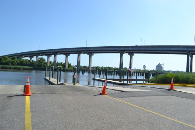
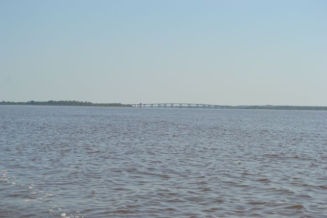
Sailing past a wharf with tugs and break-bulk structures, and the entrances to the Georgetown waterfront, we slipped out into Winyah Bay, riding the light west wind and strong falling tide. The main sources of the freshwater into the Bay were visible via distant bridges: the lower structure over the Great Pee Dee River (and tributaries including the Black River) closest to Georgetown, and the elevated bridge over the Waccamaw River and the marine thoroughfare of the Intracoastal Waterway.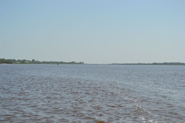
 It became apparent in the passage down the Bay that the sailing momentum became less important than the current’s force. A sail appeared to the south, and was hauled down as the wind lightened. We passed this larger sailboat Sparrow, a Snowbird heading north, but despite motoring was making limited progress on its ICW passage against the full ebb tide. We were on the right course, but without other alternative on this seaward heading.
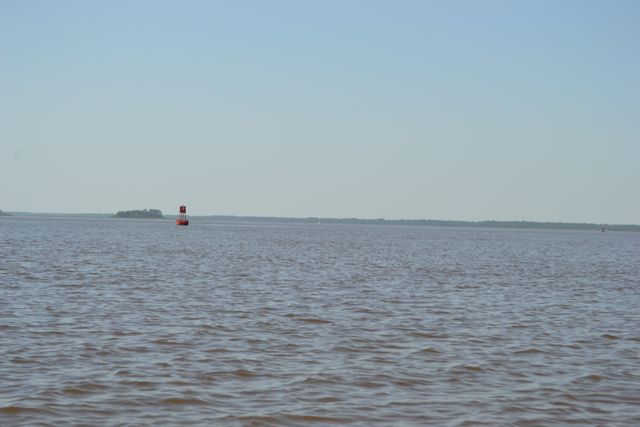
While the west wind was blowing, the sail provided some shade, but the arrival of calm made way for the full brunt of sun and heat. Fortunately, I was well prepared with hydration, drinking fully prior to sailing, and carrying plenty in a cooler on board. Besides a wide brimmed hat, I used my lifejacket to cover my legs, and at times would also tuck arms underneath. Despite the heat I kept my neoprene sailing boots on for coverage. I began periodic dips in the Bay for short-lasting coolings. This experience, though only lasting a few hours, gave me a taste of what a sail would be going through the Doldrums, where the relentless heat and lack of wind could hold sailing vessels in its grips for days and even weeks.
We drifted steadily past islands and navigation markers, where the velocity of the flow was most apparent as the water chugged by.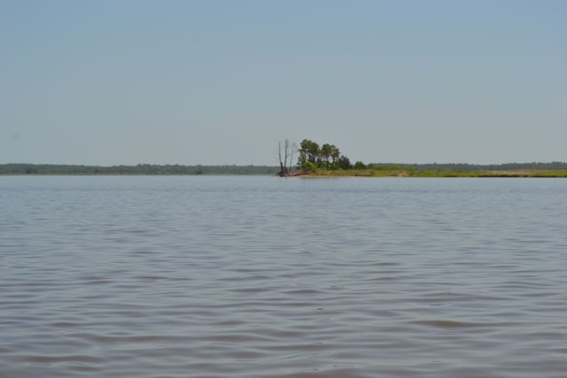 A black body of a fish appeared on the surface on its side, and on close approach the large sheepshead dove quickly. I was surprised to see on this Monday a tour boat cruising on the west side of the Bay, and to hear an amplified sound system. Without a chart I could not make out the southern entrance to the ICW between the mainland and Cat Island, and saw later it was hidden behind one of the Bay’s islands.
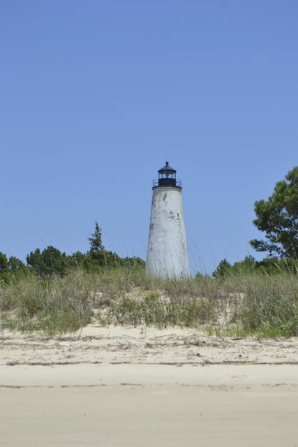
In sight of the last section of Winyah Bay, the waters between North and South Islands, the first glimmers of the sea breeze appeared at 1:30, and filled in solidly in minutes.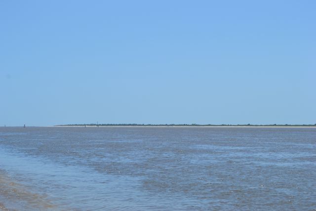 It was relief on many levels: the end of being a helpless floating object drawn along by the relentless ebbing tide, the pleasure of windward sailing, and the flow of air around Kingfisher and my body, ameliorating the heat. Having visited South Island on tours, I chose a landing on the other side of the Bay for my first North Island visit. South toward the point the tour boat earlier seen also landed and disembarked passengers. I walked back along the shore for a closer view of the lighthouse, a prominent navigation aid in these waters.
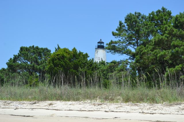
 Sailing again, I continued south for a look out the inlet, reaching one of the sea buoys marking the shipping channel. An ocean-going yacht was heading in from offshore. We bore off to begin the long return sail, which calculated later was around eighteen miles. In my mind, there seemed to be still outflowing waters, though not as rapid as earlier, and the hydrodynamics of this Bay and the rivers’ fresh water output became more evident. The Bay waters between North and South Island had been the location for a famous anchorage in 1777 – Lafayette’s landfall after his Atlantic crossing to join the Revolution on June 13, 1777 in the ship La Victorie. As I glanced astern, I observed the large vessel motoring in to these waters. Rather than following toward Georgetown, she rounded up as if preparing to throw out the hook in this historic anchorage.
The southwest winds provided for a fine run up the Bay, and a lively chop for a bit of surfing over waters which were dead calm just hours before. The sailing allowed for observing the immense size of the Bay, stretching out behind a set of islands on the North Island side of the channel – Mud Bay. My earlier view of the Bay was a much smaller body of water; inversely my view of Kingfisher was much larger in my mind than the reality, most likely a function of its capabilities, stable platform, and reliability. While I entertained a turn around the Georgetown waterfront, the many miles and hours on the water kept us on course for the landing. Happily, Kingfisher‘s rig easily passed under the Highway 17 bridge over the Sampit River before slipping into the quiet landing.
I enjoyed going along on your adventure. I salute your seamanship on your little craft.
Kingfisher does seem bigger than she is.
Good to hear from you.
Glad you had a good day in Winyah Bay. It is HUGH and can be dangerously rough. We have been in/on it when it was stirred up and it was NOT fun. Hard to believe but G’twn is almost 18 mile from the ocean!!
In my younger days dangerously rough would have been a lot of fun, but mellowing a bit. I have a much better view of Winyah Bay’s extent.
you are a nervy and brave sailor. you would not catch me on that bay woithjpit a chart in a power boat much less the kingfisher. thanks for the compliment on my last reply.
I could leave the chart out home that day, but would not have left shore without ample drinking water.
Such a joy to read and feel like we are sailing along with you on another adventure!
Thanks for coming along, Pam.
Bob,
That was a long sail you did. I know as we always go boating in the Winyah Bay every year visiting Myrtle Beach. We love the Georgetown area and the bay. Did you spot the Harvest Moon peaking above the water?
Ron
No Harvest Moon sightings, but I sure saw a lot of sun and water.
Bob, I was referring to this Harvest moon.
While proceeding in company with tug USS Clover shortly after 0800 on 1 March 1865 Harvest Moon struck a torpedo (mine) in Winyah Bay, South Carolina. Admiral Dahlgren, awaiting breakfast in his cabin, saw the bulkhead shatter and explode toward him.
The explosion blew a large hole in the ship’s hull aft and she sank in 2½ fathoms of water. One man was killed. The admiral and the crew were taken on board USS Nipsic. Harvest Moon was stripped of her valuable machinery and abandoned 21 April 1865.
http://scmaritimemuseum.org/history-sunken-union-flagship-marks-150-years
Oh, that Harvest Moon! In fact, I did see the stack protruding above the surface. Thanks for sharing this fascinating bit of SC maritime history, and the link for more info. Appreciate it, Ron.