Often the transformation of dreams into reality is the basis for true personal fulfillment and actualization. Having been a sailor from an early age, and living and sailing along the coast of North Carolina for four years, I developed a dream. The first glimpse came while I was racing in a Laser regatta at Oriental on the Neuse River. The Neuse opens up into the ocean-like Pamlico Sound, separated from the Atlantic by the narrow Outer Banks. I daydreamed of a sail from Oriental out to Ocracoke and Hatteras Islands of the Banks. Such a sail in a Laser seemed like quite an adventure.
A couple of years later, I fantasized about reaching down the coast from Wrightsville Beach to Swansboro (a distance of fifty miles), taking advantage of the regular southeast sea breeze. This fantasy included staying at the northern destination until the not infrequent northeast breeze came in to speed me back to Wrightsville.
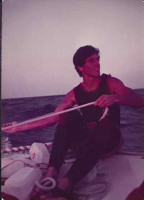
Several factors took me from the dreaming stage to planning and implementation. First of all I had been able to save enough money at my job to purchase a third-hand Hobie 16 catamaran. Its advantages over the Laser were greater speed, capacity to carry gear, and ability to sail optimally with two people. The second factor was my imminent move inland to work for the summer and then to attend graduate school. I felt I would not have the opportunity for this type of trip for a while. And third, I had an eager, equally adventurous friend who had braved some wild winter sailing with me – Rusty Davies.
The planning of such a journey, one that I had not made or heard of others making, required much thought and foresight. Crucial to everything was the wind. I proposed catching the sea breeze and making it to Swansboro, or even twenty miles further to Shackleford Banks. From there the plan would be to continue sailing up the Core Banks, and perhaps as far as Portsmouth Island. The next leg would take us to either Cedar Island or to Oriental, where a friend would bring car and trailer to carry us back to Wrightsville Beach.
A date for departure was set, and for ten prior days stagnant air and lack of a breeze prevailed. 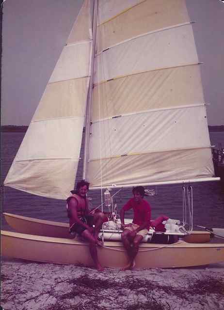 We packed and set sail on our appointed date in a light breeze, heading up the coast at a slow rate. Luck struck soon; we witnessed the birth of the sea breeze, and I remembered seeing this phenomenon on an open body of water ten years ago. The breeze picked us up, and incrementally we skimmed, surged, and finally wildly surfed up the coast on a most exhilarating sail. Day 1 map.
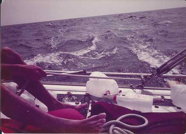
It was clear we would make our destination of Shackleford Banks. The Hobie16 was reveling in the wind and waves, but the sound of a loud snap signaled something else. Looking around, I noticed that the starboard rudder blade had broken in half, and we were steering solely with the port rudder. Fortunately it was on the leeward hull on the starboard reach, and in preparation for the trip I had purchased an extra rudder carried on board for this possibility. We made it through Beaufort Inlet, separating Atlantic Beach from Shackleford Banks, after six hours, a remarkable time. Though fatigued the excitement of landing on a new barrier island with wild ponies on the beach was exciting.
We were further blessed with strong southwest winds the next few days which easily pushed us up the Core Banks toward Portsmouth Island, probably the most isolated place on the North Carolina coast. Though I had charts of the entire area we planned to explore, intermittently we found ourselves in shoal waters. 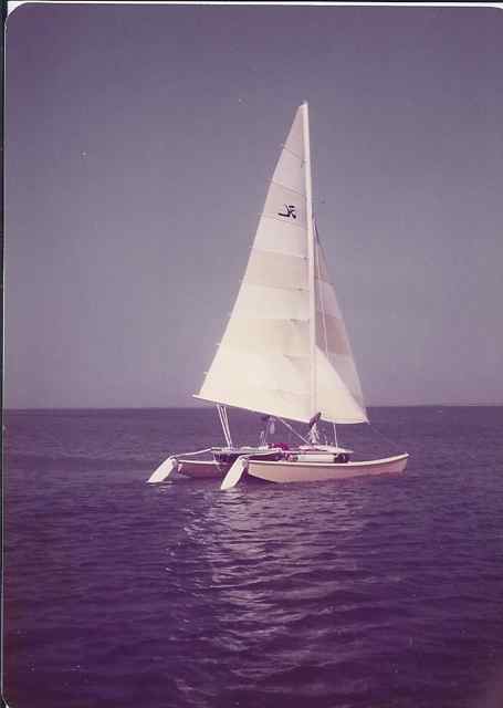 We stopped our second night on the narrow Core Banks, and sheltered in one of the numerous fishing shacks. Day 2 map.
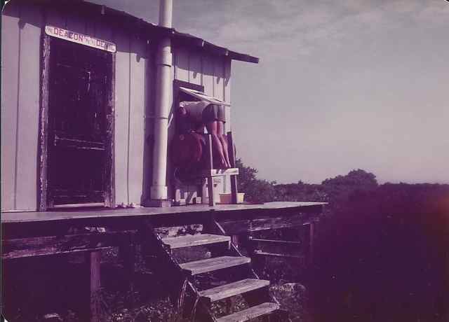
Stopping in the small fishing town of Atlantic to pick up water before the final sail to Portsmouth, I talked with a shopkeeper about the trip. He commented on our luck in picking up the winds in their present flow. I told him jokingly that if in two days a northeaster would come around, we would be able to shoot back to Wrightsville. He found the idea incredible, but did not rule it out, for the southwest to northeast pattern does occur. Day 3 map.
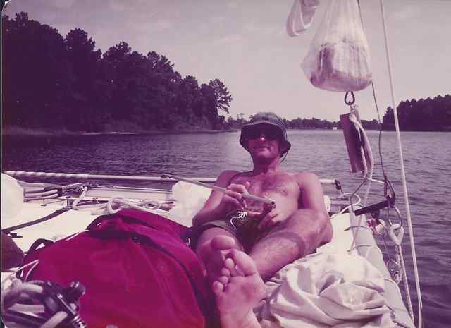
With shortened sail and the strongest breeze yet encountered, we sailed wildly into the unknown. Even with the wind from behind, I found it prudent with a reefed mainsail to drop the jib. We found Portsmouth an incredibly beautiful and wild island. There was an old village with fine homes and a church, a beach over a mile wide, but not a living sole.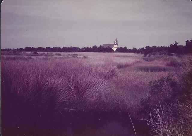 It turned out to be the most beautiful, and most inhospitable island on the coast: hungry swarming mosquitoes and flies descended on us, and without our tent survival would have been questionable that evening. Even so, when we ran to get into the tent after dusk to flee the horde, we were not prepared to see after several minutes the inside of the tent covered with biting sand gnats that had easily passed through the mosquito netting. We coated on the noxious repellant, and covered our skin with clothes and sleeping bags as much as we could for the miserable night ahead.
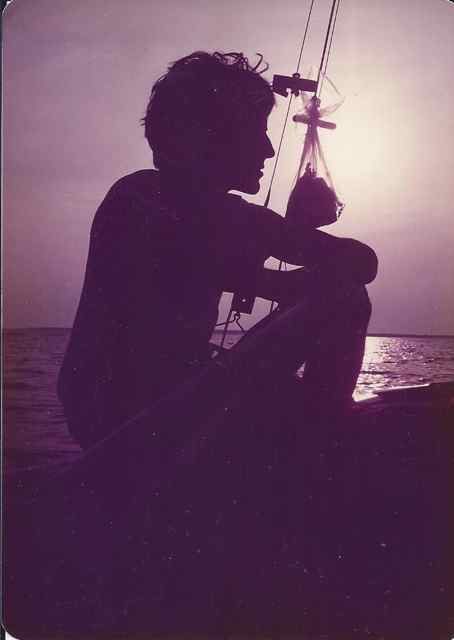
We wasted no time departing at first light, beginning a day with little wind and slow progress toward our next goal of crossing the Pamlico Sound and entering the Neuse River. 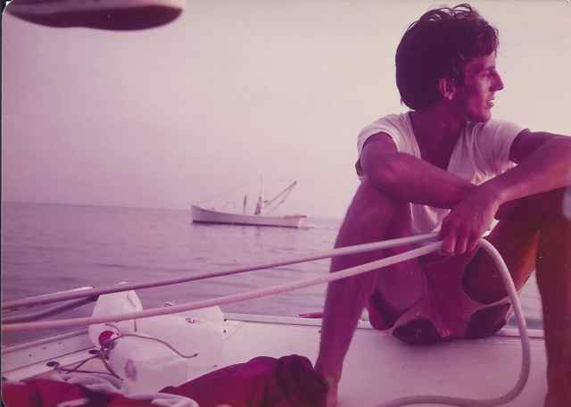 The hulls stayed in the water throughout the long day as we used every breath of wind to head west. At sunset we ghosted into Oriental.
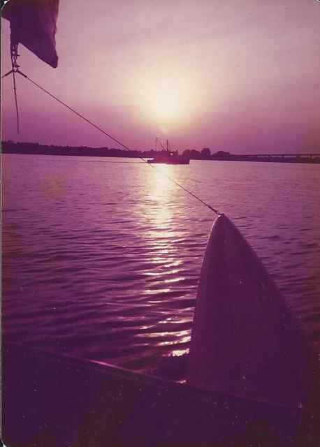
 This was a reverse realization of my initial dream, but the reality far outstripped that vision. We had reached Oriental a couple of days before we had planned to return. Fatigue had definitely taken hold of both Rusty and me, and we were most grateful to be able to stay in the comfortable home (beds!) of the Allaires, friends of my parents from NJ who had moved to Oriental. Day 4 map.
There was uncertainty about our return. Charlie Allaire, a most successful competitive sailor, and I spoke at length about our journey. In response to my plan of trailering back, he suggested “You don’t want to give up now.” I told him I had not planned to sail back (a trip of 100 miles), but that if the wind came around to the northeast I might reconsider. He did comment that we had to get through a long canal with no wind, and that next to impossible without a tow.
Early the next morning, the movement of trees showed a new breeze – from the northeast. After reaching agreement with Rusty, and preparing the Hobie, we set sail with a farewell from the waving Allaires. It was a final goodbye to Charlie, who died of a heart attack in a few months. [Day 5 leg 1.]
 As Charlie had mentioned, the canal was long and windless. After passing under the Hwy 70 bridge we made it into Bogue Sound. Off we went with the northeast wind, and no finer breeze could have been concocted as we scudded to the southwest. [Day 5 leg 2.] We reached a certain point of hunger and need of a decision at Bogue Inlet; it was 4:30PM, and fifty-five miles remained to reach Wrightsville. I was hesitant about going out for another wild sail in the ocean, being concerned with the weariness of boat and crew. Yet conditions looked excellent, the crew was willing, and after breaking out provisions, pulling on wet suits, and speaking to curious onlookers, we shoved out to sea.
There have been many times that I have felt a part of the boat when sailing, and other rare times when I have felt part of the sea. Heading out Bogue Inlet, sailing and flying over the incoming seas, I experienced a communion with a sole pelican soaring closely over the swells with outstretched wings. It was a transcendent experience, and continued as we charged south.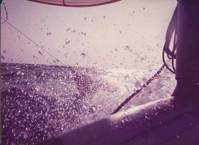
 [Day 5 leg 3.] Sunset came, and as darkness settled the twinkling of beach community lights commenced. We had not planned for night time sailing, though had no thoughts of stopping with such a homeward bound wind. The familiar lights of navigation buoys led the way into Masonboro Inlet and the security of the Banks Channel around 10PM. Having come full circle on this coastal adventure, I was prepared to leave the coast, though knew at some future point I would return for good.
[Author’s note: I found a handwritten draft of this tale after my return from Ocracoke in May of 2015, packed away in a box also containing charts used for the sail, It was untitled and unfinished. I was tempted to publish as-is in draft form, but my editing self would not allow it. The photos are scanned prints from 1977, and were all taken by my friend Rusty Davies.]
Love the trip back in time – oh, the wonderful days when we were in grad school!
Yes, it was from another era, for sure.
What an adventure! Wish I had discovered the outdoors & the water in ’77 instead of ’10. But now I’m trying to make up for lost time, where I can. Won’t ever be able to replicate some of your adventures, but I can live vicariously through your experiences! See ya on Bulls Island soon!
Never to late to get out there. Lots of adventures and hiking await you.
Loved seeing the photos of a dashing young(er) Raynor! Also neat to read about the Wrightsville area as well, my old stomping ground. We’ve camped on Masonboro. Its magnificent!
Masonboro Island was a treasure back then, and still is. But the barrier islands to the north – Shackleford, Core, Portsmouth, Ocracoke, Hatteras are really special. That will be a great adventure for your family in the near future.