The tide was high Sunday morning February 20 when I arrived at the landing. The wind whipped down the Intracoastal Waterway from the northeast. It had been so long since my last trip out on the water (Jan. 1), and today was a window of opportunity for making a Bull Island trip. But the wind gave me pause. I had been recovering from sinus surgery, at an unexpected snail’s pace, and had just gotten back to work full time in the past week. I had felt a resurgence of health the previous day at work, finding myself climbing stairs two at a time. Perhaps it was the pop of spring (or the pre-pop). But I wondered in viewing the conditions if I was up for it: sailing out Andersonville Creek, against the surely challenging bay wind and waves, and landing on the Northeast Point. I wanted to take a walk for a couple of hours on the island, and return prior to the low tide. More importantly, I desired to continue an annual tradition of a Bull Island adventure in mid-February.
After launching, I raised up Kingfisher‘s sail, and took care with the wind filling it at the dock. Turning around after the halyard was secure, I saw my paddle floating to leeward toward the other pier. I got off on the dock and started to run around to intercept this essential piece of gear, but it had already passed under and beyond the pier. With adrenaline kicked in, I cast off and jumped on Kingfisher, dropping the daggerboard in the slot, trimming sail, and grabbing the helm, but had no steerage since the rudder was still kicked up. Pushing it down quickly, I almost became entangled with the pier, but after a quick trim we squeezed by within inches. I bore off quickly sailing around the pier before jibing and heading toward the marsh to cut off the paddle before it floated into the grass. This classic man-overboard drill was successful with a rescued paddle, and a quick tack headed us across the waterway toward the passage to the bay.
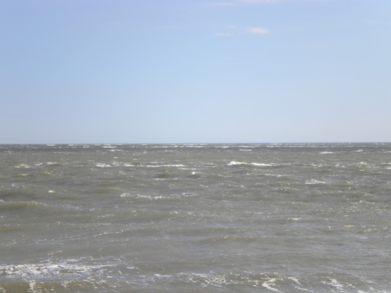
The first long section of the creek required tacking several times to the southwest side in order to avoid a submerged oyster rock. As the creek turned to the south no more tacks were required to make our entrance to Bulls Bay. As anticipated, the wind was a steady 20 knots from the northeast, and the bay had some wave action. I had earlier thought I could turn here if I wanted a more protected sail to the island, taking the ferry route, but with a flattened sail I seemed to be holding my own initially as I ventured out close hauled on the port tack. The nagging question from earlier subsided. The bay said hello – several waves splashed over me, dousing my head. In the distance I saw my first boat of the day, coming across from the Northeast Point. This crabber was throwing sheets of water off his bow, and we waved in the passing. Close underneath my lee, he yelled “Awfully rough out there!”, and I acknowledged the heads-up with a raised fist.
It was a long port tack toward the island, though I made several hitches over to stay in the channel, which provided the beginning push of the outgoing tide. Another wave gave a mighty splash, and the water coursing down my back inside the rain gear stimulated a moment of laughter. My course pointed to the center of the marsh by the Jacks Creek dike, and we held it as as far as the water depth would allow. Back on the starboard tack, we enjoyed a little bit of smooth water until finding the Bull Creek channel and its lumping waves. We blasted along on the approach to the beach on the port tack. I got the daggerboard out completely and surfed onto the sand with a crunch, stepping out into very soft wet sand up to my ankles. Securing Kingfisher, I found myself quite wet despite my rain gear – a soaked butt.
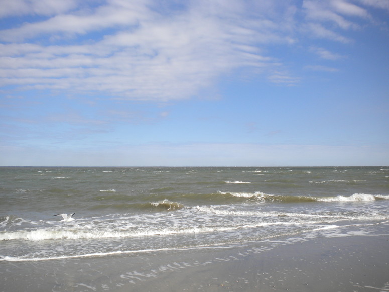
I walked around the point toward the eastern shore, intent on examining the path into the maritime forest where the road connected the former lighthouse with the rest of the island. The light long ago disappeared into the Atlantic Ocean, going out of service at the end of the nineteenth century and not being rebuilt. It marked the southern end of Bulls Bay. It warned mariners of the treacherous shoals offshore – Bull Breakers, still identified on marine charts. I climbed up on the highest dune around the point to photograph as best I could the waters leading out to these breakers, and the whipping northeast wind added some vibration captured in this image.
The lighthouse was built of brick and had a tower built on top for the light. As the following historic photo shows, the building was located in the dunes. The US government purchased the ten acre plot of land from Charles Jugnot ($200!). That ten acres disappeared long ago – this end of the island continues to be most dynamic. The dunes and beach have changed since my last walk here with the winter northeasters. The walk from the beach into the forest road falls into a list of dramatic transitions from one ecosystem to another on the island.
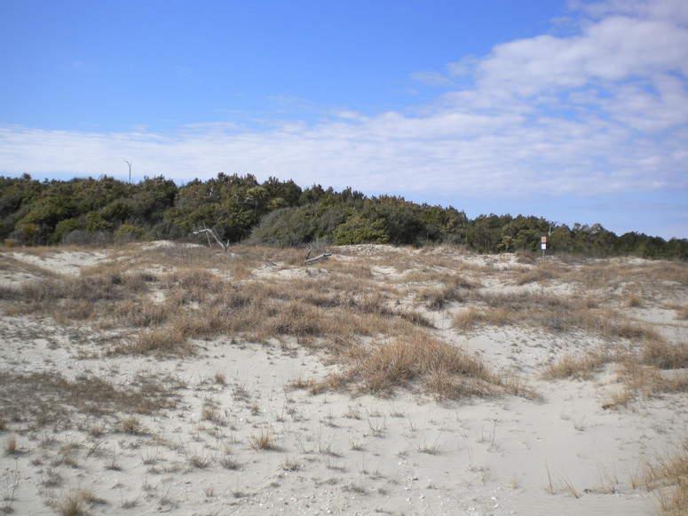
Fresh pine straw dressed the forest road, the beginning of the Lighthouse Road which runs all the way south to the intersection with the Beach Road. Not just an ecosystem change, there was a feeling of warmth in the pine, palmetto and live oak forest, sheltered from the wind. It was a short walk to the intersection taking one to the Lighthouse Road (left turn), or the Old Fort Road (right).
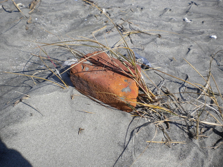
And left it was, walking along the eastern dike of Jacks Creek. The very high tide from the morning was still submerging the marsh between the ocean strand, mostly devoid of sand dunes, and the dike. I followed this road until the dike spilled out onto the beach, punctuated with protruding roots and stumps. I was not sure if I would be able to get around the remains of high ground filled with tangled dead trees and shrubs, but two hours of outgoing tide allowed this walk without problem (no wading required). Chunks of brick, most likely remnants of the lighthouse foundation, appeared along this section of beach.
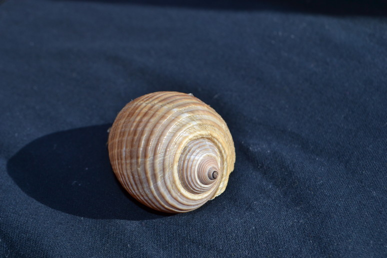
One small clump of maritime forest sat alone up the strand, with only several cedars still clinging to life among the other dead trees and shrubs. An array of shells littered the high tide line, but besides the usual ones a number of tuns appeared, a delicate brown shell.
This walk required wading across one tidal creek, but a shelf of marsh sediments made it little more than ankle deep in water not too cold for my bare feet. Beyond, a number of large herring gulls stood out on a section of exposed beach near the water. Rounding the point, I was surprised to see what appeared to be several people on the strand in the distance. It would have been a tough landing or anchorage in these conditions, but these were no motor boaters – their kayaks were already up high on the beach. These two upstate kayakers had come from Garris Landing, and followed my course out Andersonville Creek across the bay.
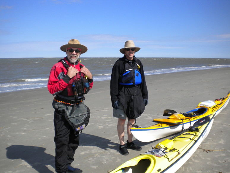
I was impressed: they were humble, and well outfitted with boats and gear for these winter waters. They were obviously very competent paddlers. We compared notes on our crossings before I took my leave to make the return sail. They would not make their return paddle until the tide changed after 3.
The wind and the waves had not moderated, and I expected an exciting sail downwind. It was also half tide, and the full running outgoing tide opposed to the seas created waves lumped up and pushed close together. Kingfisher planed and surfed along, and steady attention was necessary. I’m not sure where my focus wandered, but I found Kingfisher‘s bow plowing underneath a wave, and continuing down as if toward the bottom of the bay. I finally shook it out, but not until the cockpit was half full of water. Getting the plug out of the bailer, I got most of the water out before surfing through the final waves heading into the mouth of Andersonville Creek. Despite the strong falling tide, we made a fine passage and landed well before the low tide.