It was not my usual Bull Island experience of sailing Kingfisher and walking solo around the island. On this Saturday I rode over on Island Cat and walked with a group of twenty people, in fact leading this group on a guided walk.
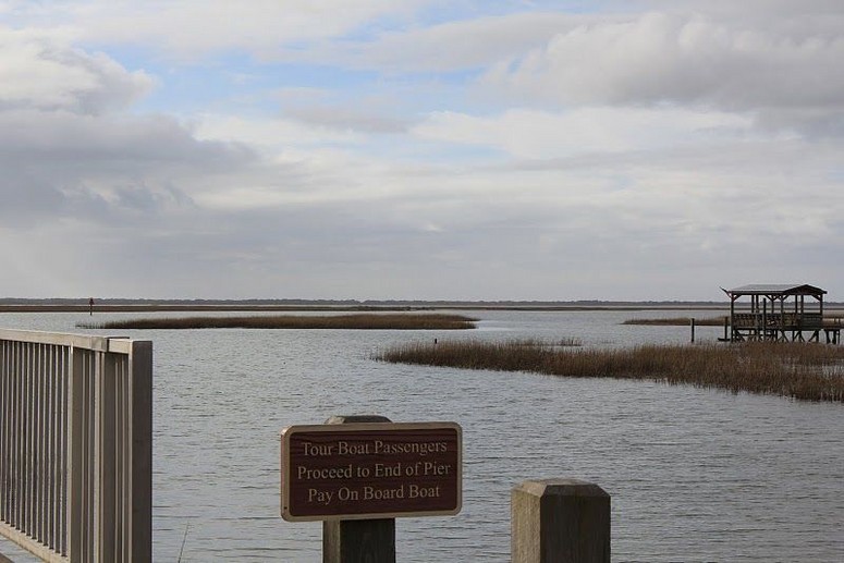
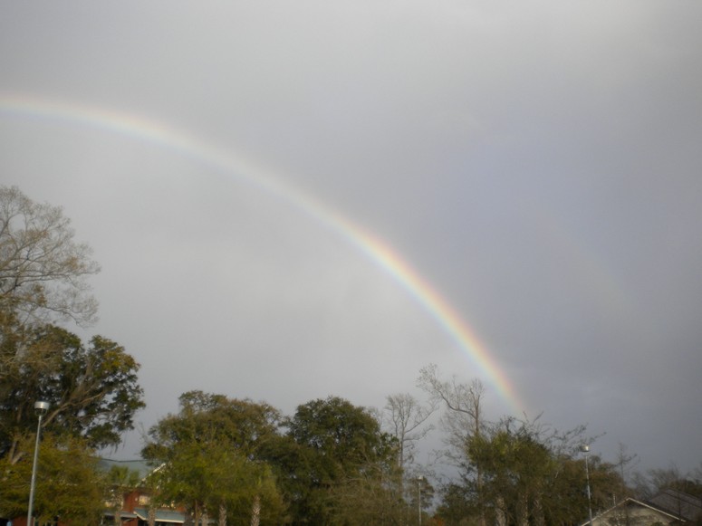
The ferry carried over 38 people that morning. Captain Will Christenson was at the helm, and Weatherly Meadors provided the naturalist interpretation as we headed out through the marsh. The Will and Weatherly show was as usual personable, knowledgeable, and enthusiastic. Weatherly’s estuarine talk was preempted by a stray intruding shower, wetting the passengers on the starboard rail. It was brief: would we be graced with a rainbow? Most emphatically – the bright end burned into the mainland, and struck my neighborhood of Romain Retreat.
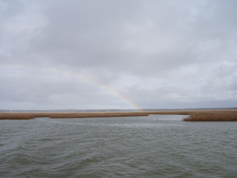
(Photo credit Ronnie Hucks).
While I recalled the old adage “Rainbow in the morning, sailor take warning.”, it seemed that this stunning, transitory phenomenon was a sign. The trip had already exceeded expectations.
After disembarking, I collected my group from the other island visitors. Included were some natives from other parts of the world: Norbert from Germany, Maryanne from South Africa, and Alistair from New Zealand. I deputized a young man, Joshua Hall, to capture some of the images to share with others. (All but the two rainbow photos in this post are his fine work). I had planned a seven mile walk, and besides the usual hot spots of the island I would take the group to some less visited places.
At the Dominick House, we considered the last private owner of the island, Gayer Dominick, and his directing the building of his winter retreat, along with some of the fresh water impoundments.
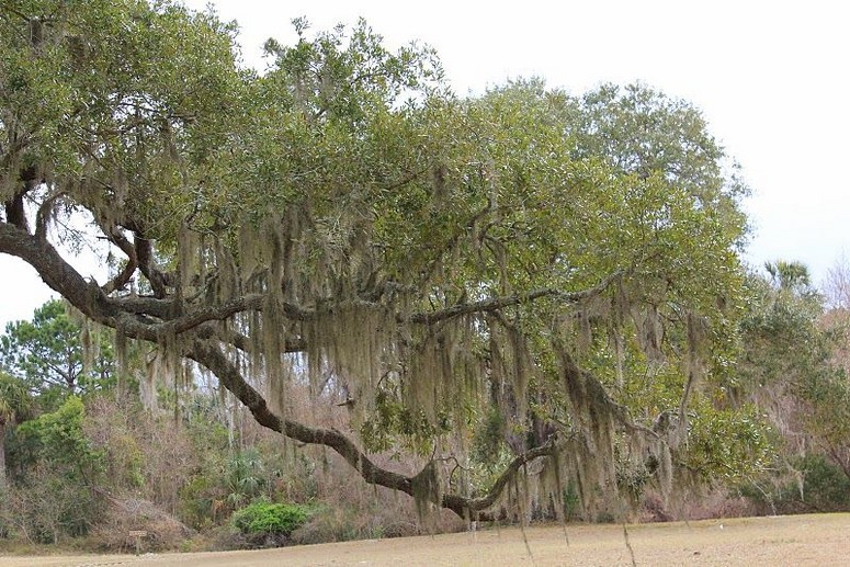
The large live oaks by the house provided an appropriate setting to explore the history of live oaking. A short walk down Beach Road brought us to the graveyard, and the opportunity to discuss a Lowcountry family who formerly lived on the island, the Magwoods.
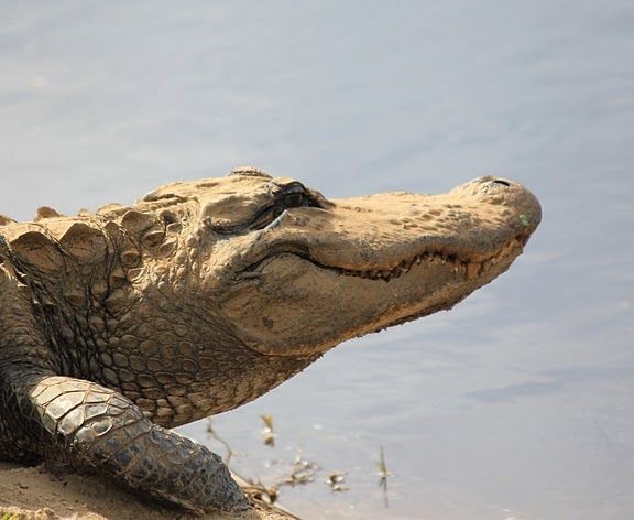
As many visitors to the island do, we headed north toward Alligator Alley. The access to Big Pond Road was blocked due to the major construction project on the island replacing water control structures, and we were to see evidence of this work in many places. Alligator Alley did not disappoint when we arrived, since there was a nice array of alligators in Pool #2 and along the sloping bank of the dike.
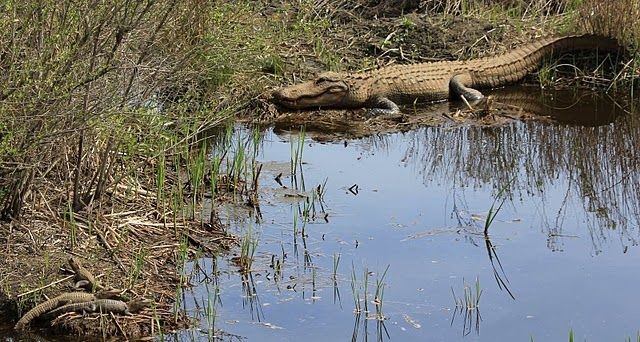
Several in the group wondered about alligators and safety, and I advised caution, some distance, and respect. A couple arrived after us, and our group noticed that they moved in quite close for photos. An interesting article in National Geographic in March 2011 looked at the hypothesis that alligators might once have had feathers.
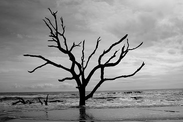
Between Pool #2 and #3 a grove of Chinese tallow trees prompted a discussion of invasive species in the refuge. Paul wondered why this was not a “natural” process, and we talked about the introduction of this Asiatic species. The west side of Pool #3 had a wall of these trees. We stopped off at the mound next to a pool off of Jacks Creek to look for alligators, and though one we spotted dwarfed all we have previously seen on this trip, it still did not rival the legendary Alligatorzilla. Beyond I led our merry band on my favorite path for entering the Boneyard, a live oak covered trail. I had prepared the group for coming into this magical place, and the responses of the group were wonderful to observe.
After our lunch break, and taking a page out of Chris Crolley’s interpretive playbook, I built a couple of barrier island models made of sand and sticks to show some coastal dynamics. Gathering the group in a little amphitheater of bleached logs, I recalled the Sewees and their tragic trading voyage attempting to cross the Atlantic. I prepared the group for the next leg of our trip up the eastern shore, including the wading of a tidal creek. Along the way on this outdoor adventure, we had begun the process of bonding in walking these miles together and sharing these experiences.
Around the curve of the Boneyard we finally viewed the vista to the north. Low tide exposed plenty: root systems of remnant trees, marsh sediments, shells, brick rubble, and three recently operational crab traps. In fact two of these traps had a dozen crabs a piece, and half of the crabs in one were alive.
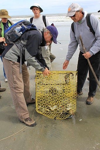
Jeff opened up this trap to liberate these mainly blue crabs, but one stone crab held on with its huge claw for dear life while Jeff worked to extricate it, finally with one claw still locked on to the mesh. One sharp observer in our group, Rick, picked out both of the Cape Romain lighthouses in the distance, and others in the group shared their binoculars so all could see.
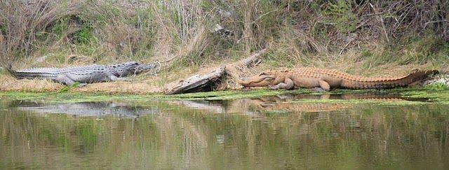
The barrier of the shallow tidal creek cutting across the beach did not stop any of our group from wading to the other side. At the site of the old dike backed up by a new one gradually being threatened by the sea, I discussed what Hurricane Hugo had done to Jacks Creek, and what future decisions will need to be made about the eventual destruction of the backup dike. Putting back on shoes to guard against sand spurs, we climbed up the scarp on to the dike and headed back down the road along Jacks Creek. A great blue heron flying off reminded me of a conversation earlier with our South African native, Maryanne. I had asked her about the giant heron in her land, and we both were not able to come up with that name. She recalled later – the goliath heron, standing up to five feet tall. Though I would like to see this great bird, our common great blue should not be taken for granted. Jacks Creek gave us a nice view of gators with opposing colors: one with the typical black, and the other of copper, most likely from the mud in the impoundment.
We stepped down the scarp at the Boneyard and began our walk around the the side of this curved point south toward the Beach Road. It was low tide, and the beach widened beyond the Boneyard. We began to see the first signs of a typical beach front with dunes, growing as we proceeded further south. We made it to the Beach Road a bit ahead of schedule, and on this last leg our group split: the party of six in a private boat left to head back, half of the remaining group went down the Beach Road toward the picnic area, and the other half added another mile by committing to the Turkey Walk trail. This same group squeezed even more out of their day by making the walk down to the Dave Clough Wildlife Platform and back.
Our ride back to the mainland saw Weatherly now at the helm, and Will working the collection table, engaging enthusiastically the group in interpreting the remains of seashore animals. In talking about the found crab traps, Will discussed how derelict traps became death traps for many animals.
Back to mainland reality, I traveled to my local Publix to pick up some items. A brief shower hit just before my arrival at the store, and once again I looked to find another rainbow, this time at the end of my day.
It was worth hanging around in the parking lot for its short existence. As a coda, on the way back north, another rainbow dropped into the land ahead, pointing toward my beloved Awendaw.