The final leg to Cataloochee Valley from outside Great Smoky Mountains National Park presented a challenging drive up Cove Creek Road, demanding an unwavering focus, faith, and resistance to the impulse of peering off the edge. Following the descent after the Cataloochee Divide, and again finding pavement, I checked in with the campground host and found our long reserved campsite located on Cataloochee Creek.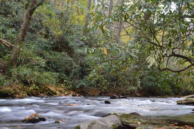 My friends Mike Phillips (NC) and Jim Smolen (PA) arrived soon thereafter, and we quickly set up camp for the next three days and nights. A trail awaited us that afternoon, and we set off around 2 for the Boogerman loop.
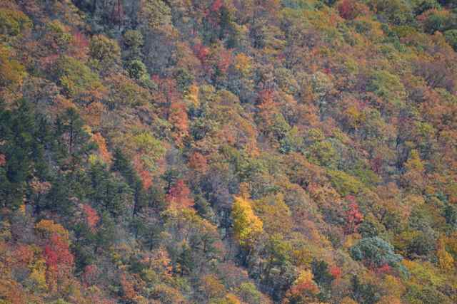
We had traveled this path before, and recalled with laughter our Cataloochee Crossing the previous spring. We had learned that the absent bridge had been replaced, and we easily traversed what had been a rigorous but memorable adventure. Not long up the trail we still had to shed our shoes to cross another creek, Caldwell Fork. Some of the parts of the trail were familiar, a memorable huge tulip poplar standing out, but most of the views were transformed by the fall foliage color. 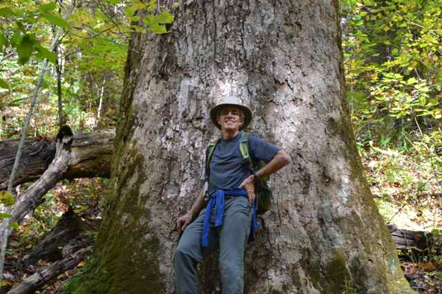 It had been predicted that the peak color would be this weekend at mid-elevation, and the projection appeared correct. Of many stands of tree foliage standing out the sourwood’s reds were glorious.
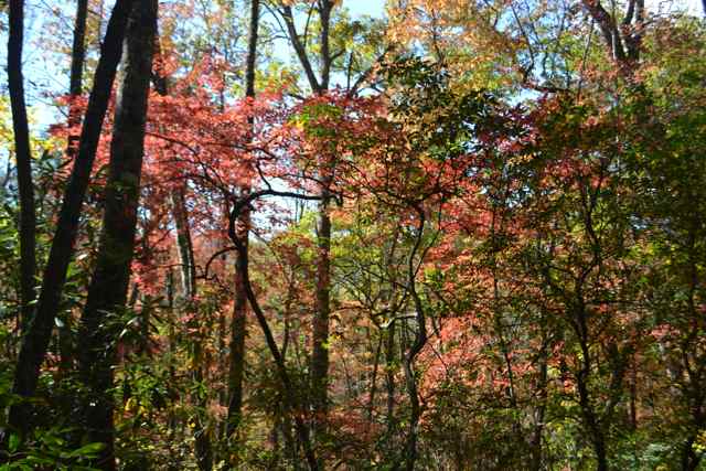 This trail has attracted hikers due to the many old growth trees escaping the lumbermen’s saws before the Park was founded, and we continued to be astounded by these giants. Mike noticed that Jim in the lead had stepped on a snake, easily overlooked due to the leaf covering, but no harm was done to the northern water snake (non-venomouus) or Jim.
 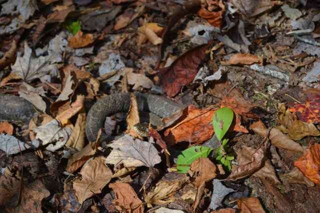 We rediscovered upstream a path over a creek with another washed-out bridge: a downed tree six feet above the water and rocks, creating an alternative bridge and inviting us to utilize our balancing skills.
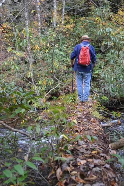
Before returning to our base camp, we drove out into the valley just around the corner from the trailhead and found elk in the fields. For the next three days whenever passing through the valley we would see elk at this special time for them – the rut. 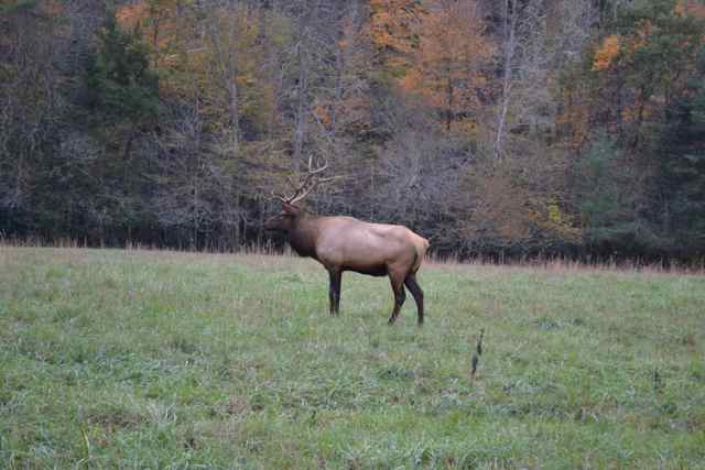
 At camp that evening we enjoyed a spicy gumbo around our campfire taking the edge off a chilly night.
 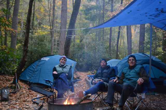 The steady sound of the running creek twenty yards from our site was joined by a rising wind dropping leaves and pine needles onto our tarp and tent flies, and approximating the sound of rain. The real precipitation came a little later, but was quite light and not at all resembling the deluge of over six inches in a few hours earlier in the week in the Smokies.
*****
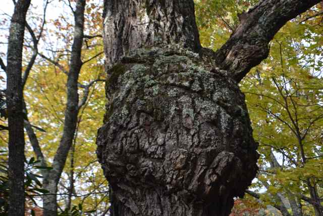
We dropped off one vehicle at the west end of the valley and drove on the road toward the Mountain Sterling trailhead. Along the way, I had Jim stop in order to view a huge tree burl.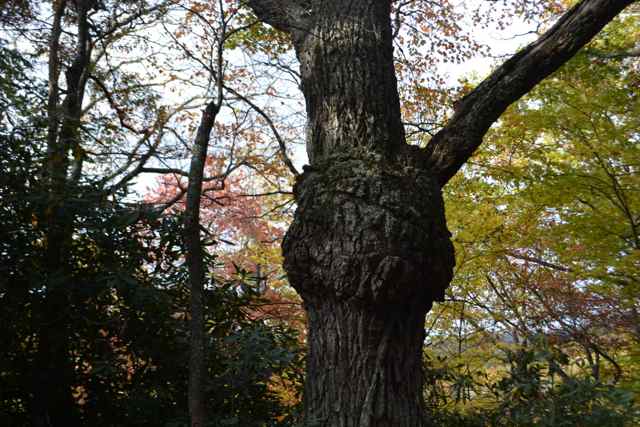
 Overcast skies continued from the previous night, but a couple of shafts of sunlight shone on a ridge to the northwest, a sign of the clearing to come. Cars were already at the trailhead, though we found that a couple had sought shelter from the cold night, sleeping in their car and even turning on the car heater at times. Mike recounted to us a trip to the backcountry campsite years ago on the top of Mount Sterling with his wife and two young sons when they endured a night dropping into the teens. It was cool when we started up the trail, and as anticipated it warmed with the sky clearing to a deep mountain blue. We chatted with hikers coming down from the camp, and learned of their cold night and the presence of ice on trees at the higher elevation we climbed toward.
  We experienced the transition into evergreens before arriving at the Mount Sterling Ridge Trail, part of the 300 mile long Benton MacKaye Trail. A short walk through a dripping forest of ice melt took us to the summit capped by the prominent fire tower.
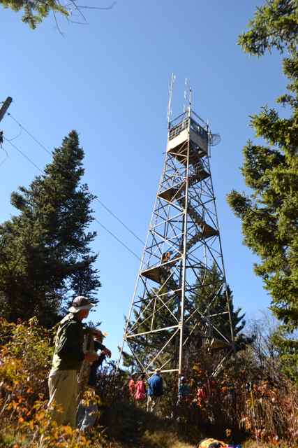
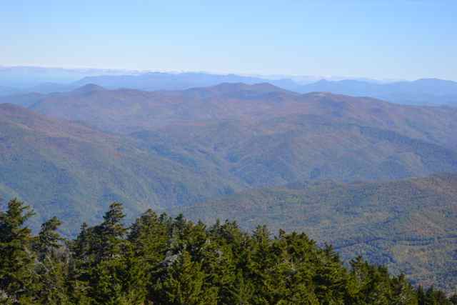
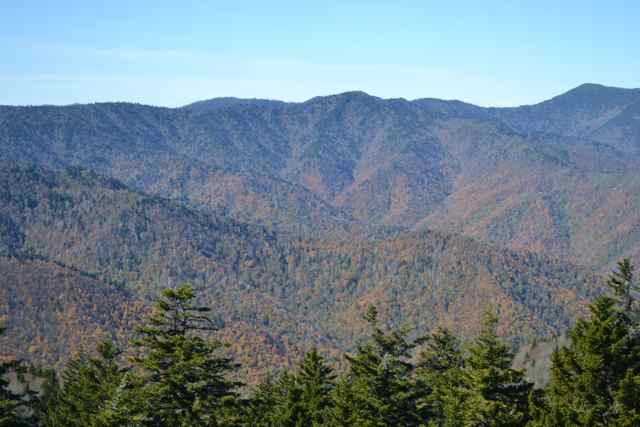
The mountain top was most welcoming: the sun was shining bright without a cloud in the sky, and not a breeze stirred the trees. We spoke with a photographer from Maryland who was preparing his 35mm equipment and waiting for some of the ice to burn off the tower before making the climb. He also encouraged us to wait until the others came down, since the tower climb was narrow and the viewing area would allow only three people at most. I was surprised that accessing the tower was still available to the public, since it required an act of faith to ascend this old and shaky structure. In fact, several people making the climb later stopped at the first landing, and having had enough of this vertigo-inducing structure came back down.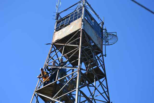 The climb was well worth it, with 360 degree views through the small windows at the top, and I used my time at that perch to capturing images of this spectacular day in the fall Smokies. The ridge to the west marked the Appalachian Trail, Mount Guyot appearing to stand tallest from our perspective.
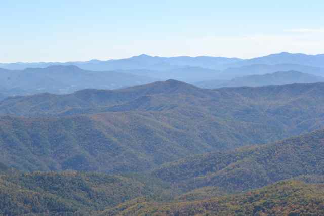
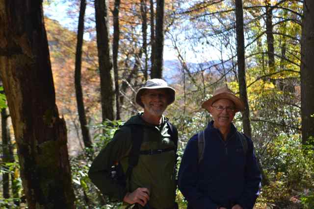
After our descent, we chatted with a large party of hikers who had camped the previous night at Big Creek, and were awaiting their turn in the tower. This group was all from the triangle area of North Carolina, and we chatted about Carrboro, Chapel Hill, Durham, and our Smokies experiences. Mike, Jim, and I had became friends during out UNC days. We had the good fortune to resume our friendships more substantially a few years ago, and our annual camping and hiking trips have sustained our camaraderie. We have all worked on staying fit in our sixties: this fitness has allowed us to remain active, and hang with each other on these hikes. Mike shared with us his commitment and plan to hike the entire Pacific Coast Trail. This was no pie-in-the-sky fantasy for him: having done five weeks several years ago as a precursor, he was ready and gearing up to do the full 2,700 miles as a thru-hiker over five months.
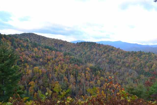
We began our walk back to Cataloochee heading southwest on Benton MacKaye until Pretty Hollow Gap, running into a couple of hiking parties coming up from Walnut Bottoms campsite toward Mount Sterling. We turned off at the gap on the Pretty Hollow Gap Trail, and soon found ourselves for the next four miles all by ourselves, a possibility always present in the Park even at the most crowded times when one walks away from attractions and roads. Moving into mid-elevations we passed through waves of colors: on ridges nearby, and above and around us. We stopped just to look and listen, and genuinely smile for our shared experience.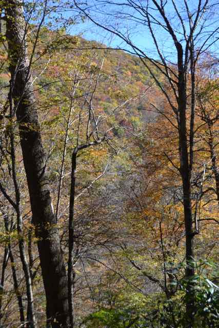
This walk along ridges and through gaps reminded me of a trip with a good friend, Alan Held, in the Park over forty years ago. Alan, an old sailing and river rat buddy from the Navesink, had helped me along with my father in cutting and erecting the frame for my post and beam house. 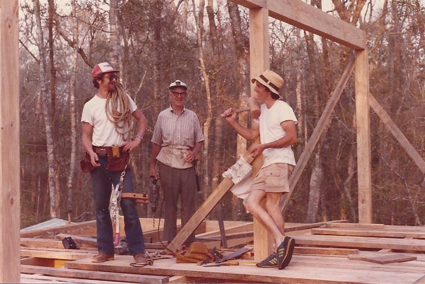
Awendaw notchers mugging for the camera: Alan at left, my father, and I.
We left my ’65 Impala at the trailhead to Noland Divide off of Clingman’s Dome Road, and began a several day backpacking adventure that October. This backcountry trip allowed us for the first time to see the Smokies the way it should be experienced, and we saw only one person during our hike. Though my 36 years of working in inpatient psychiatry in retrospect might give me some insight into his malady, at the time we just saw him as a “lost soul”. He had set up the backcountry campsite as his base, and each day he pulled from his duffel bag 3 cans of food – one for each meal (I believe he started with 30 cans). We shared our dinner the night of our stay at that campsite, extending his stay for one meal. Alan taught me a old camping trick about staying warm in a marginal sleeping bag – take a rock from the campfire, wrap it in a towel, and put it in the foot of the bag. I recalled when we walked out the Mingus Mill Trail, and returned to civilization – a gridlock of cars on Hwy. 441 in the throes of phenomenon of “leafers” – we giggled at the spectacle after our wilderness experience.
Completing our hike after joining the Palmer Creek Trail, we also ran into crowds on this Sunday afternoon. We had parked near the trailhead, and found cars filling the road heading across a one lane bridge into the upper part of the valley. A Park service employee was valiantly attempting to direct traffic. Asking her what was going on, she replied “There are too many cars in the Valley!” We obliged her by extricating ourselves from the auto scrum and heading back to the campground.
*****
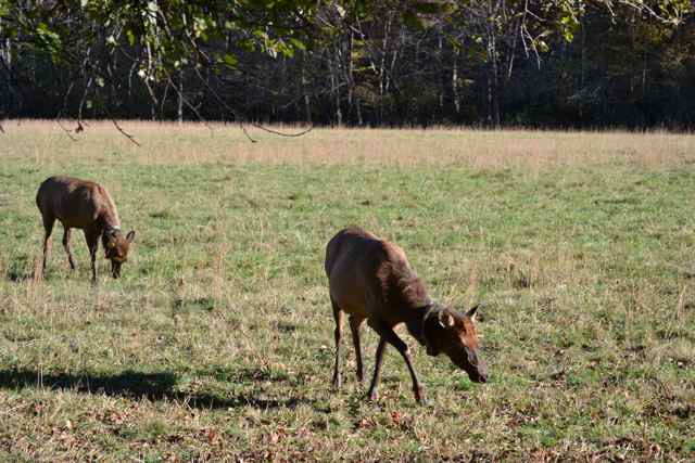
Our final day hike was planned the night before. We probably knew the least about this hike except what the map told us: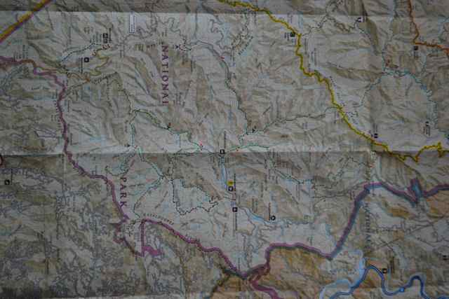 up Big Fork Ridge Trail, southwest on Caldwell Fork Trail, and return to trailhead via Rough Fork Trail. We had neither hiked any portion of the loop, nor had any word-of-mouth or written guide knowledge. It was a quieter day in the valley on this Monday morning. We drove to the end of the valley, and crossed the one lane bridge over the creek to another set of open fields. Elk were present, and accompanying them were a cadre of photographers, here for this Cataloochee convergence of elk rut and autumnal leaf brilliance. Although we had seen many people taking photos with mobile phones, the group already assembled as we drove by were equipped with long lenses, tripods, some camouflage clothing, and serious intent.
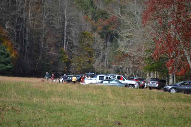
Our hike covered over ten miles in the southeastern corner of the Park, and as we anticipated we did not see anyone until the last section. We knew we would pass two backcountry campsites, and expected to see mainly newer growth forest, but were surprised when many giants arose around us. A sign “Big Poplars” led to a pretty stop for lunch where one ancient poplar held court. Mike continued to tell us about some of the challenges of the Pacific Crest Trail, including finding and carrying enough water for a desert crossing, and a high mountain pass requiring the purchase of an ice ax for a safe passage.
After a long descent on the Rough Fork Trail, we arrived at a structure on our map, the Woody House. It was a frame rather than a log house, and represented one of the 1000 buildings listed when the Park was founded.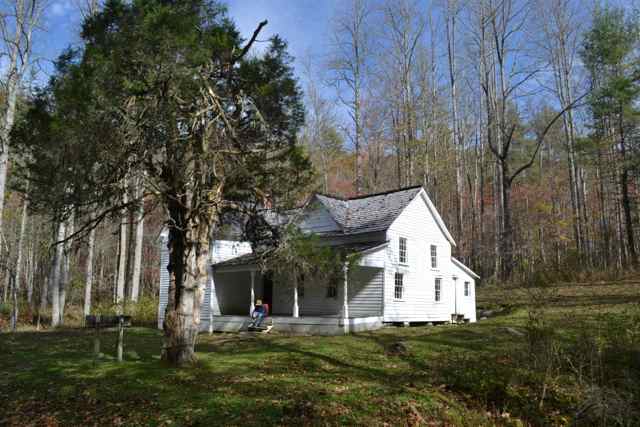 A sign before the entrance encouraged visitors to respect the history of the building and not deface it. Unfortunately that was not the case – many walls inside were covered with graffiti. That vandalism, along with a general disrepair of the building, left me sad as I stepped back outside. It was a different sadness than the viewing of dead hemlocks throughout our hikes in the Park, a quite different form of loss.
 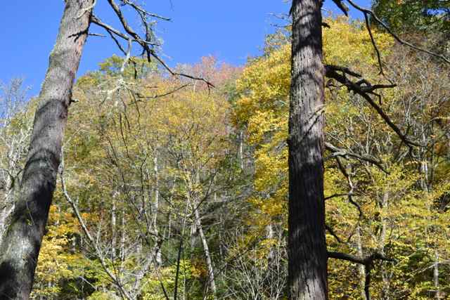 After returning home the same helpless feeling in response to the irresponsible and criminal acts of others returned when reading that the Palmer House in Cataloochee had several irreplaceable artifacts stolen from a display case. The damage to these buildings in the Park, a national treasure, felt personal.
On the last flat stretch on the trail that was now road-like, we ran into two parties of college students walking with instructors from the forestry program at Haywood Community College. As we came upon each separate group, the instructors were working on tree identification, and had independently picked a Carolina silverbell for the subject, particularly noting the distinctive bark that some call it the “Hershey tree” for the pattern on the candy bar. I recalled seeing its flowers littering the trail back in May, and the knowledge continued my quest to know this primeval and diverse forest community more deeply.
*****
We broke camp early the next morning to head our separate ways, and Jim got an early start on his drive to Pennsylvania. On my way out I pulled over on an overlook on the Park road for one last look out into the valley and ridge beyond. Driving out I saw a photographer walking with his equipment to a trail on the overlook, and I stopped to see the view. Despite my desire to get on the road, the views were so stunning that I returned to my truck to dig out my camera and tripod. There was the signature smokiness around Mount Sterling, and I did my best to capture it. And of course there were the fall colors that I had soaked up for three days.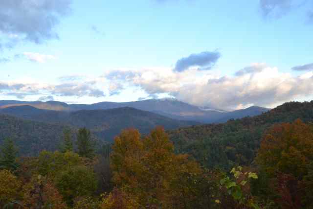
 Arriving back in the Lowcountry I was aware of my home area’s own colors. Ibises at the landing displayed their varied colorings.
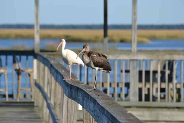 Both in the wild and in planted landscapes the blush of sweetgrass shone a beautiful pink hue.
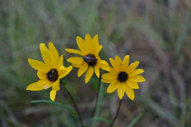
 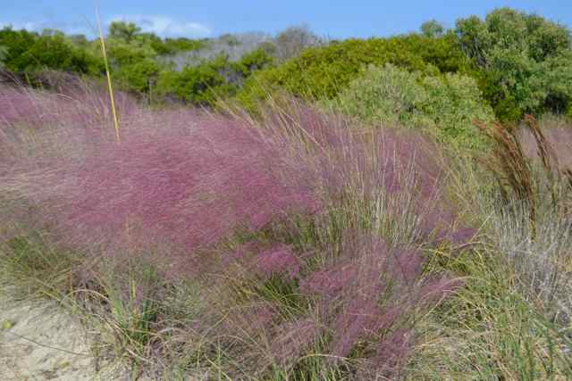 Goldenrod and narrowleaf sunflowers ran riot in rural roadsides.
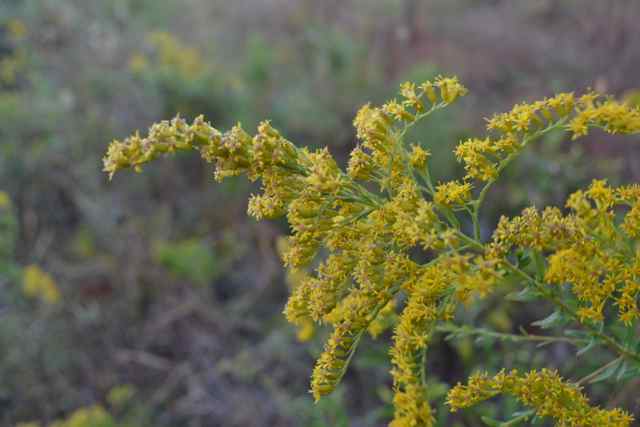
 Those colors were reflected in the fall transformation of salt marsh to gold, a sight I sought upon my return.
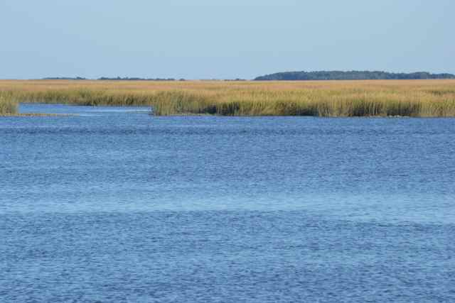
Great post, Bob!
Great hike plan for Pacific Crest Trail, Mike. I’ll be there with you in spirit.
Thanks for sharing Bob – it was well worth the wait between posts!
Thanks for your patience.
Awe inspiring photos, you traveled vicariously for me this fall in my favorite mountains, Bob
Lots of awe in the Smokies.
Enjoyed the post! Beautiful photos-thanks!
Love, love your post. My husband and I have always wanted to hike to Mt Sterling but it seemed something else in the smokies always attracted us away from our plan. I will share this post with him. Very well written, informative and interesting!
So many miles of trails (800), so many places in the Park. Fall foliage, spring bloom, winter snow – many adventures awaiting us all.
Wonderful post and pictures! It looks like y’all had a great time. I especially enjoyed the 1960’s Awendaw picture – too cool!
Glad you enjoyed it. The date on the Awendaw picture was actually early 1980’s, I believe a few years before you and Eliot were kicking around the neighborhood.