Loaded on Caretta, our group of twenty-seven hardy souls began our cruise south toward the drop on the southern tip of Bull Island. It was a cooler morning than some of our group anticipated. We gave a cold morning benchmark that our captain Chris Crolley and participant Gary Weart had experienced on the pre-dawn boat ride for the January sunrise photography expedition – a nine degree morn. (Mr. Weart, whom I met on the island in November, agreed to be deputized as photographer for this day, and the following photos are courtesy of Gary.) With the aid of the moon’s influence and a solid northeast wind, we had a significant high tide. Captain Chris was solo in taking us to our destination, and I took the wheel so he could speak about the estuary, barrier island, wildlife, and history we were entering. I joked with the group about the very high water and how badly I would have to be off course to run aground. As we turned into Prices Creek heading out toward the inlet, I found the marsh covered up on the creek banks, and my navigation joke became serious. The floats of crab pots helped as guides.
Neither Chris nor I had previously seen the water higher at this southern edge of the refuge. It was new territory for the landing, as the waves in the inlet came into play at our landing spot. Chris got help from me and one of our group, the retired fishing guide Richard Stuhr, to set out the gangplank. Seeing the waves pushing up the beach past the gangplank, I alerted the group to prepare for wet feet, and many decided to take off shoes and socks for the beach plunge.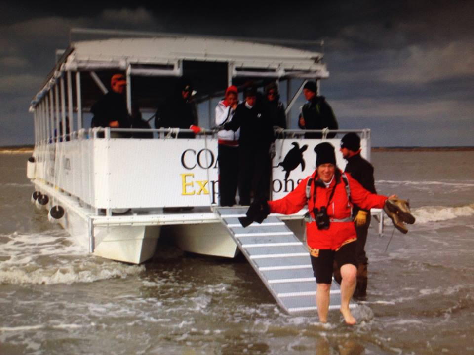
All photos courtesy Gary Weart.
It was a most tricky beach drop, and with the tide rolling out and waves pushing Caretta the possibility of her stranding on the shore was palpable. Yet with a bravura solo performance our captain pulled the gangplank aboard and by astute handling of his craft backed her off into deep water, to the applause and cheers of our group. Yet this was just act one for Chris Crolley, owner and CEO of Coastal Expeditions, in the fundraising effort. He had informed the group that not only would the proceeds from this trip go to the refuge’s turtle program, but would also be matched by Coastal Expeditions. It was clear that our group, and Cape Romain, had a great friend in Chris. So we were left high but not dry. Water seemed all around us, and the simple walk around the dunes of the point was blocked by the extraordinary high tide. The bank was also covered by deep yellow sea foam, and I found myself fielding several questions about the phenomenon.
 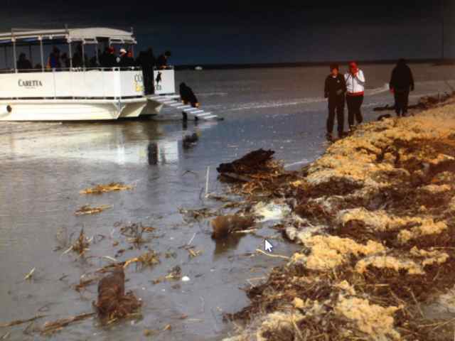 My answer was simplistic – I always associated the sea foam with heavy surf and wind. Yet I would find that there was more involved, since the foam was also the sign of an organic ingredient in the mix.
After exploring our place on the coast through looking south to the Isle of Palms condo towers, and projecting north on the long, undeveloped coast through Hobcaw Barony past Georgetown, we began our walk north, staying on a remnant narrow dune spine between the high Atlantic waters covering the beach and a water-filled dune field.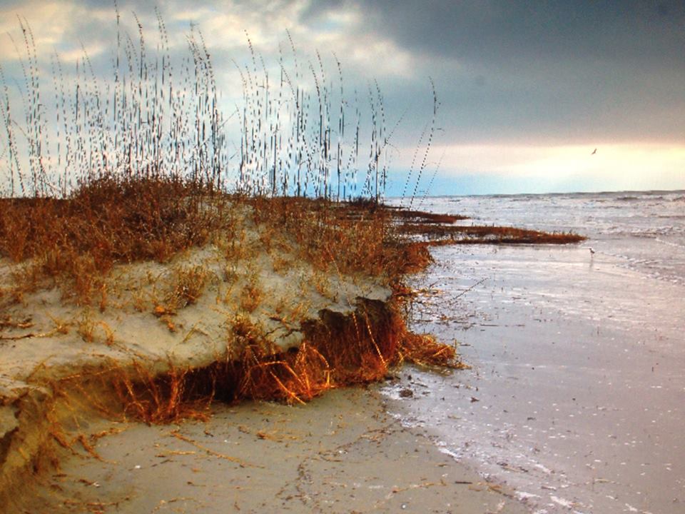 I wondered if we actually might be cut off ahead, and have a water feature to traverse before we made it to clear walking around the point. This was new ground for me – winter storms and this high tide had transformed the southern point. In stepping off to a flat on the backside of the dune, I instead went up to my calves in water, having mistaken the sea foam-covered water for sand. I used my role as “guide” to warn others away from also getting cold wet feet. Fortunately, there was no water feature ahead to cross, but out of necessity we continued our path on top of the primary dune spine with no beach yet exposed.
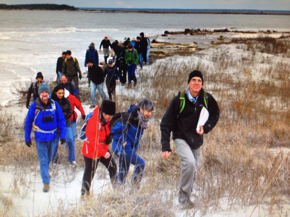 These dunes had been significantly eroded, and I cautioned our group to not get too close to the edge where a six-foot drop waited with the sand’s collapse. After traveling this ridge, I finally spotted room on the beach to walk, and we made our way down to the strand.
We walked north, stopping to view barrier island features and wildlife. Several of the group had wandered up to the high tide line, and found a carcass in decomposition. The jaws and skull made it an easy identification as a bottlenose dolphin.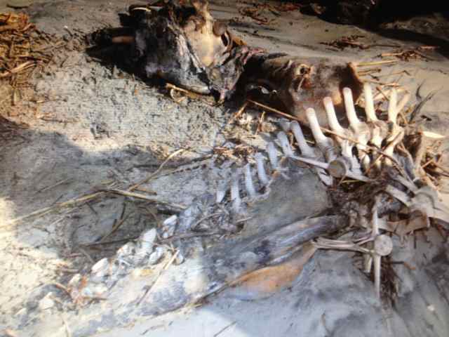
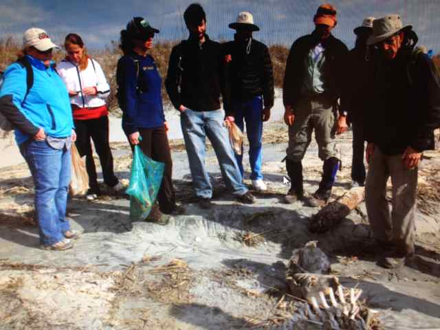 I commented on the brain size and its cognitive capacity, specifically its navigation abilities. After leaving this carcass, we soon passed the remains of a loggerhead turtle, its large carapace spread out on the sand. We had passed the last of the eroded primary dune front, and at the first breach in the dune ridge I found empty shells on the surface marking the remains of a loggerhead nest that had been “cooned” the previous season. It was a perfect venue to talk more about this marine reptile, and Cape Romain’s nest protection program. Several of the group inquired about volunteering.
We continued to reel in the Boneyard in our walk north, viewing the disappearing of the dunes and shrub zone, and meeting up with the maritime forest on the beach. Palmetto logs lined the high tide line for sections of the beach not previously seen by this beachcomber. It was the first time for many of our group to experience the Boneyard.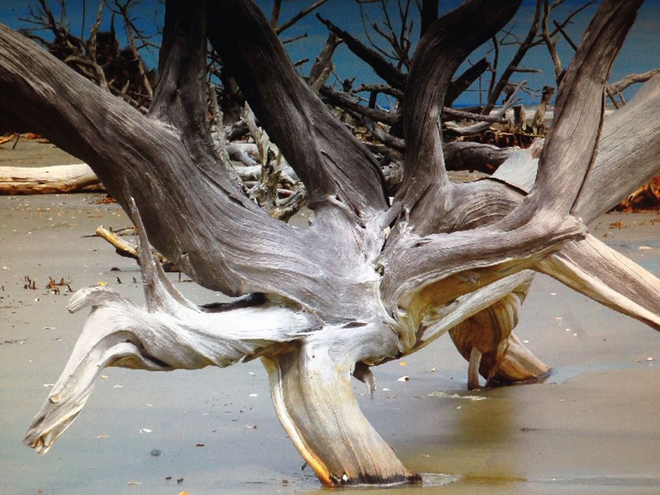
Before reaching our lunch destination, we ran into an obstacle. A tidal creek had cut through the beach, and water was racing through as an outpouring of the very high tide. Its source inland was a connection with Moccasin Pond, a natural island pond now infiltrated with salt water as an outcome of sea level rise. Working to avoid wading across, I led the group inland along the bank until we came to a log jam of horizontal trees providing a bridge across this water feature. After crossing myself, it appeared that for safety it would help to have spotters distributed to support each participant making the crossing. So we formed a human chain so all of our 27 group members could cross dry and unscathed. 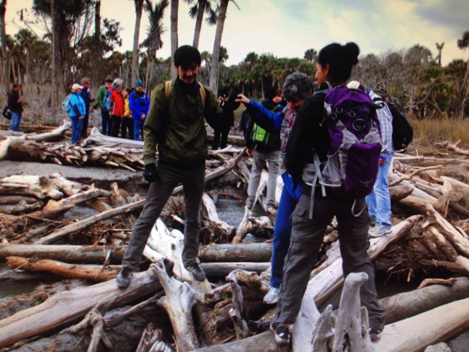 In the process I joked about our day being Down the Island and Back Again and More, and this was part of the More, adding to the surprises earlier experienced at the southern end of the island. It was also a reminder of the group therapy I do using problem solving, and this crossing was definitely an exercise in team building.
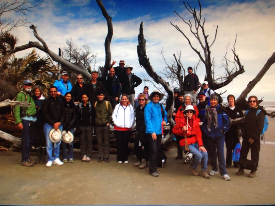
After lunch, rest, a few drops of rain, and some barrier island modeling in the sand, including a simulation of the severing of Cape Island, we headed north along the island’s eastern face and exposed beds of marsh sediments. We also found More, which I anticipated – another tidal creek without a natural bridge for a crossing. I modeled for the group pulling off shoes and socks, and wading across the shallowest spot. After the unsuccessful bridge-building effort of a small group, most everyone followed suit. I mentioned to someone that this was the last crossing, but though I had walked this same section two weeks before, I decided to keep this thought to myself. My son Eliot agreed to not announce, wondering if another surprise – some More – might bring on a mutiny.
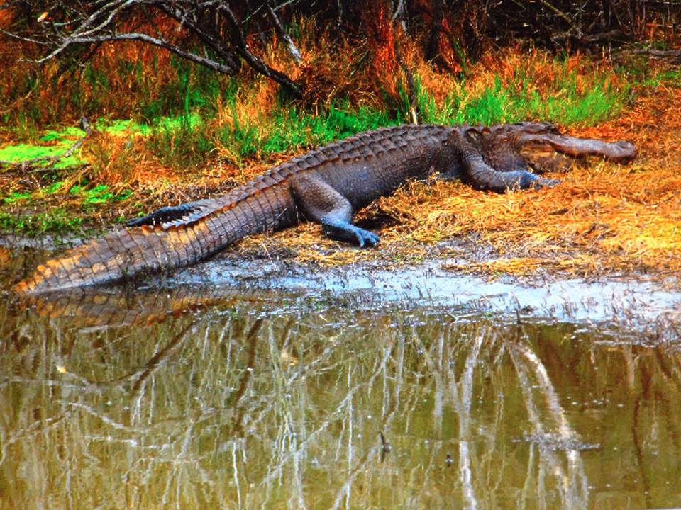
The gaping opening of the Jack’s Creek dike provided a stop to reflect on the impoundment’s construction, climate change, and the next breach of this dike. None of our group accepted the opportunity to rest here and shortcut the walk, and all forged on to our turn near the Northeast Point and the view out to Bulls Bay. We picked our way through the dune field, ending our long walk on the beach and beginning the transition into the maritime forest and impoundments of the island. The day remained overcast, but despite clouds, periods of drizzle, and cool temperatures, we still observed alligators swimming and basking along Jacks Creek, and beyond on Alligator Alley.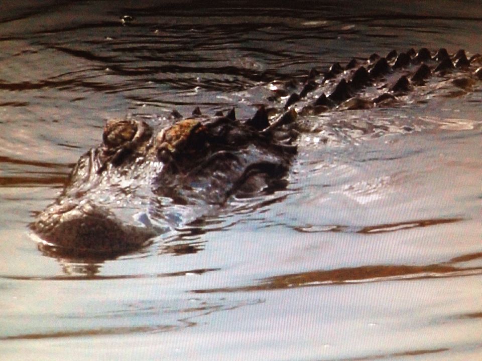
At Sheepshead Road, we turned south for the walk south to Beach Road. With time to spare, many of the group took the opportunity for a little extra walk to see and hear about more of the island’s history at the cemetery containing the graves of four members of the Magwood family. The sun came out for the last bit of our walk and embarking on Caretta for the ride back to the mainland. Captain Will piloted us to a dolphin pod by the deep hole at several creeks’ conjunction, and we slowed to watch the group feeding. We processed the day and chatted on the return. It was not until later that I recalled a quote by John Muir I meant to share with the group – not the only thing I had forgotten recently. I used the words on a walk in 2013, and its meaning rung true for this 2014 day: “In every walk with nature one receives far more than he seeks.”
Thank you Salty One for all that you do in stewardship of Cape Romain National Wildlife Refuge. Our beloved Cape Romain seems to be under attack due to current government policy producing an egregious lack of employees and funding. It is my hope that by creating connections with people through providing real experiences in Cape Romain we may inspire them to volunteer, lobby and otherwise support this refuge in these difficult times.
Respectfully,
Capt. Chris
Yes, it was a real experience, and one that inspired some new volunteers and Friends of Cape Romain. I am glad you mention the federal government erosion of support for the refuge – this was a talking point I missed with the group (sort of like the John Muir quote). We have lots to do in supporting this important area of our coast.
It was indeed an honor to be “deputized” as your photographer on our most “memorable” hike on Bull’s Bay. The feedback I heard was most positive and this experience was certainly educational, a bit challenging, and worth every minute.
Ecologist Eugene P. Odum (University of Georgia) defines “ecology” as “the totality of relationships.” Hikes to isolated areas like Bull’s Bay clearly show the dynamics of nature and help us realize that a multitude of factors impact this island constantly. In fact, the only thing that is constant there is change. One can only hope to grasp a small amount of understanding regarding the complexities of this amazing environment. However, I truly believe we all have a much greater appreciation for “Mother Nature” after having spent a day with Bob Raynor and the wonderful staff at Coastal Expeditions.
Finally, it was certainly a “win-win” for everyone concerned by supporting the sea turtles and sharing many wonderful moments in one of my most favorite locations on this planet. In fact, I am ready to go again to see just how much everything has changed in the past few weeks.
A dynamic day on a dynamic island. Fine job capturing the images to share with others, Gary. And definitely a win-win for all.
Are two remote lighthouses on your photographic agenda next?
WOW and what a pleasure to read! Bob, Chris and brave souls … you had a wonderful day on one of the most glorious spots on earth! Thank you Chris and Bob and especially to the hardy souls who braved the day to support the important sea turtle work done by USWFS and turtle volunteers. You can continue to support that work by spreading the word … ask folks to join the SEWEE Association or volunteer to assist the U.S.Fish & Wildlife as they have many needs and a significantly reduced staff and funds. If you are interested in volunteering you can call 928-3264 and tell them you are interested in learning about volunteer opportunities at the refuge. Ginny
Yes, our fragile natural resources need more Friends.