Venturing into the Santee Delta, I would neither be on Kingfisher or solo. I would again borrow a canoe, a Nova 17. from my friend Chris Crolley. After several years discussion, joining me on the trip was Ian Sanchez, a man of many talents but certainly an experienced paddler. Another dear friend Ginny Prevost helped us out with our Jeremy Creek launch and land support. 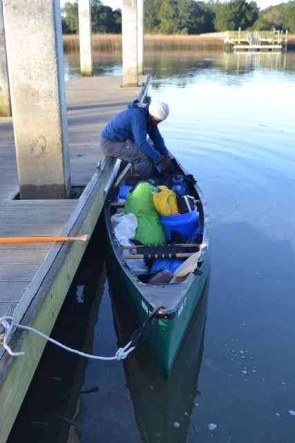 Soon after beginning our journey, I learned that Ian was an expert paddler. I had deferred to his experience in giving him the “seat of honor” in the stern. I had learned to paddle a canoe from my friend and fellow adventurer Rand Schenck – in fact my last time in this canoe was a Lumber River adventure with Rand. Yet in a very tactful manner Ian instructed me in my paddling technique, both in the paddle’s entry into the water and the body mechanics of “pulling” the canoe forward using core muscles.
 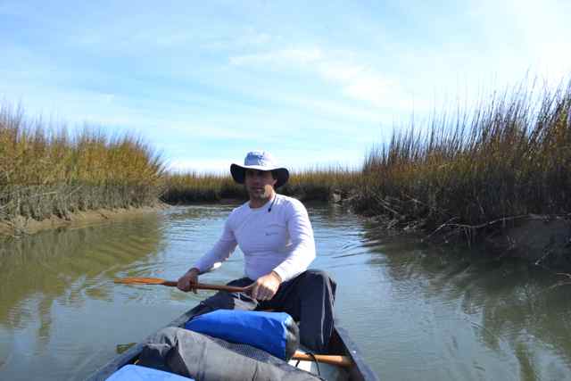 I later gained the benefit of this change from shoulder and arm muscles that in the past had screamed out after a day’s paddling.
We planned to paddle to Murphy Island on our first day, and had chosen a course through the creeks of Cape Romain, connecting with the Inland Passage, rather than simply via the Intracoastal Waterway (ICW). We left the ICW early to head out Clubhouse Creek. Though Ian had traveled on these waters ten years ago while participating in the nest relocation program on Cape Island, he had limited familiarity with our planned route. WIthin thirty minutes of our departure, while on Clubhouse Creek, I was awkwardly shedding a layer when I heard a “plink” in the water next to the canoe. It was the sound of my prescription glasses disappearing to the bottom of this deep creek. Besides the expense, my ability to read was gone (no backups along). After gathering myself, I discussed the consequences with Ian, especially for my role as navigator reading the charts. We decided to push on, and I passed the charts to Ian. I worked to let go after this stupid move, though my obsessive brain would return to the event intermittently during the trip.
Our navigation became shared, the charts in Ian’s hand, and the route and memories in my mind. So we passed by Jeremy Island, through Skrine Creek, and into the Congaree Boat Creek. I shared with Ian the meaning of the name of this last creek – it provided the pre-ICW connection with the Santee River and upstream the Congaree. With outgoing tide, we paddled in the quiet waters until we could see the open waters of Cape Romain Harbor in the distance prior to our turn into Mill Creek.
Our shared navigation went awry with our turn into the Eye of the Needle. I anticipated a short straight section into the next creek, but we began to paddle through a number of bends. This did not seem right, and we finally turned back into Mill Creek. I attempted to look at the chart, and found with some effort I could “read” it. We had made our turn one creek too early. As we continued down Mill Creek, we sighted our first dolphins. They not only continued ahead on our course, but showed us the way into the Eye of the Needle.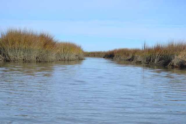 We passed through this short section before following the dolphins right into Ramshorn Creek, and again to the east in Alligator Creek. We still were in the outgoing tide on our last leg, and soon arrived in the open but very still waters of Cape Romain Harbor.
  Our dolphin guides appeared again as we passed between Murphy and Cape Island, and they surfaced close to where we selected our campsite.
Camping on Murphy and Cedar Islands is permitted, but at this time of year only on the beaches. Access to the interior of the islands is restricted due to the migratory waterfowl and hunting season. After securing the canoe, and surveying the campsite, we went for a walk around the front of the island. I had walked the entire beach in 2008 on a hot summer day, and recalled the creek that historically divided the island into “Little Murphy Island” and “Big Murphy Island”. That day I had waded in waters up to chest deep to reach the other side. There would be no crossing on this day, but we hoped to reach that creek before our return walk.
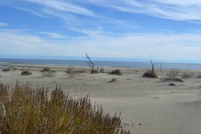
Around the point, the ocean was very smooth and the winds almost calm. Along all the beaches of the Santee Coastal Reserve, we would find much flotsam and jetsam, and many derelict crab traps. 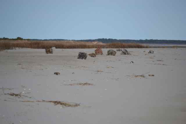 Between the beach and dunes and the upland ridge in the distance, a wetland spread out over a vast area. Skeleton trees still standing on the beach indicated the large amount of coastal change.
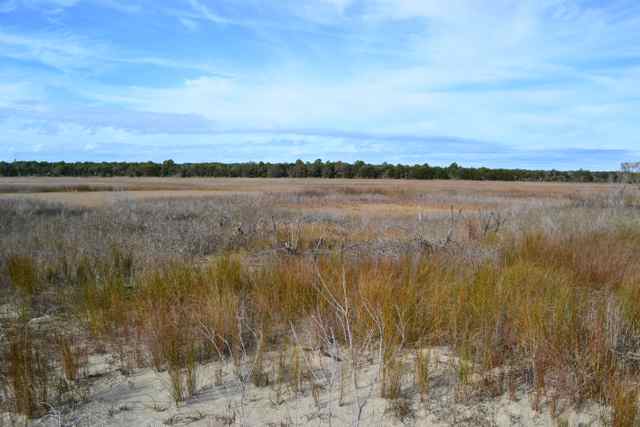
 Further down the island, a large creek flowed into the wetlands. Ahead we could see the inlet of this creek, and a gathering of white pelicans on the bank.
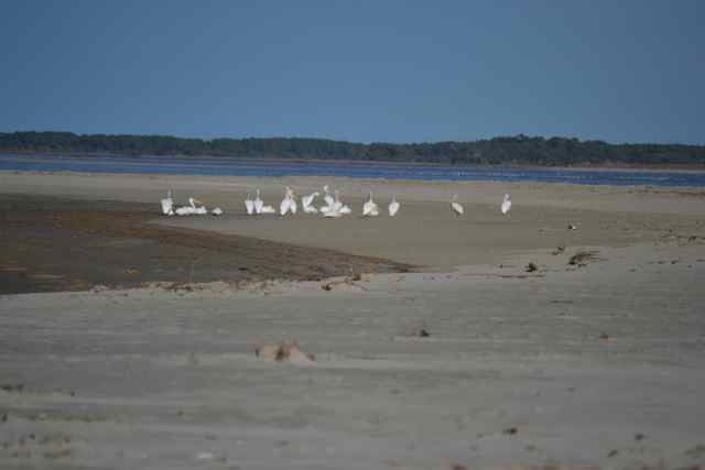 It was not far from here where I had my first view of white pelicans around 2008. Beyond the white pelicans was the bend of the island, the South Santee River, and Cedar Island beyond. The walk along the beach showed deceptively placid waters, and an imagined “shortcut” across the island’s front, but waves began to appear, canceling out the idea of a passage in a deeply laden canoe.
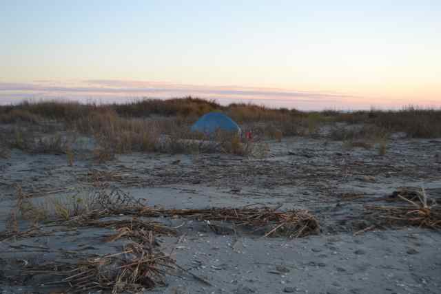
After our return to the campsite, we worked on our respective shelters for the night.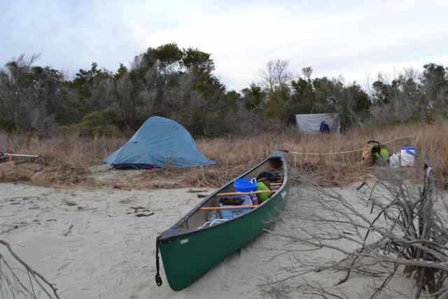 I pulled out my dome, siting it on the ledge above the high tide line. Ian planned to break in his new hammock, though was challenged by the lack of decent trees for the job. He fantasized about having stout coconut trees for his supports, but instead had to implore a system of lines to hold things up, several of the “trees” giving way in early attempts. He eventually by trail and error, and an abundance of persistence, ingenuity, and knot skills, was able to construct his shelter. These characteristics of Ian had been honed on many outdoor adventures, no more challenging or significant than his kayak trip from the upstate to the coast in 2008, documented in the SC ETV show Web of Water. Ian and I have shared interests in natural and cultural history, and we discussed these throughout the trip.
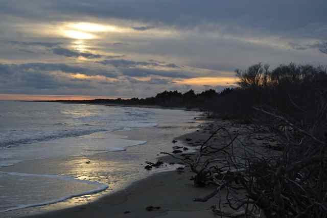
After dinner, we talked for a while under a moon peaking in and out of the clouds, at one point a full ring encircling it. We anticipated rain that night and the next day, and it did come down hard at times during the night. The surf in the distance on the island was pleasant, but appeared to get much closer during the night. The next morning the reason was evident – waves were breaking right on our beach. The surf was small, but would be challenging for our launch with a full canoe. It certainly got Ian’s attention, and he asked me if I knew what could happen to a canoe in surf. I was very aware of the possibilities of swamping or capsizing, neither of which would be a good start to our day, a most gray and cool morning with alternating drizzle and steadier rains. Our plan was to retrace our paddle up Alligator Creek and continue on to the ICW, eventually coming around to the South Santee River and our planned campsite on Cedar Point at the tip of Cedar Island.
Ian took charge of the canoe’s loading and securing of gear. The surf became smaller as the tide went out, though that assist would be against us when we paddled toward the ICW. All ready, and picking our spot, we ran the canoe straight out until jumping in quickly and paddling resolutely, with only the very top of one wave coming over the bow. We were pleased with the launch as we began our paddle on this solid gray morning. It seemed that all color was extinguished from the world, leaving a gray residue. The gray did separate into opposite colors on the tip of Cape Island by the presence of groups of white pelicans and black cormorants.
Despite our course in shallow water we were going against the tide and a brisk wind; the rain was expected to last much of the day. My view was that this challenge of the elements helped us empathize with the difficulties of many paddlers coming before us, whether John Lawson and others in 1700, or Nathaniel Holmes Bishop rowing his paper canoe south on his 2000 mile journey to the Gulf via the inland passages along the Eastern Seaboard in 1875. We created another difficulty for ourselves by missing our course, and working way too hard before backtracking. I kicked myself for the miss, having sailed these waters several times in the past. Besides my visual impairment from loss of my glasses, I had lost my voice, a development beginning over the weekend. What would I lose next? I wondered. As we proceeded up Alligator Creek toward the ICW, the wind came around from our stern, and provided a boost. We passed the Alligator Creek hammocks which I had visited a number of years ago, but we did not find the tiny creek to explore.
At the ICW we turned toward the northeast and continued our path around the island. We landed on a smooth sandy bank to peer into the inland world of Murphy, and it was here that I first discovered the phenomenon of canoe legs. Stepping on to the bank I found my balance impaired, fell back on the canoe and grabbed hold so I would not roll off into the water. Back on the bank we both stretched before peering through a stand of aquatic grass to the vast wetlands of Murphy, a world appearing as huge and inscrutable as an African savannah.
Continuing on, we searched for the entrance to the next appearance of Alligator Creek. All this section of the ICW had been dug fairly straight, and the original course for this section of the Inland Passage was a waterway named Alligator Creek, the same that took us out to Cape Romain Harbor. The conditions were not conducive for alligators, and we saw none the whole trip. The entrance of Alligator Creek into the wetlands of Murphy was signaled by a dolphin leading the way. The creek was wide, and the passage out of the wind was pleasant. I looked for an opening into a canal which would lead to the western end of Settlement Ridge. We would not be able to access this even if navigable due to the restrictions on access to the interior of the island until after February 8. Yet I wondered if the settlement there would have used this canal as a thoroughfare.
We arrived at the South Santee River, and turned downstream for the last leg. Ian picked out a loon on the surface, and we heard it’s plaintive cry. We proceeded with the last of the outgoing tide, speeding us along toward our second night camp on Cedar Island. We made one stop on the bank of an upland coming right to the river’s edge. The rain continued lightly, and Ian made a plea for its end. As we completed our crossing of the river to Cedar Point, Ian’s request was answered as the rain stopped, and signs of clearing occurred over the ocean and finally back to the west. Soon after our landing the sun emerged for the first time on this day.
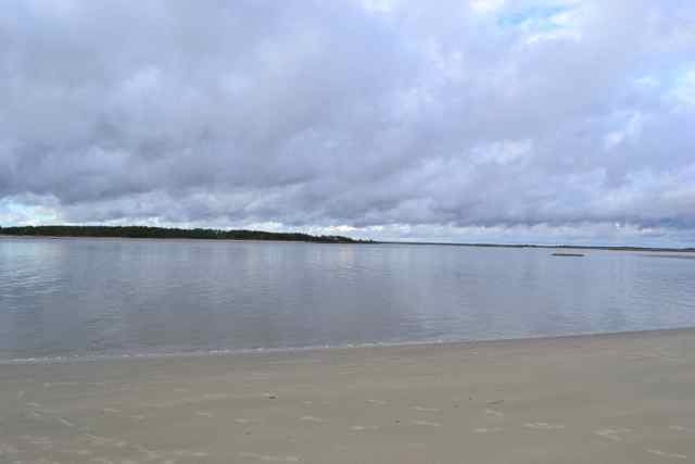
First things first, we strung line from trees at the grove of cedars to dry out wet gear – tents, rain gear, clothes, etc. Ian next went for dry clothes, while I initiated the morale booster of hot coffee and homemade cookies purchased the morning before at the Sewee Outpost. After unloading everything from the canoe, we took the opportunity to wash out the mud from our two stops on the bank earlier in the day. Once again we worked on our separate camps – Ian’s hammock strung in his cedar grove, and my small dome in the extensive dune system.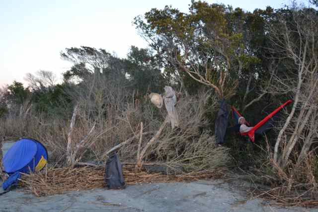
 We made a short walk around the point to the ocean side, again impressed with the amount of flotsam and jetsam littering the high tide lines. Looking back to the southwest, we could see Cape Island with the lighthouse rising beyond it on Lighthouse Island. The top of the dunes provided great views to the North Santee River end of the island.
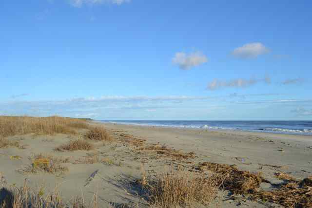 I recalled my walk from end to end the summer of 2012 Looking for the flow. The moonrise came before sunset, and was accompanied by Jupiter.
We were treated to a most beautiful sunset over Murphy Island. 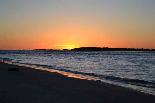 The skies were perfectly clear, and the moon provided ample light to take a walk after dinner across the island through the extensive dune field to the ocean side. We also were formulating our plan for the following day, when we would face a most challenging paddle. The tide would be high around 8 AM, so our paddle upstream would occur against the outgoing flow of both the South and North Santee Rivers. We committed to an early morning start to take as much of the incoming flow up river before the tide changed. We had the goal of reaching the Poleyard landing on the North Santee River by mid-day. Despite a record cold in coastal SC the previous week, Ian was still bothered by some surviving pesky mosquitoes both nights, proving wrong our assumption that every mosquito would be dead.
We both were up long before dawn the next morning, taking down camp and stowing gear. We would not eat breakfast, but pause along the way to snack. The early morning start allowed us to view Jupiter and the Moon setting over Murphy Island. WIth all preparations complete, we shoved off. We both jumped in too soon, and since we did not clear the little waves quickly enough, we soon were turned parallel to the shore with the waves holding us in. Very awkward, but we extricated ourselves and were paddling with the flow over toward Murphy Island. In the next several minutes we entered into a bank of fog that would continue for the next hour. There were outboard motors in the distance, so we stayed close to the Murphy Island shoreline. While dawn did not light up the world completely, the sound of gunfire did commence, signally the ongoing duck hunting season. The fog stayed thick, and we could not see the other side of the Santee from our vantage point.
We had planned two possible routes to the Poleyard landing, and each would require the transit to the North Santee River. We leaned toward a creek passage through the Delta on Pleasant and Sixmile Creeks, which would allow us to avoid the North Santee and its outgoing flow as long as possible. Yet we had never navigated the creek route, and the persistent fog added some anxiety to this decision. However, once we passed across the ICW, the sun began to break through, and the fog began to lift. We pulled into the grass on the bank for our first stop and breakfast to refuel for the long paddle ahead.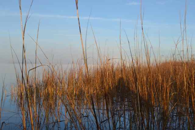
We resumed the paddle upstream in the South Santee, and searched for the entrance to Pleasant Creek. As we passed Brown Island the entrance opened in the river’s northern bank, and in the now sunny and colorful morning it did have a pleasant and inviting aspect. 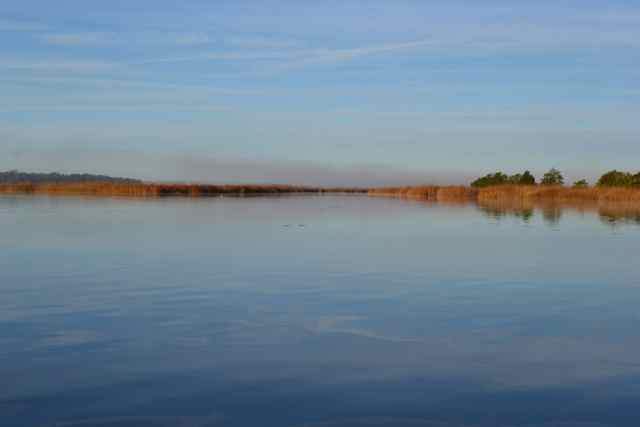 We seemed to still have a little flow with us, and found comforting the protective embrace of the grassy banks and smooth creek waters. Evidence surrounded us of a natural landscape transformed by the rice industry.
 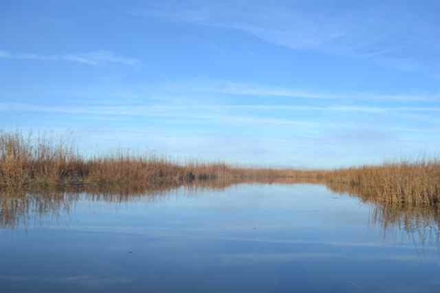 Hundreds of years ago this creek wound through a virgin cypress/gum swampland. Around 10,000 acres of this forest were removed to create the Delta’s rice fields.
We did our best to prepare for our major turn on Sixmile Creek, but had miles to go before arriving. The course after the turn was counterintuitive in a seemingly backward direction to the southeast, but it was correct and led us to the North Santee River. We stopped in an eddy on the bank for refueling prior to our final push.
And that final push was at the time we had dreaded, battling the river’s downstream flow at the maximum ebb. Though we chose the course most out of the flow, it was a force to reckon with, and allowed for no stops or breaks if we wanted to make it by mid-day. Thankfully we were spared an earlier projected strong headwind. I felt the wear of paddle on my fingers, having taken off my gloves at the last break, but felt no liberty to stop. It was stroke after stroke, fighting our way up river in a relentless grind, recalling to me the battle against a strong wind when sailing to windward toward a necessary destination. I had no voice to talk, and Ian also was silent, conserving all for the long pull. As we closed, in my best recollection, on our destination, Ian spoke up to say that the curve we were on and which he was following on the chart was as long as any he had ever seen. To stop paddling would mean to go backward. Once around the long bend, we could finally see the Highway 17 bridge, marking the distance to the Poleyard landing. Ian continued to steer close to the bank, under live oak branches and through hidden snags. Pulling to the floating dock, I put our bow line around a cleat, and pulled up on the dock on all fours, aware of another case of canoe legs. This last section on the North Santee River had been one and a half hours of hard paddling.
I recalled my last visit to this section of river, and similar difficulties I described as The Delta’s price. There was a price exacted on this final day of our trip, and seemed to serve our shared desire to understand the experiences of the many paddlers/boaters coming before us. We had covered a lot of territory on this three day trip, and would be processing the experience for days to come. We had come looking for a greater understanding of the Santee Delta, and while this goal was accomplished we both had many more questions to ponder.
Hey Dad – Great post and photos! Glad you survived and didn’t “lose anything else!” I bet your arms were burning for days after that last paddle straight. Not bad for an old retiree! Love, Sara
The loss of my voice was a symptom of the acquisition of a nasty sinus infection. I hope my account reflects it was all worth it. No burning of arms – the core technique worked well.
Brave venture on a tight schedule in an open canoe, Bob! And I have to say, dome tents have it all over the hammocks -:). Descriptions and pictures as always were wonderful – loved seeing the territory thru your eyes. Keep on paddling and writing!
New sleeping pad added comfort to the dome, too. It also was not a brave venture with a paddler like Ian Sanchez along. Thanks for the encouragement!
The tale was riveting to my reading, good penmanship and flow of words. I was there with you, but i was imagining a small motor on my boat. That would not be the same trip though to be sure.
I will be trying out my new dome as soon as it warms up, that I bid for at the sewee oyster roast auction.
Looking forward to those warm southwest breezes too.
What a great trip Bob! You are too humble a person to let your readers know the incredible determination, strength, and resilience you emitted during the toughest days of the paddle. Every challenge was handled with a cool, unpresumptuous manner that made it the trip that much more enjoyable. We were rewarded with such spectacular displays of nature and planets. That last morning on Cedar island, when we launched during a magnificent setting moon into the mystical fog of the Santee is one of the many pictures that will remain in my memory.
It was a pleasure to trade stories and share the fantastic experience with you! Thanks for making it happen.
The last morning pre-dawn paddle up the Santee River was spectacular. I am grateful that we were able to make this happen.