Sailing along with the west wind through Andersonville Creek, I passed my neighbors Hal and Yogi in a johnboat returning with a large basket of blue crabs. The wind was predicted to be southwest from 10-15 knots with 20 later, but at the time the west wind was favorable for the sail out to the island. At the Shark Hole I turned to the southwest to follow that fork of the Andersonville Creek, coming up to closehauled, and then beating as the creek turned to the west. It was not long after the high tide, and in looking to the southwest I saw protruding above the marsh the upper works of Island Cat, the Bull Island ferry making the mid-day return of visitors to the mainland. Captain Will sounded his horn as I waved my hat in greeting. We briefly spoke as we passed in opposite directions. The course turned more to the south, and we ran into various fishermen on the ferry route to the public dock on the island. The passage from dock to dock was just a little over an hour.
After securing Kingfisher and putting items in my pack, I chatted with Will upon the return of Island Cat. He is one of a number of kindred spirits I have come upon, attracted to Bull Island like moths to a light. He asked about my walking plans, and I expressed my vague notion of wanting to go both south and north.
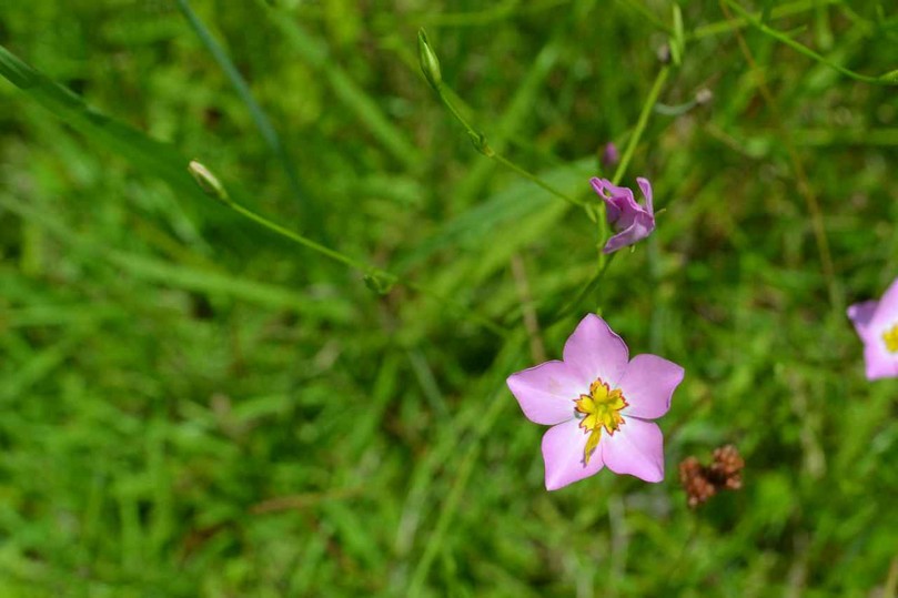
After taking a close look at some wildflowers including marsh-pinks along the Beach Road past the Dominick House, I decided to take the road less traveled, turning south on Summerhouse Road, a sandy track without a footprint. I made a quick stop to consider one of the tombstones in the graveyard: what would a life, marriage, and death for Bessie Viola Magwood at such an early age on this island have been like? The sandy road was marked by the crossing paths of snakes, but the sun was too high in the sky and hot to see any of these reptiles crawling. In fact the sun was close to the zenith as the longest day of the year grew near.
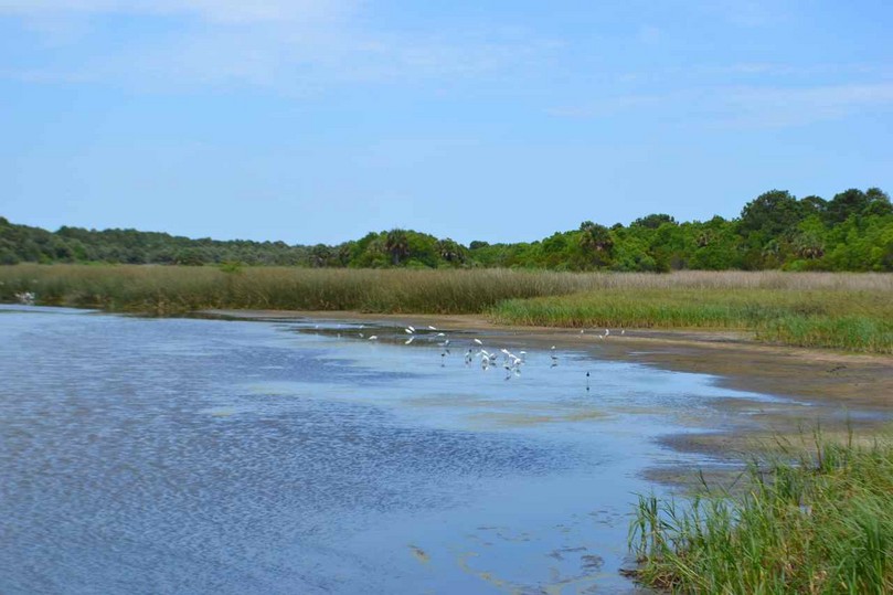
The world changed at the intersection with the Turkey Walk Trail, and the Summerhouse dike, for there was a large splash of an alligator in the ditch along the dike, and a crash in the forest nearby of a white-tailed deer. Several wood storks circled over the maritime forest, and ahead on the dike at a new water control structure a group of egrets great and snowy loitered. The drought conditions were evident in both the Upper and Lower Summerhouse Ponds, and the low water and exposed mud flats were being exploited by a large congregation of birds including a couple dozen wood storks, egrets, glossy ibises, and black neck stilts.
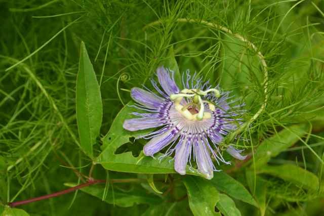
Along the edge of the dike were a number of wildflowers – the passion-flowers were spectacular.
Attracted to the many blooms were butterflies including the black swallowtail. In a small water hole several alligators were doing what they could to beat the heat. One had left a muddy rut as it crawled out searching for a little shade underneath a wax myrtle, leaving its tail exposed behind.
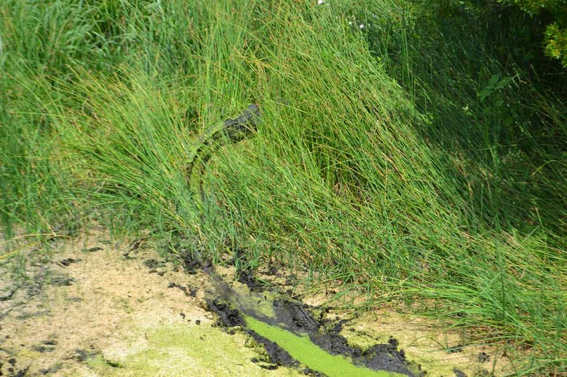
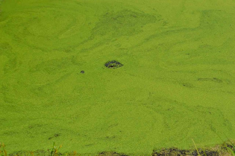
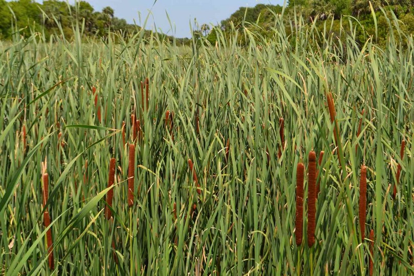
The other just exposed its eyes and nostrils above the water and duckweed. A solid wall of cattails presented itself just beyond.
My walk had evolved into a slow observing amble, taking time to view, photograph, and look closer at nature in this wildlife preserve. It was relaxing and rewarding, and as often happened the journey trumped the destination.
The world changed again as I left the dike to enter the maritime forest via the Turkey Walk Trail.
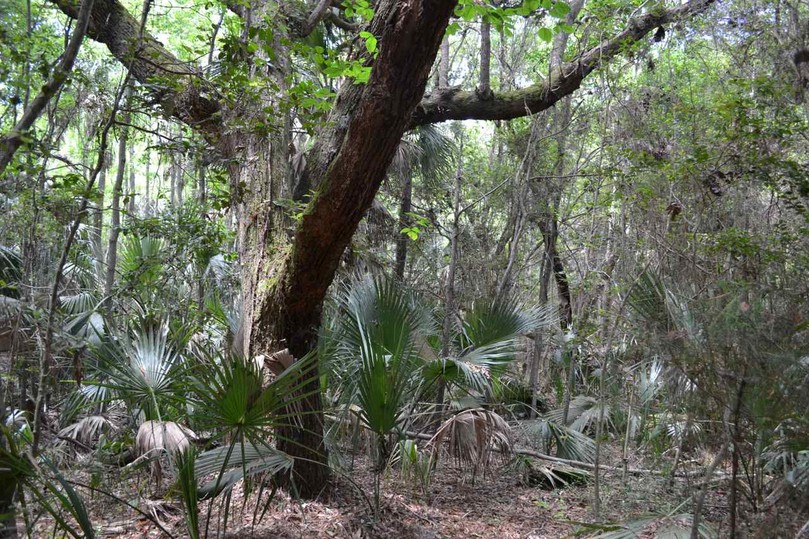
Even here, biting insects were absent, and with the drought the mosquito population was very low. Along this fine trail I came upon the mating dance of a couple of black swallowtails, and later saw three involved.
![]()
I also came upon my only group of people seen from the ferry, with the lead person negotiating and carefully leaving spiderwebs, and the trailing person focused even here on his cell phone.
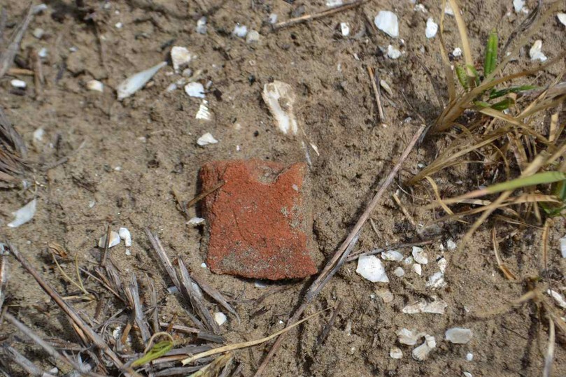
It was at the intersection with the Beach Road that I headed north along the Lighthouse Road to walk a loop I had not traveled in some time. An old osprey nest in a dead live oak tree came into view. Along the side of the road, a spattering of oyster shell (probably moved here in road work) pointed to a Native American potsherd, evidence of an older people also living and dying here.
My turn to the beach came at the intersection with Big Pond Road, and I followed this path of uncut brush knocked down by the passage of ATV’s accessing the beach strand. This little causeway crosses a wetland, and the edge provided the conditions for wildflowers and butterflies. The track climbs an old dune and enters a section of maritime forest before the beach. The wind and the salt spray have pruned the dune shrubs all along the strand and on the path to the beach, with the clean sculpted vegetation lines broken by protruding palmettos.
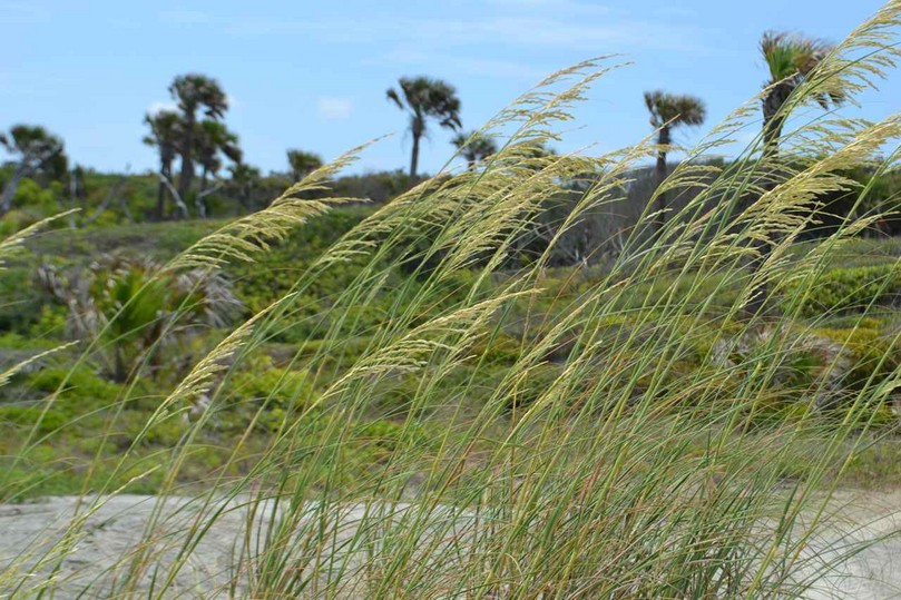
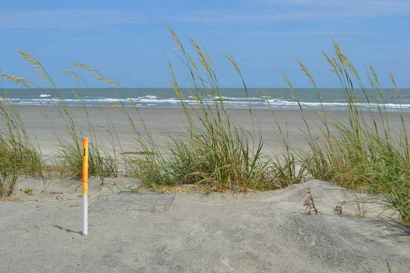
The dunes were graced with sea oats swaying in the solid southwest breeze. Along the dunes a bit to the south was the first loggerhead nest of the season, indicated by the PVC pole marked #1.
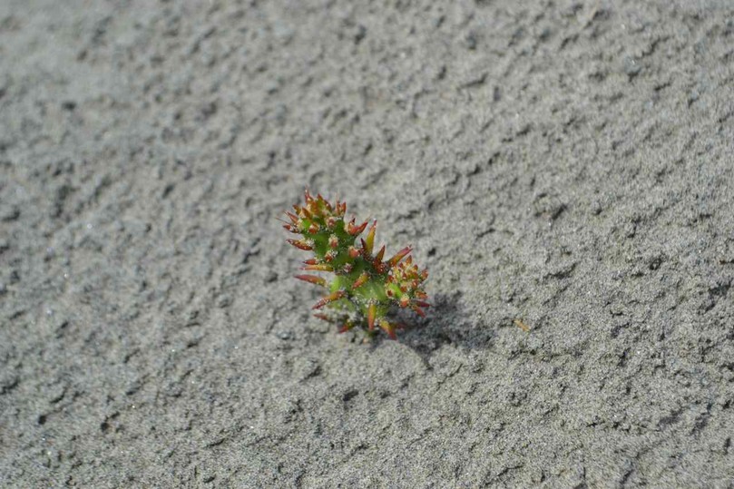
In the backside of this dune jutted out the first buds of a dune devil-joint.
The beach was vacant of people at this time, and I continued the walk back to the dock on the Beach Road. At the intersection with the Mills Road, by a forest pond where a large resident gator often crawls out to sun, another black reptile lay. This black racer hung around to mug for the camera, and stretched out to show his full length.
![]()
When he finally slipped down the steep side of the pond, I resumed my walk back to the dock.
The scene at the dock was quite different than when I arrived: Island Cat was gone and cruising back to the mainland on its last run, the tide was dead low, and the southwest breeze was up at a solid 15-20 knots.
Sailing again out Summerhouse Creek, we rounded up near the marker in Bull Creek and headed up to closehauled to retrace our course. I sailed flat out with considerable effort to continue this long port tack and make the point before easing off. Past the point we were off and flying, and only slowed when we were deep in a creek with a high marsh to windward. Once in the dug section near Seewee Bay, we were running straight downwind to the NW, and then to the NE in a bend of the creek, and back to the NW in the widening section toward the Shark Hole.
Coming up in the Andersonville Creek, we had spasms of planing through the narrowing waterway until we blasted out to the ICW. We flew across and tacked back, then planed across the ICW again. After another reach across I made a flying jibe and blasted back toward the mud and shell shoal, again populated with black skimmers. Carried away, I held the screaming reach too far, and ran aground. With the daggerboard pulled out all the way, I did not have room or water to tack or jibe Kingfisher in the strong wind, and reverted to stepping out in the mud to manually turn the hull around. I took this as a sign that the sail was over, and headed to the muddy landing for hauling out.