What do Horsehead Creek and Cataloochee Creek share? The same as Cape Romain National Wildlife Refuge (CRNWR) and Great Smoky Mountains National Park (GSMNP) – both are areas with an international designation as UNESCO Biosphere Reserves, indicating natural and cultural resources of global significance. I found myself in both places within a span of a month – roaring out Horsehead on the way to Cape Island for the annual spring building of loggerhead turtle hatcheries, and wading across Cataloochee to begin a loop hike in old growth forest in the GSMNP. What a contrast between the ecosystems that these creeks flow through!
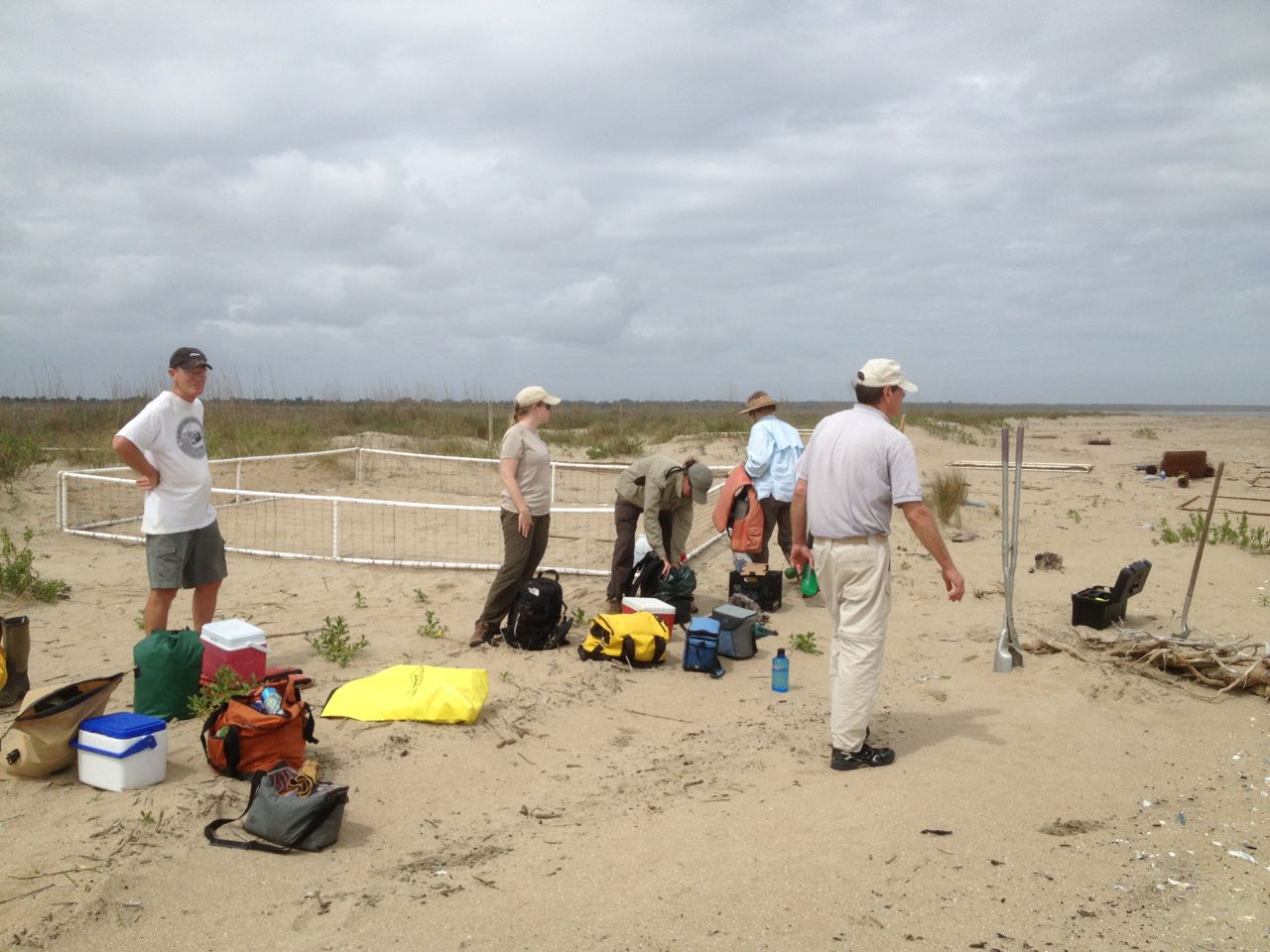
A beautiful three days of Lowcountry weather made our work on Cape Island very pleasant – comfortable temperatures and a minimum of biting insects. And the beauty of Cape Island is always striking. 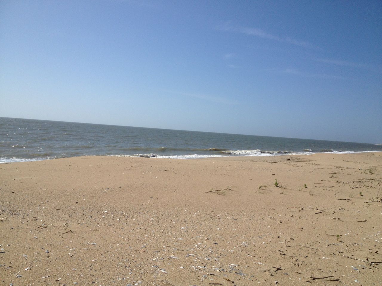 There were over 1600 loggerhead nests in CRNWR last year, so preparing viable places for nest relocation remains an essential annual task. We were able to partially erect seven hatcheries on the first day, and complete virtually all the necessary components of nine in our three days. We had our usual mix of professionals and experienced volunteers for this annual event, and over the years we have forged both a camaraderie and an effective work unit.
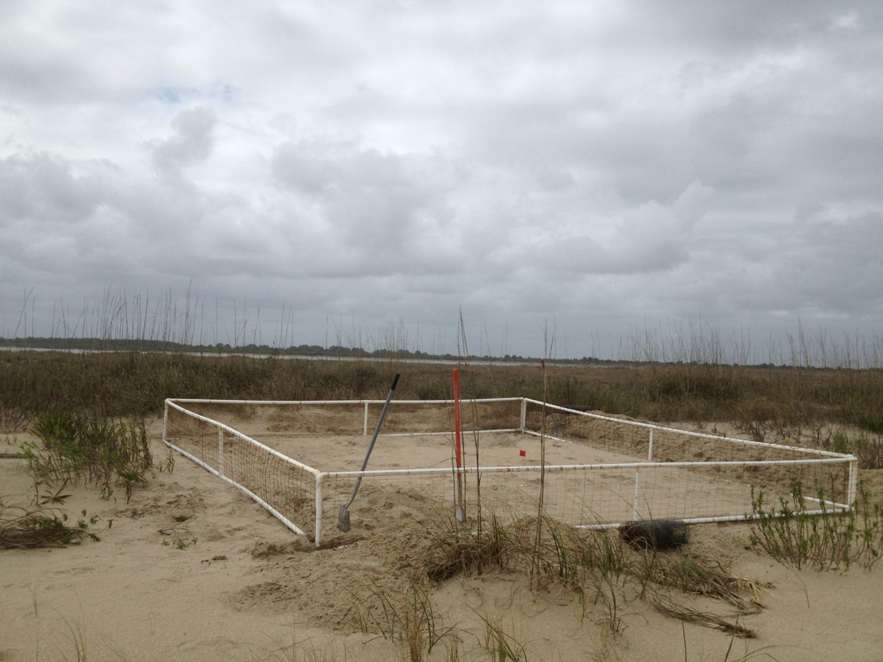
 Two strandings of loggerheads, one new, were observed by staff on the beach. More positively, we observed live adults both in the ocean and more frequently in the sound behind the island, and on our return to the mainland on the last day witnessed two adults mating on the surface.
 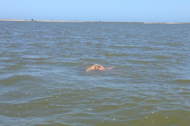 A couple of more hatcheries would be built on South Cape, but our work had prepared for the many nests requiring relocation as the females began their nightly efforts.
I live on the mainland bordering the refuge, and frequently visit the islands and waters. It had been two years since my last visit to GSMNP. It was with much anticipation that I arrived in Cosby Campground to meet up with two college friends, Mike Phillips and Jim Smolen, who arrived the day before and were already on the trail. 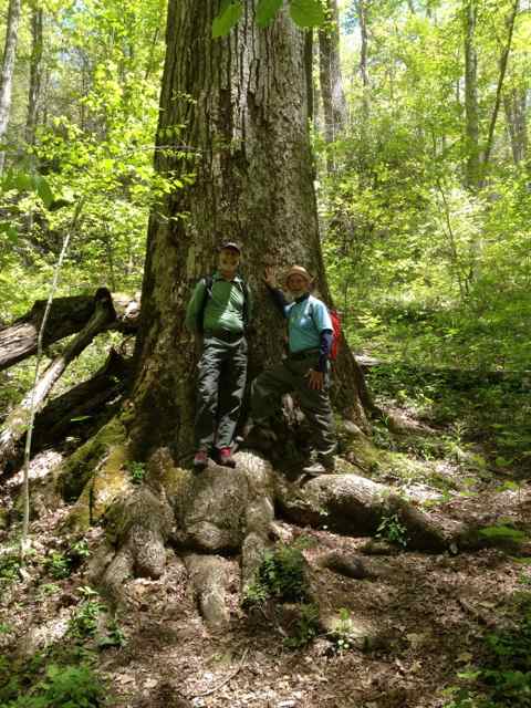 They returned to the campsite before dinner, and around the fire they recounted their day hike up and along the AT and back down Snake Den Ridge Trail. They spun the tale of a thru-hiker headed north with others toward Mt. Katahdin in Maine. They observed the mid-60’s Coloradoan carrying a huge pack (60 lbs?), and appearing a bit unsettled. They learned he had slipped off the ridge trail, sliding down a sharp incline about 50 feet. They pressed to see if he needed assistance, and as he reported banging his head on the fall, tears came to his eyes. He brushed them off, and continued his slog north.
The next day we decided to go back up Snake Den Ridge Trail to the junction with Maddron Bald Trail, and head down, looping through Albright Grove until picking up a left car for the ride back.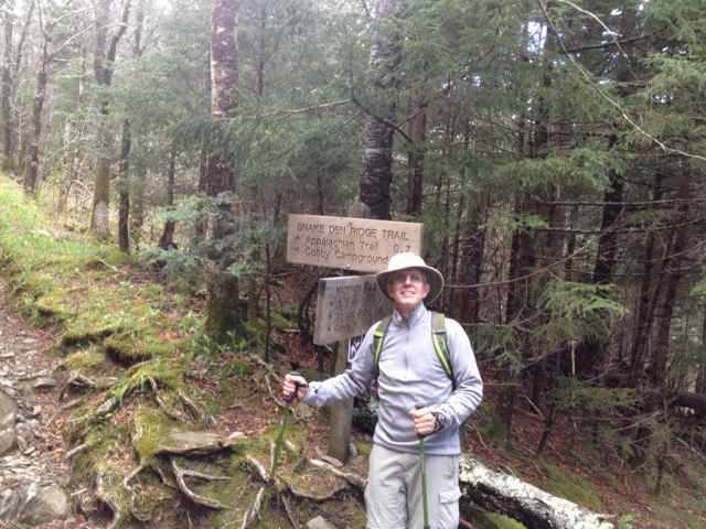 Initially we considered another six mile loop back, but were all very glad to not have this addition to our 13 mile walk. Personally I had found my fitness for strenuous climbs and descents more than a bit lacking.
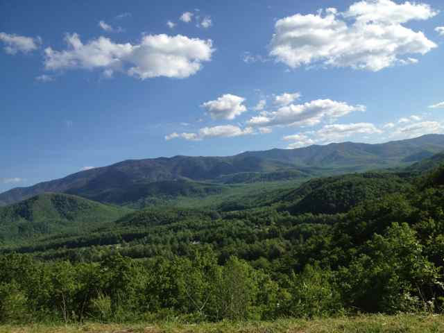
After considering various hike options for the next day, we opted to make the drive to the Cataloochee area of the Park. It was an excellent decision, and opened up for me a completely new section of the mountains. Cataloochee is the name of both the valley and a sizable creek. Cataloochee is a version of the Cherokee “Gadalutsi”, and there are various possible meanings: “fringe standing erect”, “waves of mountains”, “wave upon wave”, “land of plenty”, “in a row”, and “standing in rows”, suggesting the trees on a ridge. We had read a trail description of a loop known as Boogerman Trail, and with moderate difficulty, reasonable length, and more old growth forest, it seemed right. We would pick up this trail a short ways up the Caldwell Branch Trail, and after one miss we located the trailhead along Cataloochee Road and parked in a designated spot. We were stunned when we walked over ready to hit the trail and found there was no bridge to cross Cataloochee Creek. The stone piers were there, but the bridge had vanished, most likely in some previous flood. The creek was not narrow, the water was flowing strongly, and there was still some coolness from the near frost of the previous night. Though a brief discussion ensured about a change of plan, I decided to attempt a crossing with shoes off, and using my hiking sticks for balance.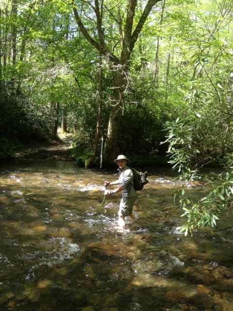 I did well until five yards from the other bank when I stepped into a hole, and my rolled up pants got wet up to about mid-thigh. Jim and Mike followed almost without incident, though Jim slipped once and without a strong planting of his right arm on the bottom would have been drenched. We knew we would be crossing again at the end of the loop, and I prepared by going first and videoing my friends. The water was actually a little higher and harder, and Mike had the most eventful crossing. He had left his hiking sticks at home, and the stick he had selected for the crossing proved to have limited utility. It would be a fond and humorous memory, our Cataloochee Crossing.
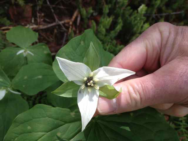
These two hikes with my friends, and a solo one the following day after they had left, were rich with the biodiversity of the Smokies. It was not by accident that I sought out old growth forests for these three hikes. Though the wildflower burst of April was over, we still found plentiful blooming of many species. 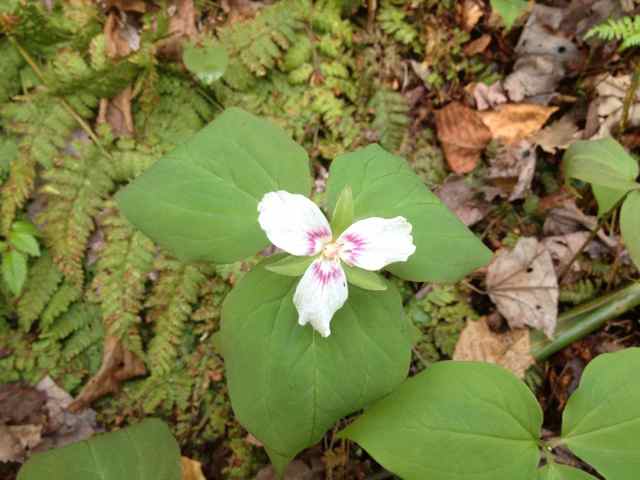
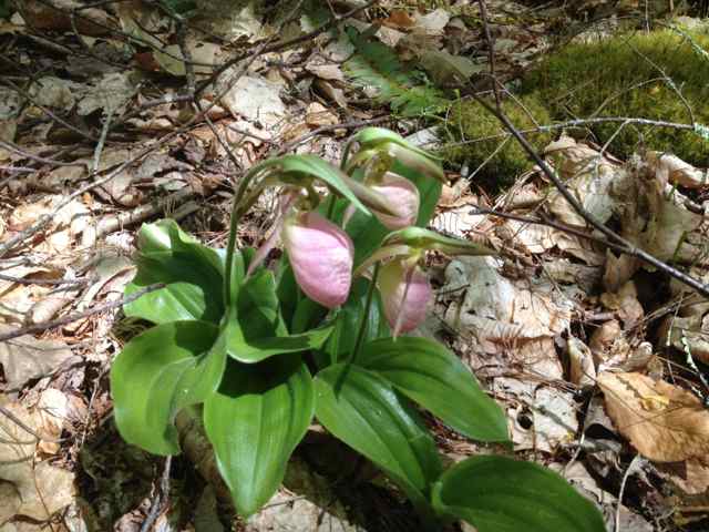
 There was much to observe, and wildlife become more present as we spent more time on the trail, including a new snake for me on my hike on Porters Creek Trail on day 3 – a northern ringneck snake.
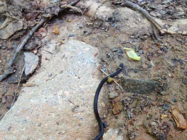 Reading the remaining signs of Appalachian homesteads was another interest throughout our walks. Near one old wall was an interesting iron object – some adjusting mechanism which we pondered.
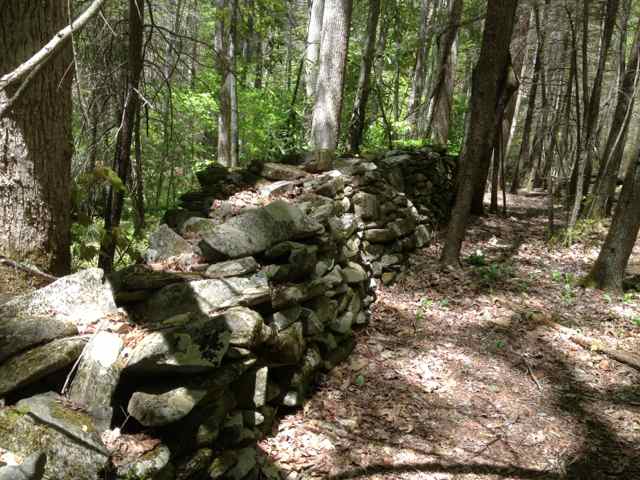
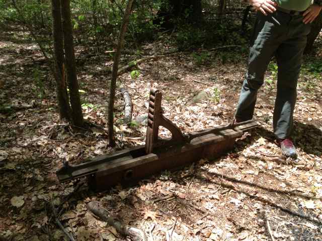 After sharing a photo with Park staff at Sugarlands Visitor Center, I learned it was probably used in a private small saw mill, not one of commercial operation.
After three days on the trail, and facing an entry back into the “civilized” world in Gatlinburg the following day for a three day conference, I concluded that I would need to clean up my act before entering the hotel, since I would not be able to shower before the symposium’s start. Timing the end of my last day hike for mid-Tuesday afternoon, I found a sunny spot in the flowing Porters Creek for a quick dip and cleansing. The cold water took my breath away, but I soon recovered on a sunny rock in the middle of the creek to dry off, feeling amazingly refreshed.
The shock of the cold water triggered my recall of another cold water experience from forty years ago. On spring break a group of friends (including Jim and Mike) from UNC traveled to the mountains for about four days of camping on a mountain lake near Robbinsville, NC – Lake Santeetlah. We set up camp, and on Easter found unseasonably warm temperatures (about 80), reinforcing our traveling with my Laser class sailboat, and a canoe, both which we used all day Easter in cruising around the lake. About six of us shared a large canvas tent, and we woke with the sound of rain and the feeling of dampness in our leaking shelter. On the first full day of rain we used our towels to mop up, but after the second night of rain we were sacrificing sweaters for the same purpose. On the second full day of rain we put on what rain gear we had and hiked in nearby Joyce Kilmer Memorial Forest, my first encounter with true old growth forest. We had so much rain by then that our loop hike was foiled by a washed-away bridge which presented the barrier of an unfordable creek. We foolishly made a bushwhack without compass for a return walk with no backtrack; somehow it worked out. I continued to be optimistic (and naive) throughout each day that the weather would change.
It did. We woke the next morning to find snow falling. Surveying the lake, the water level had risen after two days of precipitation to our tent stakes. We were in agreement that it was time to abandon the camping trip, and head back to Chapel Hill. Besides breaking camp (and packing up that miserable leaking canvas excuse for a tent), we also had to get our two boats (Laser and canoe) back about half a mile to the landing. So Mike and I stripped down to long underwear and stocking feet, and towing the Laser behind the canoe set out paddling to reach the landing. It was a valiant effort, though doomed due to our limited rough water canoeing experience, almost blizzard conditions, and a short tether to the Laser, which veered sharply from side to side. We fortunately had chosen a course close to shore, which proved wise when a sharp jerk from the Laser capsized us. I will never forget seeing Mike come up from beneath the surface with eyes alight with panic. We pulled the canoe to shore, tied it up to a tree, and quickly scaled the steep slope to the road. We raced the hypothermia, running down the road in our stocking feet and soaked long johns to the landing. Our friends were waiting there in a running vehicle, and we jumped into the warm shelter from the storm, our shivering finally subsiding. We ended up driving as close to the boats as we could along the road, and with many hands hauled the boats up the bank.
The mountains and the coast have always been places of adventure and discovery for me. These two special places, Cape Romain and Great Smoky Mountains National Park, have a number of issues in common, and face similar threats: invasive species, climate change, and a recurrent manmade crisis that has reared its ugly head again – budget woes. Sequestration has taken its toll, and expected to further restrict funding for these natural resources. In GSMNP, three campgrounds, one horse camp, two picnic areas, and two roads are already closed in 2013, and rumors suggest more will come. Funding for the loggerhead program in Cape Romain has never been so limited. Though firmly committed to the coastal refuges and National Forest of South Carolina as a board member of the SEWEE Association, my connection with GSMNP inspired me on this recent trip to join the Great Smoky Mountains Association, something I have contemplated doing for years. It was comforting to know that I was joining 12,000 other members, and I look forward to many others joining SEWEE to help our fantastic resources in the Lowcountry. The public must protect and preserve these vital resources – their degradation or loss would seriously reduce the quality of life for us all. 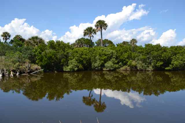
Great article & photos Bob! Makes me near-hypothermic just remembering our Santeetlah swim…..
Yes that was some swim Mike – don’t think I have been in colder water.
Great post, Bob! Your college story I had to read out loud to my Laser-and-canoe-loving husband. We could (almost) feel your pain!! Thanks for sharing!
That would have quite a photo of us running down the road in long johns! More numb than pain I recall.