Bull Island, July 17, 2011. I took the Coastal Expeditions ferry Island Cat on the trip over to the Northeast Point of Bull Island, along with about forty others on the ferry and another ten on board a skiff. This trip was a special fundraiser for the Sewee Association. I went along to give an interpretive walk in the AM, to be repeated for a second group in the afternoon. We rode above the marsh at high tide, the result of being just a few days after the full moon tides. The ferry ride extended longer in distance and duration than the regular trip to the dock due to the final destination of the Northeast Point. The conditions were relatively cool due to the east wind and the relatively low humidity. A little chop was kicking up on the last leg in Bull Creek, but later would be more lumpy for the second group when the tide would be rapidly ebbing. The landing and safe “Beach Drop” of the passengers required the expertise of the two captains at the helm today – Will Christensen on Island Cat, and Chris Crolley on the skiff. This was handled flawlessly: not one but two times, since a second group made the trip two hours later.
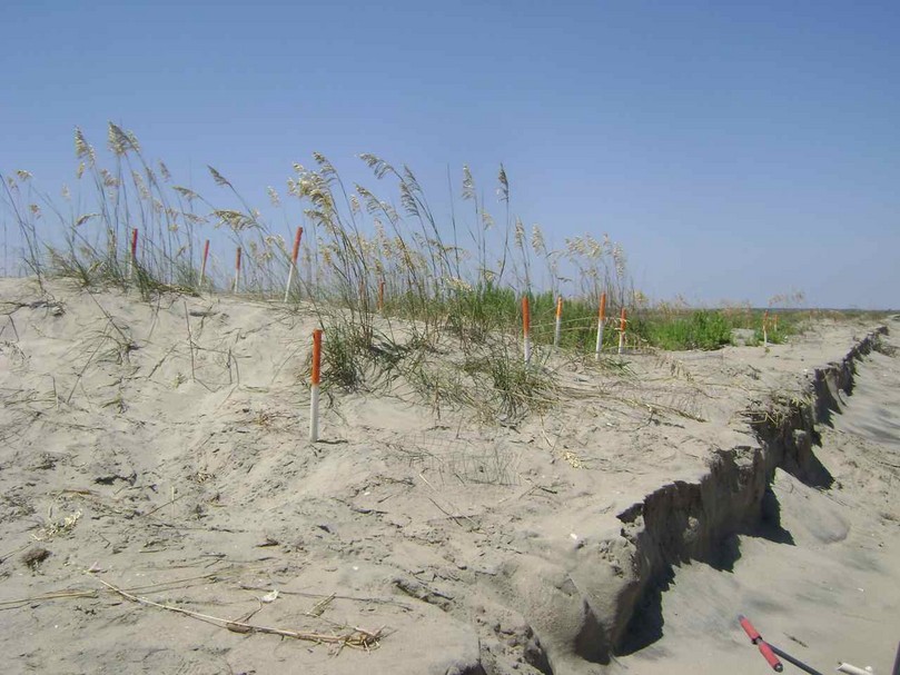
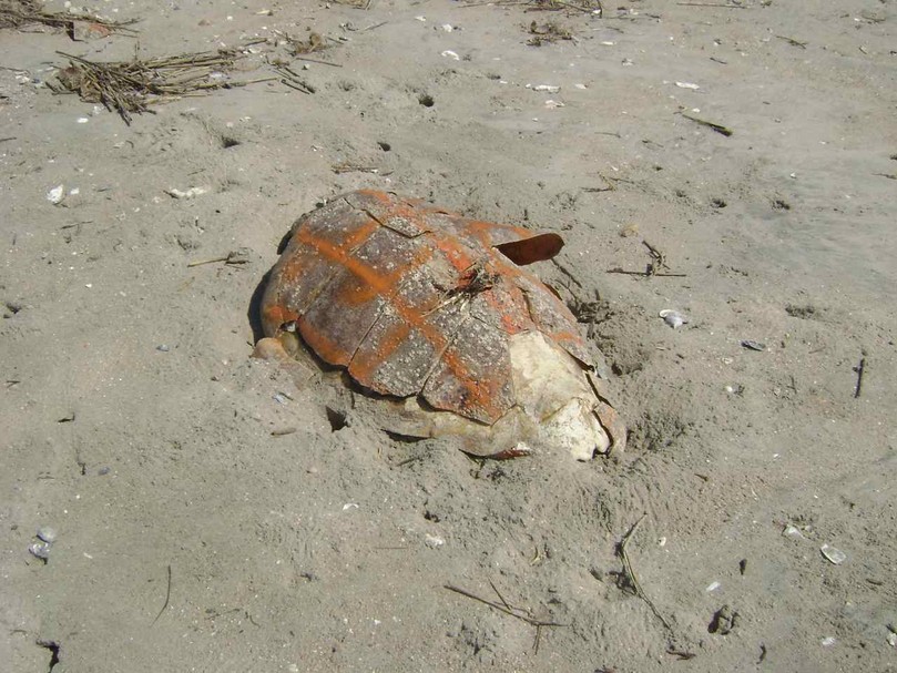
For many of the passengers this was the first time on the island. I gathered the big group on the Northeast Point for an orientation to where we were in Cape Romain National Wildlife Refuge. Along the way we covered some human history on the island (March 15, 1670; Bull Island lighthouse; Jacks Creek construction by CCC). On the natural world side I focused on some of the barrier island dynamics that were prominent on the island’s east side (exposed marsh sediments on the beach, erosion of Jacks Creek dike, the Boneyard). Remnants on the beach of marine animals provided other opportunities for discovery. A variety of seabirds and shorebirds were prominent, and as the tide fell more shorebirds probed the marsh sediments for invertebrates.
Relocated and protected loggerhead nests appeared early on this eastern face of the island, and the importance of the refuge’s nesting islands, particularly Cape Island, was described. For one visitor from Litchfield Beach, where the nest count for the season was less than 20, the fact that Cape Island had over 900 nests was mind boggling. Walkers were strewn all along the eastern face of the beach, some reaching the Boneyard, and others stopping to enjoy this incredible strand on a wonderful day. A common comment by first time visitors was the pristine quality of the island.
The second group’s trip back to Garris Landing was highlighted by a group of fifteen wood storks taking off from the marsh, and circling overhead.
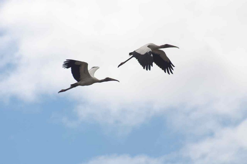
Photo courtesy of Shirley Youngblood.
Cameras snapped away, and the group excitement was epitomized by Captain Will who stopped his discourse on marine animals to run to the port side and take some shots himself. This moment was a reminder to not take the familiar creeks and marshes for granted – they provide beauty and inspiration always.
(To view a Facebook album of photos from this day, go to the following link.)
http://www.facebook.com/media/set/?set=a.221029687932266.49955.197546056947296&type=1
Cape Island, July 18, 2011. Our group of six headed onto Highway 17 North in a refuge pickup towing a reliable aluminum skiff toward the Ashley Landing in McClellanville. Led by Billy Shaw, and including a SC DNR staff, two interns, and two volunteers (my daughter Sara and I), we headed out for a day of loggerhead turtle nest relocation and associated work. My last trip out to Cape Island was back in April for hatchery building (see post April 17, 2011 “Greeting on Cape Island”). It was a wonderful cool morning, with a dramatically clear atmosphere, and we enjoyed a fast ride out to Lighthouse Island to drop off one of the interns, Sonya, to work there alone. We made the ride over to Cape Island and landed at the pier.
Billy described the challenges of the previous day. The full moon tide and stiff east wind had created a substantial bout of erosion, and exposed was a four foot scarp in the beach front with numerous nest cages hanging out over this carved dune face. Twenty-four was in fact the number of nests requiring relocation that day. But the astronomical tides had a more profound impact on Cape Island – a breach toward the south end. It was not a new deep inlet, but water was covering this section of the beach for part of the day.
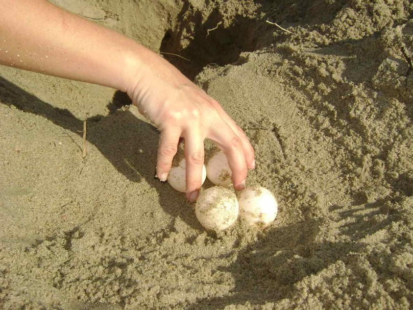
We split up on the two ATV’s, and Sara and I went with Billy to the north. The five nests we found all required moving.
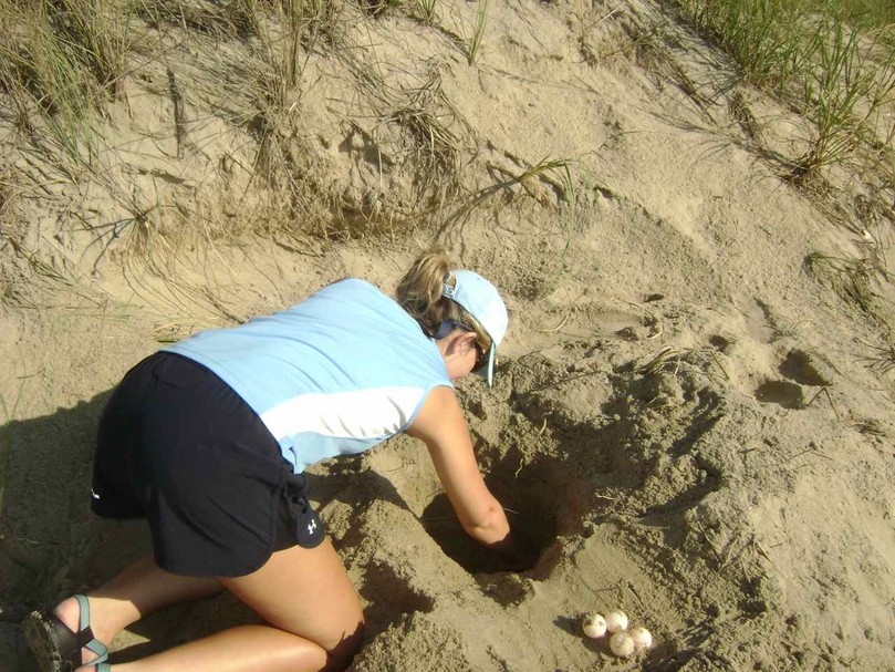
Sara Painter beginning a nest relocation.
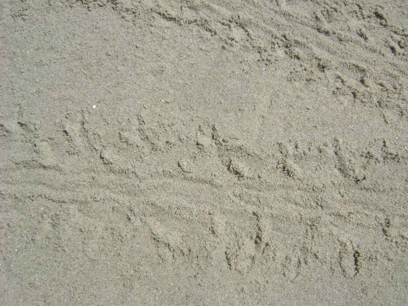
Noted were nests that had hatched out the previous night. One in particular had clear sign of a “boil” with tracks heading to the water.
There were many places where it would be difficult to find room for another nest.
Many of the cages also had signs of minks passing by – these little mammals were opportunistic in taking eggs from loggerhead nests and nesting birds. In several places along the way we came upon the skeletal remains of a right whale that came up on the strand in winter.
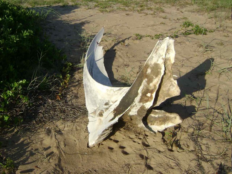
Jawbone.
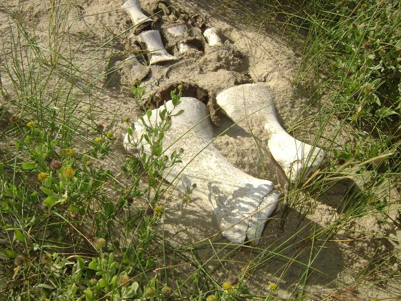
Skeletal remains of flipper.
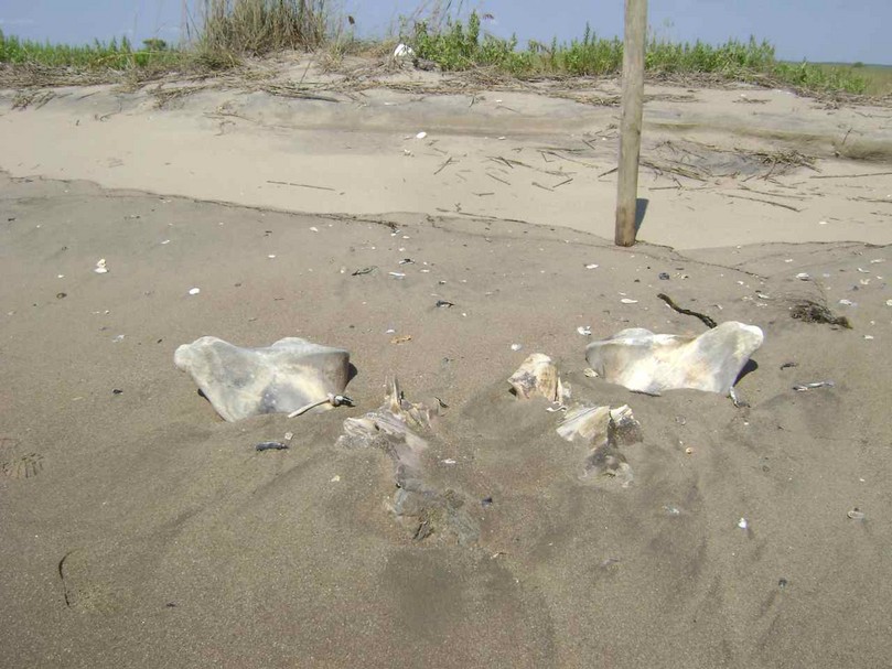
Upper skull.
These skeleton parts would be part of future displays at the Sewee Center.
Two dead loggerheads lay on the beach, spray-painted to mark them as previously found.
Billy told us the story of how four of these mothers had wandered the wrong way after laying their nests, heading back into the dune field and marsh on the back side of the island.
Two were successfully rescued with immense efforts from the turtle crews, but two did not make it. Billy noted one nest that was the legacy of one of the victims of the day’s heat.
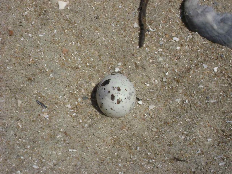
None of the nests at the hatcheries had hatched to date. A large group of black skimmers hung out on the beach near the hatcheries, with their nests located on the beach. We took care walking through this area, and observed one egg on the sand.
Least terns were also grouped on the beach, displaying their nesting behavior. The contrasting colors of these two birds were prominent and radiant in the day’s clarity that also deepened the richness of the blues of the sea, and the greens of the dunes and marsh. In waiting for the tide to go out so we could make the ATV trip back down the beach, we inventoried several of the hatched out nests. My one nest yielded a live hatchling, which Sara carried to the ocean and released.
The other crew brought us needed poles for our relocated nests, and Sara and I joined them to head back to the south end to complete earlier work. We learned that they had to ford the breach close to high tide, carrying the needed equipment, and the water came up to waist-level. The water was mostly out when we arrived, perhaps an hour and a half before low tide, but the ATV still bogged down, and we had to get out and push.
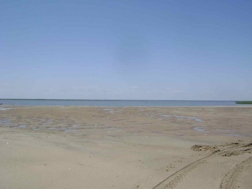
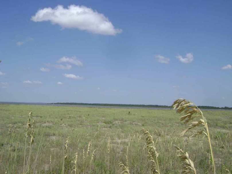
The breach was not at the location where I expected – the place where a significant break occurred with Hurricane Hugo, but further south. Note: In the following week this breach closed up, and for the moment would not be an impediment to the turtle crews.) This place, and one further south, also appeared ripe for breaches in the future with just a narrow strand of sand with no dunes and no marsh on the back side. Bull Island seems to be stable bedrock compared to this rapidly moving and changing transgressive barrier island. I had anticipated seeing a small sand island that had been accreting the past few years near the south end, and was surprised to see it was now a sand spit connecting to the beach. At this tide one could walk out on this dry narrow ribbon of sand.
Our work finished for the day, we left Cape having a count of eleven new nests, and returned to Lighthouse to pick up Sonja, who had a busy day on her own in relocating eight nests. She also observed the day-time nesting of a loggerhead just finishing up. I continued to be impressed with Billy’s knowledge and skills as he expertly navigated the waterways at low tide on courses I was not aware of. The glorious day continued, saturating us with a rich sensory experience on our trip back to the landing.